


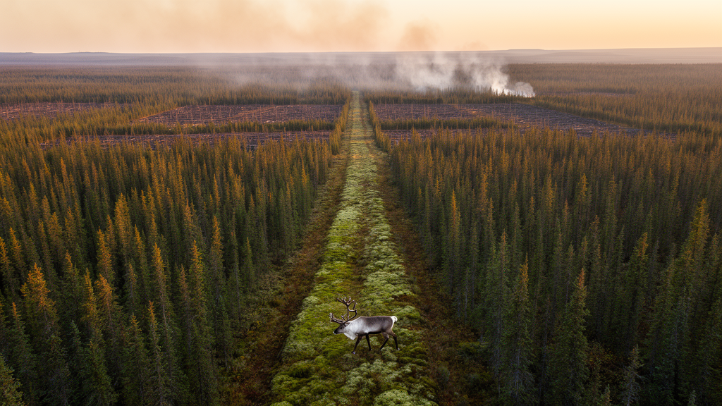
Wildfire has become the defining disturbance of North American forests, and the scale of the problem is forcing land managers to rethink one of their oldest tools. Fuel breaks, corridors of land where flammable vegetation has been reduced or removed, have long been used to slow or stop the advance of fires. The idea is simple: segment the landscape so that a blaze running through continuous fuel hits a barrier and loses momentum. In practice, however, deciding where to place these breaks across vast, heterogeneous forests is a formidable planning challenge, one that involves uncertain fire behavior, finite budgets, and the risk that a break will simply fail to contain a fire under extreme conditions. A new study published in PLOS Complex Systems by Denys Yemshanov, Ning Liu, Eric W. Neilson, Daniel Thompson, Frank H. Koch, and Kelsey Gritter offers a mathematically rigorous answer, framing fuel break placement as a network optimization problem that simultaneously weighs fire hazard against the needs of an endangered species.
The research team’s central insight is that a forested landscape can be treated as a network. Each patch of land is a node, connected to its neighbors by edges that carry information about fuel load and the likelihood that fire will spread from one patch to the next. When a fire ignites, its potential path across the landscape can be traced through this network, and any given ignition under a given set of weather conditions produces what the authors call a fire propagation graph, a map of which patches the fire could plausibly reach. By generating a large set of such scenarios, each representing a different combination of ignition location, weather, and fire behavior, the researchers built a probabilistic picture of how fire moves through the landscape. Fuel breaks then enter the picture as modifications to the network: treating a patch reduces the fuel along the edges connected to it, and the optimization problem becomes one of choosing which patches to treat so that the expected burned area across all scenarios is minimized.
What distinguishes this framework from earlier fuel break planning models is its explicit treatment of failure. A fuel break is not a guarantee. Under extreme fire weather, wind-driven embers can leap across a cleared corridor, or the fire may find a path around the break’s flanks. The model captures this uncertainty by assigning widths to candidate fuel breaks and using those widths to track the probability that a break will fail to contain a spreading fire. A wider break is more reliable but more expensive and more disruptive to the landscape, so the optimization must balance the cost and footprint of each break against its expected contribution to hazard reduction. This scenario-based approach, formulated as a mixed-integer programming problem, allows the model to search the enormous space of possible fuel break configurations and identify the allocation that delivers the greatest reduction in expected burn area for a given level of investment.
The second, and arguably more novel, dimension of the work is conservation. Fragmenting a forest with fuel breaks does not only affect fire; it also alters the structure of habitat and the connectivity of the landscape for wildlife. Species that depend on large, contiguous tracts of old forest can be harmed when corridors of movement are interrupted. The researchers focused on woodland caribou, Rangifer tarandus caribou, a population listed as endangered in Canada whose ranges overlap some of the most fire-prone landscapes in western North America. Caribou are particularly sensitive to landscape disturbance because they rely on extensive, connected habitat to move between seasonal ranges and to avoid predators. A fuel break network that efficiently stops fires but severs caribou migration routes could solve one problem while deepening another, so the model was designed to protect a target proportion of known migration routes while pursuing its fire hazard objectives.
Formally, the planning problem is expressed as a mixed-integer optimization in which binary decision variables indicate whether each candidate fuel break segment is built, and continuous or integer variables capture the widths of those segments. The objective function minimizes the expected area burned across the full set of fire spread scenarios, subject to constraints that ensure a specified share of caribou migration routes remains intact. Because each scenario is a separate propagation graph, the model can evaluate how a given fuel break configuration performs across the whole distribution of possible fires rather than against a single average fire. The authors also explored an alternative formulation that minimized the expected area of the largest fires, the extreme events that cause the most damage, alongside the fuel connectivity of the landscape. For any given hazard reduction goal, the optimal solutions are those that impose the least disruptive impact on the wildlife movement network, making the trade-off between fire protection and conservation explicit and quantifiable rather than left to negotiation after the fact.
To demonstrate the framework, the team applied it to the Red Rock-Prairie Creek area of Alberta, Canada, a fire-prone landscape in the foothills of the Rocky Mountains that also supports woodland caribou populations. This region exemplifies the tension at the heart of the study: it is exactly the kind of place where aggressive fuel management could reduce catastrophic fire risk, and exactly the kind of place where such management could fragment critical habitat. The researchers assembled data on fuel loads, predicted fire behavior, and documented caribou movement routes, then ran the optimization to identify the configuration of fuel breaks that best reduced wildfire spread potential while respecting the conservation constraints. The results showed that the approach could meaningfully lower the potential for fire to spread across the area, at the cost of moderate impacts on known caribou migration routes, a trade-off that the model makes transparent and that planners can adjust by changing the target proportion of protected routes.
The technical machinery behind the model deserves attention because it reflects broader trends in how complex environmental problems are being solved. Mixed-integer programming is a mature operations research technique, but applying it to landscape-scale fire planning requires encoding fire spread, a spatially explicit and stochastic process, into a form that an optimization solver can handle. The scenario-based graph representation achieves this by precomputing the propagation possibilities and letting the solver reason over them. The use of fuel break width as a proxy for failure probability is an elegant simplification: rather than modeling fire physics in full detail within the optimization, the model captures the essential relationship that wider breaks are less likely to be breached, and lets the optimizer decide how much reliability to buy with each segment. This keeps the problem computationally tractable at landscape scale while still acknowledging that fuel breaks are probabilistic tools, not walls.
The implications extend well beyond Alberta. Fire-prone forest landscapes across North America, and indeed around the world, face the same dual pressure: intensifying fire regimes driven by climate change and fuel accumulation on one hand, and biodiversity conservation obligations on the other. Planning frameworks that treat these as separate problems tend to produce solutions that optimize one at the expense of the other, or that require cumbersome manual reconciliation. By embedding both objectives in a single optimization, the new approach gives managers a defensible, quantitative way to explore the trade-off space. They can ask, for example, how much additional fire hazard reduction is achievable if the protected share of caribou routes is relaxed by ten percent, or how much conservation can be gained for a small sacrifice in expected burn area. The methodology is timely, the authors note, for developing strategies that reduce wildfire hazard while achieving conservation management goals in other regions with similar conflicts.
There are, of course, practical considerations in translating such a model into on-the-ground decisions. The quality of the optimization depends on the fidelity of the fire spread scenarios, the accuracy of fuel maps, and the completeness of wildlife movement data, all of which carry uncertainty. Real-world implementation also involves budgets, jurisdictional boundaries, and social factors that a mathematical model does not fully capture. Yet the framework’s value lies precisely in its ability to structure the conversation: instead of debating fuel breaks in the abstract, planners can examine a set of optimal or near-optimal configurations, each with quantified consequences for both fire risk and caribou connectivity, and choose among them with a clear view of the costs and benefits. As wildfires grow larger and more severe, tools that make these trade-offs explicit, rather than implicit, may become as essential to landscape management as the fuel breaks themselves.
Subject of Research: Optimization of fuel break placement to reduce wildfire hazard while conserving woodland caribou migration routes
Article Title: A network optimization framework for fuel break planning in wildfire-prone landscapes: Accounting for fuel break failures and wildlife conservation goals
Article References: Yemshanov, D., Liu, N., Neilson, E. W., Thompson, D., Koch, F. H., & Gritter, K. (2026). A network optimization framework for fuel break planning in wildfire-prone landscapes: Accounting for fuel break failures and wildlife conservation goals. PLOS Complex Systems, 3(8), e0000117. https://doi.org/10.1371/journal.pcsy.0000117
Image Credits: AI Generated
DOI: 10.1371/journal.pcsy.0000117
Keywords: wildfire, fuel breaks, network optimization, mixed-integer programming, woodland caribou, habitat connectivity, fire spread modeling, landscape planning, conservation, Alberta, fire hazard, wildlife migration
Cite Scienmag News
Margaret Porter. (October 9, 2026). Smarter Fuel Breaks: New Optimization Model Fights Wildfire While Protecting Caribou Routes. Scienmag. https://scienmag.com/smarter-fuel-breaks-new-optimization-model-fights-wildfire-while-protecting-caribou-routes/
Margaret Porter. "Smarter Fuel Breaks: New Optimization Model Fights Wildfire While Protecting Caribou Routes." Scienmag, 9 October 2026, https://scienmag.com/smarter-fuel-breaks-new-optimization-model-fights-wildfire-while-protecting-caribou-routes/. Accessed 9 October 2026.
Margaret Porter. "Smarter Fuel Breaks: New Optimization Model Fights Wildfire While Protecting Caribou Routes." Scienmag. October 9, 2026. https://scienmag.com/smarter-fuel-breaks-new-optimization-model-fights-wildfire-while-protecting-caribou-routes/


