


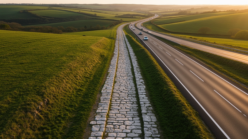
For centuries, the roads of the Roman Empire have stood as the archetypal symbol of ancient engineering prowess, so perfectly aligned that the proverb ‘all roads lead to Rome’ became shorthand for a system designed with almost imperial precision. Now, a team of researchers has subjected that reputation to its most rigorous quantitative test yet, and the results are both confirming and surprising. Using a newly constructed, spatially detailed digital model of nearly 300,000 kilometres of Roman roads spanning Europe, North Africa and the Middle East, the team applied the tools of network science and spatial statistics to questions that scholars have debated for more than a hundred years: how straight were Roman roads really, how central was Rome itself, and how much of this ancient infrastructure still shapes the highways we drive today?
The study, published in Nature Communications, builds on the Itiner-e dataset, the most comprehensive digital reconstruction of the Empire’s road system ever assembled. It contains 299,171.31 kilometres of roads, represented as a network of 10,516 nodes marking intersections and dead ends, connected by 14,901 edges representing road segments. The researchers divided the entire network into more than 400,000 one-kilometre segments and measured each one for slope, topographic position, orientation and sinuosity, a ratio of actual road length to the straight-line distance between a segment’s endpoints. A value of 1 indicates a perfectly straight road; higher values indicate winding courses. This granular approach allowed the team to move beyond qualitative impressions and test long-standing assumptions with hard numbers across the full extent of the Empire at its height around 150 CE.
The verdict on straightness is nuanced. Roman roads are indeed remarkably straight by pre-modern standards: the mean sinuosity across the dataset is just 1.048, with a median of 1.0045, meaning most segments deviate only marginally from a straight line. The straightest stretches lie in lowlands such as Western Europe, the Pannonian basin, the Po valley, North Africa and Syria, where terrain posed few obstacles. In mountainous regions, particularly Southeastern Europe, sinuosity rises noticeably. The analysis shows that sinuosity correlates positively with maximum slope, confirming that topography, not a lack of engineering ambition, dictated where roads bent. Crucially, however, major modern roads are straighter still, with mean and median sinuosity values of 1.024 and 1.0026 respectively, because contemporary earthmoving equipment can flatten and cut through terrain in ways no ancient surveyor could match.
Slope measurements reveal just how carefully Roman engineers managed gradients. Since animal-drawn carts and wagons could generally handle rises of no more than about 16 percent, the researchers checked how much of the network fell within vehicular limits. The answer: 90.57 percent of all recorded roads, some 270,955.85 kilometres, stay below that threshold. Most striking are the Alpine roads, which show lower slope values than routes through the Taurus, Pyrenees, Cantabrian Mountains, Atlas or Greek mountains. The team attributes this to two factors: the Alps offer favourable longitudinal valleys and passes, and Roman builders invested heavily in reshaping terrain through large-scale cuttings, terracing, retaining structures and, in exceptional cases, rock-cut tunnels, as seen in the Aosta Valley road system. The commitment to keeping Italy connected to the rest of Europe by land, it seems, was backed by serious engineering resources.
Perhaps the most consequential finding concerns persistence. Comparing the Roman network with a modern dataset of major roads and highways, the researchers found a moderate positive correlation between the two, with a Pearson coefficient of 0.46. In other words, where Roman roads were dense, major modern roads tend to be dense as well, nearly two thousand years later. The pattern is not uniform, however. Road density has surged in the industrial cores of Western Europe, including northern Italy, the Rhine-Meuse basin and Britain, and around modern metropolises like Paris, Madrid and Marseille that grew from small ancient towns. Conversely, Greece, Asia Minor and North Africa, which were among the most densely urbanised and road-rich parts of the Empire, now show comparatively sparse modern networks, reflecting centuries of shifting economic and political fortunes.
To probe this relationship more deeply, the team employed geographically weighted regression, a spatial statistical technique that allows the strength of a relationship to vary across the map rather than assuming a single global average. The model linking Roman and modern road locations explained a substantial share of the variance, with an adjusted R-squared of 0.61, but the residuals revealed a strikingly heterogeneous pattern with no large contiguous region of consistently strong association. This suggests that the persistence of Roman infrastructure into the modern road system is mediated by highly local circumstances, from topography and natural movement corridors to the survival of urban forms and divergent institutional histories, rather than by any single empire-wide mechanism. Notably, the relationship between Roman roads and modern population density proved much weaker, with the corresponding model explaining only about a quarter of the variance.
The network analysis also delivered a quantitative verdict on the proverb that gave the study its popular appeal. Using travel-time-weighted edge betweenness centrality, a metric that counts how many shortest paths between all pairs of locations pass through a given road segment, the team identified the true arteries of imperial mobility. The highest-betweenness routes follow the Mediterranean coastline through North Africa, the Levant, southern France and northwestern Spain, and thread along river valleys like the Po, Rhine and Danube. And here is the twist: Rome is not on the most central road in Italy, let alone the Empire. Cities such as Byzantium, Antioch, Ancyra and Corinth are better positioned as intermediaries for terrestrial movement across the continental network, with Byzantium benefiting from its role as the bridge between the European and Asian halves of the road system via the Bosporus ferry crossing.
Provincial capitals, by contrast, emerge as genuinely well-placed. Twenty-four of the forty-five provincial capitals fall within the top two deciles of empire-wide betweenness centrality, and thirty-five have at least one centrality score in the top decile of their provincial network. Capitals that lack high terrestrial centrality, such as Alexandria, Carthage and Lugdunum, turn out to be major riverine or maritime ports, suggesting that Roman authorities consistently placed administrative centres where either land or water mobility, and often both, was most efficient. The analysis also confirmed that roads historically classified as main arteries, the viae publicae recorded in ancient itineraries and marked by milestones, carried significantly higher betweenness than secondary roads in forty of forty-three provinces, with a median probability of 0.65 that a randomly chosen main road outranks a randomly chosen secondary one. This independently validates, with hard metrics, assumptions that archaeologists had previously made on qualitative grounds alone.
The provincial-level results reveal three distinct structural templates: linear networks strung along rivers or coastlines, centralised systems radiating from a focal settlement such as Naissus or Sarmizegetusa, and distributed networks like those of the Gallic provinces with multiple high-importance routes. Each template carried practical implications. A centralised network allowed intermediary hubs to control trade, information and military provisioning, but left the province vulnerable to the failure or capture of a single node, whereas distributed systems offered resilience. The researchers argue that the consistent centrality of main roads and capitals hints at deliberate planning at the provincial level, and possibly even supra-provincial coordination, though they caution that the analyses cannot reveal the causes, mechanisms or sequence of that planning.
The team is candid about the limitations of their data. Only 2.7 percent of the road kilometres in the dataset are classified as certain, with the remainder conjectured or hypothetical to varying degrees, and research intensity varies enormously across the former Empire. Yet robustness checks, including randomly removing uncertain segments with 20 percent probability across one hundred iterations, showed the key network results hold firm. The dataset represents the Empire’s road system roughly in its second-to-fourth-century configuration, and the authors stress that roads were only one strand of a transport web in which rivers and sea lanes carried most long-distance traffic. Future work integrating maritime and riverine routes promises an even fuller picture. For now, this study transforms a beloved historical cliché into a measurable reality: the Romans did build straight wherever the land allowed, their capitals really did sit at the crossroads of their world, and the ruts of their chariots can still, in a statistical sense, be traced beneath the asphalt of Europe’s motorways.
Subject of Research: Quantitative network analysis of the structure and modern persistence of the Roman road system
Article Title: Network science reveals the structure and lasting impact of the Roman road system
Article References: Pažout, A., Brughmans, T., de Soto, P., Mazzamurro, M., Coto-Sarmiento, M., Filet, C., Herrera Malatesta, E., Nielsen, M. L., Ølgaard, G. E., & Vahlstrup, P. B. (2026). Network science reveals the structure and lasting impact of the Roman road system. Nature Communications, 17(1), Article 9551. https://doi.org/10.1038/s41467-026-75453-3
Image Credits: AI Generated
DOI: 10.1038/s41467-026-75453-3
Keywords: Roman roads, network science, archaeology, sinuosity, betweenness centrality, spatial regression, Itiner-e dataset, Roman Empire, transport infrastructure, provincial capitals, road persistence, topographic analysis
Cite Scienmag News
Denise Maddox. (October 9, 2026). Roman Roads Were Straighter Than Thought, Yet Modern Highways Still Beat Them. Scienmag. https://scienmag.com/roman-roads-were-straighter-than-thought-yet-modern-highways-still-beat-them/
Denise Maddox. "Roman Roads Were Straighter Than Thought, Yet Modern Highways Still Beat Them." Scienmag, 9 October 2026, https://scienmag.com/roman-roads-were-straighter-than-thought-yet-modern-highways-still-beat-them/. Accessed 9 October 2026.
Denise Maddox. "Roman Roads Were Straighter Than Thought, Yet Modern Highways Still Beat Them." Scienmag. October 9, 2026. https://scienmag.com/roman-roads-were-straighter-than-thought-yet-modern-highways-still-beat-them/


