


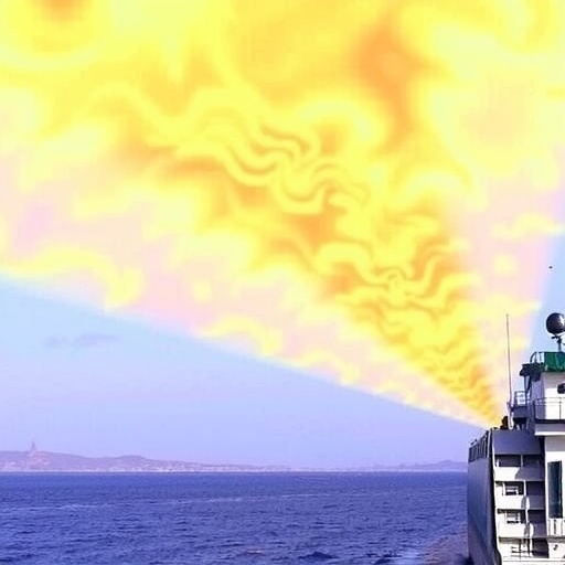
In a groundbreaking development poised to revolutionize environmental monitoring of marine pollution, a team of scientists from the University of Science and Technology of China has unveiled a fast-hyperspectral imaging remote sensing technique specifically designed to quantify nitrogen dioxide (NO₂) and sulfur dioxide (SO₂) emissions from marine vessels. This advanced imaging system addresses critical limitations of existing technologies and promises heightened accuracy and spatial resolution in detecting atmospheric pollutants emanating from ships, a sector recognized for contributing significantly to global air quality degradation.
Marine shipping remains an indispensable pillar of the global economy, transporting over 80% of merchandise worldwide. Nevertheless, emissions from vessels, including NOₓ, SOₓ, particulate matter, and volatile organic compounds, have a profound and expanding impact on the atmospheric environment, especially in congested shipping lanes and coastal urban centers. Given the intricate effects of these pollutants on marine and terrestrial ecosystems, public health, and climate, effective regulatory oversight requires precise, spatially resolved, and timely monitoring tools—a challenge that existing remote sensing approaches have struggled to meet.
Traditional optical remote sensing methods such as satellite or airborne imaging often suffer from inadequate spatial and temporal resolution. Satellite platforms can be hampered by cloud cover and generally lack the fine-scale spatial granularity necessary to analyze emissions at the level of individual vessels or plumes. Airborne campaigns, while more flexible, are limited by their operational cost and inability to provide continuous monitoring in maritime environments. Portable, ground-based remote sensing systems extend capabilities but remain expensive and typically cannot effectively capture dynamic plume dispersion over extended areas.
The newly developed fast-hyperspectral imaging system distinguishes itself through an innovative coaxial configuration integrating three distinct camera types: hyperspectral, visible light, and multiwavelength filter cameras. This arrangement facilitates simultaneous acquisition of complementary data channels, enhancing plume characterization. Central to the instrument’s performance is a high-precision spectrometer embedded within a temperature control module that maintains a stable 20°C ± 0.5°C environment, ensuring reduced measurement noise and improved spectral fidelity during data acquisition.
A pivotal advancement introduced by the research team lies in their novel plume categorization methodology. By analyzing variations in oxygen dimer (O₄) Differential Slant Column Densities (DSCDs), their technique differentiates between aerosol-present and aerosol-absent plumes. This classification enables more accurate calculation of the Air Mass Factor (AMF), a crucial parameter in remote sensing retrievals that accounts for the path length pollutants travel through the atmosphere. Tailoring AMF values to plume conditions markedly enhances concentration estimates of NO₂ and SO₂, overcoming longstanding inaccuracies in prior emission quantification efforts.
The system operates through two-dimensional ‘S’-shaped scanning patterns, rapidly covering targeted volumes with unprecedented spatial resolution below 0.5 meters squared per pixel. This rapid scanning capability allows the instrument to complete a full plume survey in under four minutes, a notable improvement over existing methods. To further refine concentration maps, the team introduced a plume reconstruction scheme that leverages differential absorption intensities derived from multiwavelength filter cameras. This approach generates high-resolution weighting matrices that correct initial hyperspectral imagery, resulting in detailed, precise mappings of trace gas distribution within emission plumes.
These technical innovations culminate in a highly effective tool for atmospheric emission monitoring validated through field experiments on a large ocean cargo ship and a smaller offshore vessel in Qingdao, China. Observed maximum concentrations reached 0.124 mg/m³ for NO₂ and 0.425 mg/m³ for SO₂ in the case of the larger vessel. Importantly, the instrument captured temporal variations in emissions as ships approached port, likely reflecting shifts in fuel quality and operational engine loads, information critical for dynamic emission inventory management and regulatory decision-making.
Beyond immediate pollution quantification, the technology offers a transformative pathway toward establishing real-time, measurement-driven emission inventories crucial for environmental policy enforcement and health risk mitigation. By addressing the timeliness shortcomings inherent to satellite and conventional airborne systems, hyperspectral imaging furnishes near-instantaneous insights into pollutant dispersion patterns and concentrations, empowering rapid response and targeted intervention initiatives.
Yet, challenges remain before the system’s full potential can be realized across broader atmospheric monitoring needs. The authors acknowledge the necessity of developing comprehensive absorption cross-section databases for diverse gases and conditions to augment retrieval accuracy. Moreover, extending hyperspectral imaging capabilities into nighttime operation and for greenhouse gas detection introduces complex technical hurdles, including the requirement for active illumination sources and enhanced tracking precision.
In response to such challenges, the research team envisions a future deployment scheme employing active multiwavelength LED sources integrated with UAV-mounted reflectors and advanced tracking mechanisms. Such innovations would enable stable hyperspectral measurements during nocturnal hours and in varying environmental conditions, substantially broadening the instrument’s operational envelope and impact on global emission surveillance.
The implications of this work reach far beyond marine shipping emissions. As hyperspectral remote sensing technology matures, it is poised to become an integral tool in managing urban air quality, industrial emissions, and even natural source monitoring. By delivering both high-fidelity spectral information and spatially resolved data, it bridges critical gaps in pollution detection that have hindered effective environmental governance.
This pioneering research, published in Light: Science & Applications, showcases a leap forward in remote sensing instrumentation that aligns with growing global emphasis on environmental sustainability and clean air initiatives. The method’s capacity to offer fast, accurate, and spatially detailed emission readings affirms its value not only to scientists but also policymakers and stakeholders aiming to foster healthier marine ecosystems and coastal communities.
In summation, the integration of hyperspectral imaging with precise temperature control, advanced plume characterization, and rapid scanning modalities equips this new remote sensing platform with exceptional sensitivity and accuracy. These capabilities empower comprehensive quantification and monitoring of harmful NO₂ and SO₂ emissions from marine vessels, setting a new standard for maritime atmospheric environmental assessments. The ongoing refinement and expansion of this technology promise to underpin more effective pollution control strategies amid mounting global pressure to mitigate anthropogenic air pollution.
Cite Scienmag News
Russell Cooper. (September 23, 2025). Rapid Hyperspectral Imaging Enables Precise Measurement of NO2 and SO2 Emissions from Marine Vessels. Scienmag. https://scienmag.com/rapid-hyperspectral-imaging-enables-precise-measurement-of-no2-and-so2-emissions-from-marine-vessels/
Russell Cooper. "Rapid Hyperspectral Imaging Enables Precise Measurement of NO2 and SO2 Emissions from Marine Vessels." Scienmag, 23 September 2025, https://scienmag.com/rapid-hyperspectral-imaging-enables-precise-measurement-of-no2-and-so2-emissions-from-marine-vessels/. Accessed 4 September 2026.
Russell Cooper. "Rapid Hyperspectral Imaging Enables Precise Measurement of NO2 and SO2 Emissions from Marine Vessels." Scienmag. September 23, 2025. https://scienmag.com/rapid-hyperspectral-imaging-enables-precise-measurement-of-no2-and-so2-emissions-from-marine-vessels/


