Researchers have built a 12-year, hour-by-hour digital reconstruction of water movement and water quality in Ise Bay, Japan, one of the country’s largest semi-enclosed coastal bays. The product, called the Ise Bay Reanalysis (IBRA), blends a coupled ocean circulation and ecosystem model with continuous measurements of water temperature, salinity, and dissolved oxygen collected at fixed monitoring stations. Published in Earth System Science Data, the dataset covers 2011 through 2022 and is freely available to scientists and environmental managers via Zenodo.
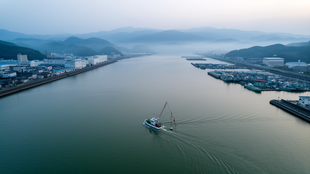
The motivation behind the work is a problem that plagues coastal waters worldwide: hypoxia, the depletion of dissolved oxygen in bottom waters that can suffocate fish, shellfish, and the organisms they depend on. In semi-enclosed bays like Ise Bay, oxygen starvation develops each summer when warm surface waters stratify from cooler bottom layers, cutting off ventilation of the seabed. Observations alone cannot fully capture when and where these conditions occur, because monitoring stations sample only fixed points in a bay spanning roughly 2,342 square kilometers with an average depth of 17 meters and a maximum depth of 100 meters.
Reanalysis datasets fill this gap by running numerical models and continuously nudging them toward reality using observations. But the authors, Yoshitaka Matsuzaki, Hayato Mizuguchi, and Tetsunori Inoue, note that most existing marine reanalysis products rely primarily on satellite data, which are largely limited to the sea surface. That leaves subsurface biogeochemical variability poorly resolved, a serious shortcoming for enclosed coastal systems where the most consequential chemistry happens near the seabed. Reanalysis datasets that directly assimilate oxygen data remain relatively rare.
IBRA was generated with the Ecological hydrodynamics simulation system of the Port and Airport Research Institute Simulator, coupled with an ensemble Kalman filter data assimilation system. The model grid spans 85 by 85 cells at 800-meter spacing, with 38 vertical layers resolving the full water column, from 0.5-meter spacing near the surface to coarser spacing at depth. Observations from eight in situ monitoring stations operated by the Chubu Regional Development Bureau of the Ministry of Land, Infrastructure, Transport and Tourism were assimilated every six hours, at 00:00, 06:00, 12:00, and 18:00 Japan Standard Time.
The six-hour assimilation cycle is one of the dataset’s three distinguishing features. Tidal currents are a dominant driver of physical and biogeochemical transport in coastal waters, and assimilating observations at this frequency allows the reconstruction to resolve short-term variability driven by tidal processes rather than smoothing it away. The second feature is the assimilation of continuous in situ measurements throughout the entire water column, including bottom-layer dissolved oxygen, rather than surface-only satellite observations. The third is the ensemble Kalman filter itself, which applies spatially coherent corrections across the entire bay, avoiding the artificial discontinuities that simpler assimilation approaches can introduce.
The ensemble Kalman filter works by running 32 parallel model members with perturbed boundary conditions and model parameters, then estimating background error covariances from the spread of the ensemble. The Kalman gain determines how strongly each observation pulls the model state, and because the background error covariance encodes spatial correlations, a single station’s measurement corrects neighboring regions in a physically consistent way. Notably, the team excluded grid cells adjacent to the lateral boundary and near the mouths of the three largest rivers, the Kiso, Ibi, and Nagara, because assimilation became unstable there. Perturbations were also applied to sediment parameters controlling oxygen consumption and hydrogen sulfide release from bottom sediments, key empirical controls on bottom-water oxygen.
Validation showed clear gains from data assimilation. Averaged across all stations and depth layers over 12 years, the mean error in water temperature fell from 0.95 to 0.31 degrees Celsius, and the root-mean-square error dropped from 1.45 to 0.77 degrees Celsius. For salinity, the mean error decreased from 0.16 to 0.09 and the correlation coefficient improved from 0.71 to 0.78, the only metric that did not improve being the standard deviation error. For bottom-layer dissolved oxygen, the mean error improved from minus 0.35 to minus 0.05 milligrams per liter and the root-mean-square error fell from 1.32 to 1.25 milligrams per liter, although the correlation coefficient remained unchanged at 0.85, and improvements were not observed at every station.
Detailed comparisons at representative stations in 2021, a year of severe hypoxia, showed the dataset reproducing the seasonal development of bottom-layer hypoxia during summer stratification and its recovery in autumn. In the inner region of Mikawa Bay, where hypoxia is most pronounced, the timing of stratification onset and breakdown was accurately captured. At the mouth of Ise Bay, where oxygen levels never reached hypoxic levels, the seasonal cycle was also well reproduced. Horizontal distribution maps compared against ship-based observations showed the reconstruction capturing the intrusion of high-oxygen offshore water from the east and the resulting east-west oxygen gradient, though absolute dissolved oxygen values were slightly underestimated in the snapshot examined.
The authors are candid about limitations. Discrepancies persist in absolute dissolved oxygen values during periods of rapid variability, such as intense mixing events, and short-term fluctuations in bottom-layer oxygen at some stations, particularly in the inner Ise Bay, were not always fully reproduced. Accuracy varies with location and environmental conditions, and the team notes that a more detailed evaluation of short-term processes remains a subject for future study. Users applying the dataset to quantitative analyses should account for these uncertainties.
The applications extend well beyond academic curiosity. Japan’s Ministry of the Environment has been gradually establishing environmental standards for bottom-layer dissolved oxygen concentrations in enclosed water bodies, and IBRA was developed in part to support assessments of compliance with these standards. The dataset can also serve as a resource for studying physical-biogeochemical interactions, validating regional models, and providing boundary or initial conditions for local modeling studies. Distributed as annual NetCDF files under a Creative Commons Attribution 4.0 license, with water temperature, salinity, dissolved oxygen, water level, and current velocities at hourly resolution, IBRA offers one of the most complete long-term pictures yet of how a heavily used semi-enclosed bay breathes, stagnates, and recovers across more than a decade.
Subject of Research: A 12-year hydrodynamic and biogeochemical reanalysis dataset for Ise Bay, Japan, assimilating in situ temperature, salinity, and dissolved oxygen observations.
Article Title: Ise Bay Reanalysis (IBRA): a 12-year ecological hydrodynamic reanalysis dataset for Ise Bay, Japan
Article References: Matsuzaki, Y., Mizuguchi, H., & Inoue, T. (2026). Ise Bay Reanalysis (IBRA): a 12-year ecological hydrodynamic reanalysis dataset for Ise Bay, Japan. Earth System Science Data, 18(10), 7839-7859. https://doi.org/10.5194/essd-18-7839-2026
Image Credits: AI Generated
DOI: 10.5194/essd-18-7839-2026
Keywords: Ise Bay, reanalysis dataset, data assimilation, dissolved oxygen, coastal hypoxia, ensemble Kalman filter, hydrodynamic model, biogeochemistry, Japan, water quality, semi-enclosed bay, Earth System Science Data
Cite Scienmag News
Violet Maxwell. (October 30, 2026). New 12-Year Dataset Tracks Oxygen Starvation in Japan’s Ise Bay. Scienmag. https://scienmag.com/new-12-year-dataset-tracks-oxygen-starvation-in-japans-ise-bay/
Violet Maxwell. "New 12-Year Dataset Tracks Oxygen Starvation in Japan’s Ise Bay." Scienmag, 30 October 2026, https://scienmag.com/new-12-year-dataset-tracks-oxygen-starvation-in-japans-ise-bay/. Accessed 4 November 2026.
Violet Maxwell. "New 12-Year Dataset Tracks Oxygen Starvation in Japan’s Ise Bay." Scienmag. October 30, 2026. https://scienmag.com/new-12-year-dataset-tracks-oxygen-starvation-in-japans-ise-bay/