


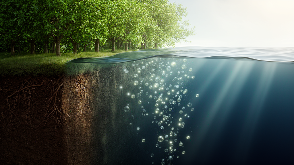
Every serious projection of future climate change rests on a deceptively simple question: after humanity emits carbon dioxide, where does it actually go? Roughly half of our emissions are currently absorbed by the ocean and by land ecosystems, but that fraction is not guaranteed to persist as the planet warms. Answering it requires models that do not merely simulate wind, rain and temperature, but that also let living ecosystems — plankton in the sea, forests on land — breathe carbon in and out of the atmosphere in real time. A team led by Anastasia Romanou at NASA’s Goddard Institute for Space Studies has now unveiled exactly such a machine: the NASA-GISS ModelE2.1-CC2, a fully interactive Earth system model whose development and evaluation are described in a comprehensive new paper in the journal Geoscientific Model Development.
ModelE2.1-CC2 is the successor to the carbon-cycle configuration that NASA-GISS contributed to the sixth Climate Model Intercomparison Project (CMIP6), known as GISS-E2.1-G-CC. The physical climate core is unchanged from that predecessor, but the new version carries substantially upgraded ocean and land carbon cycle components, longer and more carefully equilibrated simulations, and a battery of conservation diagnostics that track every gram of carbon, every joule of heat and every unit of water as it shuttles between reservoirs. The result, the authors report, is a model with smaller drifts in all of its carbon pools than the previous release — a quiet but crucial achievement, because drifting carbon reservoirs can masquerade as climate responses that are actually numerical artifacts.
The technical architecture is ambitious. The atmosphere runs at 2 by 2.5 degrees of latitude and longitude with 40 vertical layers reaching into the lower mesosphere, coupled to an ocean at 1 by 1.25 degrees that is non-Boussinesq, meaning it explicitly represents density variations in its momentum and continuity equations. The ocean conserves potential enthalpy, freshwater and salt, and uses the quadratic upstream advection scheme, which tracks subgrid-scale moments of each tracer and thereby sharpens the effective resolution of the simulated biogeochemistry. Mesoscale eddy transport is handled through a quasi-isopycnal formulation with surface-intensified diffusivity that allows eddies to restratify the Southern Ocean realistically, and vertical mixing combines the K-profile parameterization with tidally driven dissipation — a detail that matters because the model’s Atlantic overturning circulation proves sensitive to it.
The ocean carbon cycle is built on the NASA Ocean Biogeochemistry Model, expanded into a version called NOBMg. It simulates four phytoplankton functional groups — diatoms, chlorophytes, cyanobacteria and coccolithophores — competing for four nutrients: nitrate, silicate, ammonia and iron. Dissolved organic and inorganic carbon are carried prognostically, carbonate chemistry is solved with the MOCSY routines, and gas exchange with the atmosphere follows the CMIP6 protocol. The new version adds prognostic oxygen and alkalinity, an updated iron cycle with regionally varying organic ligands, and a revised treatment of nitrogen fixation in which cyanobacteria draw on an effectively unlimited reservoir of atmospheric N2 but are inhibited when nitrate and ammonium are abundant, mirroring laboratory findings on the marine diazotroph Trichodesmium.
Getting such a model to sit still — to hold atmospheric CO2 steady in a preindustrial control climate — demanded an elaborate spin-up and tuning campaign. The physical model was run to radiative equilibrium over roughly 3,000 model years; the land carbon cycle was equilibrated by iterating 9 years of simulated meteorology and litterfall 750 times through the soil carbon pools, equivalent to 6,750 simulated years and completed in under 24 hours on 88 processor cores; and the ocean carbon cycle was spun up for about 300 years atop a preindustrial ocean equilibrated over 7,000 years. Tuning experiments adjusted phytoplankton growth rates, remineralization rates and iron scavenging until the air-sea CO2 flux approached zero and ocean net primary production rose from 15 to about 30 petagrams of carbon per year. Notably, the tuned iron scavenging rate came out two orders of magnitude higher than in the CMIP6-era model, but consistent with observed scavenging rates for trace metals that behave like iron.
On land, the Ent Terrestrial Biosphere Model simulates 12 plant functional types with a coupled photosynthesis-stomatal conductance scheme based on the Farquhar and Ball-Berry formulations, canopy radiative transfer that resolves sunlit and shaded leaf layers, and soil biogeochemistry adapted from the Carnegie-Stanford-Ames model. In its current configuration, Ent runs in biophysics-only mode: vegetation structure and leaf area index are prescribed from MODIS satellite observations, while the plant labile carbon pool and nine soil carbon pools evolve prognostically. Irrigation is a prognostic field drawing first from rivers and lakes, then from groundwater, contributing about 0.2 millimeters per year of sea-level-equivalent freshwater in 2010 — an imbalance the team attributes to underestimated surface water storage and the absence of reservoirs in the model.
How does it perform against reality? In historical simulations spanning 1850 to 2021, driven by CO2 emissions rather than prescribed concentrations, the model tracks observed atmospheric CO2 closely, with the largest discrepancies between 1900 and 1970. Surface temperature anomalies follow the GISTEMP record well, particularly after the 1950s, though the model overestimates the cooling after the Pinatubo eruption and shows stronger El Niño-driven variability. Ocean heat uptake agrees well with Argo float estimates and the ECCO-V4r4 ocean state estimate. Soil carbon storage is a striking success: the simulated global total of 1,693 petagrams of carbon is virtually identical to the 1,700 petagrams from inventory compilations cited by the Global Carbon Budget.
The model is candid about its weaknesses. Ocean net primary productivity, at roughly 30 petagrams of carbon per year, sits well below the 50 to 60 petagrams suggested by observations, and the team traced part of the shortfall to a genuine coding error in the underwater radiative transfer routines — layer depth was used where layer thickness belonged, starving subsurface waters of light. The absence of photoadaptation, which would let phytoplankton raise their chlorophyll-to-carbon ratios in dim waters, compounds the problem. On land, gross primary production of about 127 petagrams per year falls at the low end of the 110 to 170 petagram range, and aboveground biomass is grossly overestimated at 533 petagrams of carbon — nearly double satellite estimates — because the prescribed forest heights derive from early ICESat/GLAS lidar data now known to be about six meters too tall. The model also omits deforestation, wood harvest and fire, missing roughly 1 petagram of carbon per year in land-use emissions, which likely explains its slightly underpredicted atmospheric CO2.
Despite these caveats, the model has already proven itself in the wider community. In a 13-model intercomparison of remaining carbon budgets for 1.5 and 2 degrees of warming, its responses fell consistently within the ensemble spread, and in experiments probing positive, zero and negative CO2 emissions it behaved like its peers except for a stronger late-phase response to carbon dioxide removal driven by a weakened Atlantic overturning circulation. Its estimates of the fraction of CO2 escaping to the atmosphere after seafloor trawling disturbances agreed closely with a data-assimilated ocean model. These are exactly the kinds of questions — carbon budgets, carbon dioxide removal, geoengineering feasibility — that Earth system models exist to answer.
The roadmap ahead is substantial. The ocean team plans to add diel vertical migration, denitrification and a closed nitrogen cycle, particulate inorganic carbon for the calcium carbonate pump, and interactive dust-iron deposition. On land, a new geometric-optical canopy radiative transfer scheme will ingest vertical foliage profiles from NASA’s GEDI and ICESat-2 lidar missions, updated tree allometry from the Tallo database will replace the biased height prescriptions, and a fire module coupled to land carbon and atmospheric chemistry is under development, paving the way for explicit deforestation dynamics. Future versions will be benchmarked against pioneering NASA observations from the PACE and SWOT missions and the EMIT hyperspectral imager. In an era when the remaining carbon budget is the number that governs global climate policy, models like ModelE2.1-CC2 — transparent about their errors, conserving their quantities to machine precision, and grounded in satellite observation — are the instruments by which that number will be refined.
Subject of Research: Development and observational evaluation of the NASA-GISS ModelE2.1-CC2 Earth system model with interactive ocean and land carbon cycles
Article Title: The NASA-GISS ModelE2.1-CC2 ESM: development and evaluation
Article References: The NASA-GISS ModelE2.1-CC2 ESM: development and evaluation. (n.d.). https://doi.org/10.5194/gmd-19-9131-2026
Image Credits: AI Generated
Keywords: Earth system model, NASA GISS, carbon cycle, climate modeling, ocean biogeochemistry, terrestrial biosphere, CMIP6, CO2 emissions, phytoplankton, soil carbon, iron cycle, model evaluation
Cite Scienmag News
Violet Maxwell. (October 9, 2026). NASA’s New Earth System Model Tracks Carbon From Forest Canopy to Ocean Depths. Scienmag. https://scienmag.com/nasas-new-earth-system-model-tracks-carbon-from-forest-canopy-to-ocean-depths/
Violet Maxwell. "NASA’s New Earth System Model Tracks Carbon From Forest Canopy to Ocean Depths." Scienmag, 9 October 2026, https://scienmag.com/nasas-new-earth-system-model-tracks-carbon-from-forest-canopy-to-ocean-depths/. Accessed 9 October 2026.
Violet Maxwell. "NASA’s New Earth System Model Tracks Carbon From Forest Canopy to Ocean Depths." Scienmag. October 9, 2026. https://scienmag.com/nasas-new-earth-system-model-tracks-carbon-from-forest-canopy-to-ocean-depths/


