


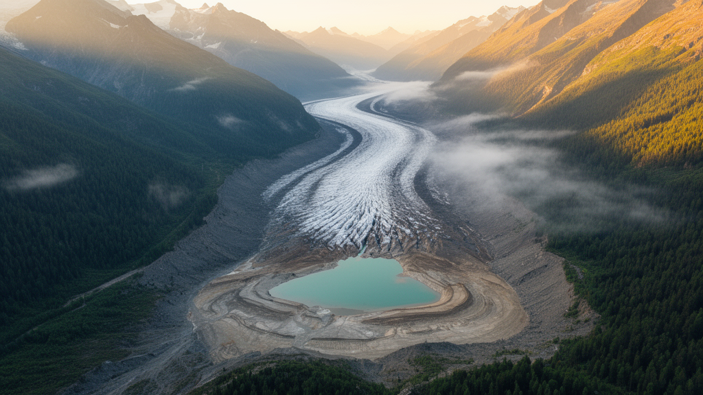
Beneath the rolling hills of Upper Swabia in southwestern Germany, glacial scientists expected to find the calm, layered muds of ancient lakes. Instead, two new drill cores recovered from buried basins carved by the Rhine Glacier have delivered a surprise: almost no classic lake deposits at all. The findings, published in the journal Scientific Drilling as part of the International Continental Scientific Drilling Program project Drilling Overdeepened Alpine Valleys (DOVE), suggest that the textbook picture of how glacial basins fill up may describe only one end of a much wider spectrum of glacial behavior.
Overdeepenings are valleys and basins that glaciers have gouged several hundred meters below the surrounding landscape, often through the action of pressurized subglacial meltwater. When the ice retreats, these hollows typically flood and become lakes, and their sedimentary infills record the transition from ice contact to quiet lacustrine deposition. Because later glaciations can erase sediments from open ground, overdeepened troughs are among the few places where the archives of older ice ages survive. That makes them prized targets for reconstructing the repeated Pleistocene glaciations that reshaped the Alps and their foreland.
Previous drilling campaigns across the northern Alpine foreland, including the nearby DOVE sites in the Tannwald Basin and the Basadingen Trough, consistently recovered a characteristic succession: a thin basal diamict deposited beneath the ice, overlain by thick fine-grained lake sediments, and capped by fluvial deposits. The new cores, however, break the pattern. Both are dominated from bottom to top by diamicts, poorly sorted mixtures of clay, silt, sand, and scattered clasts that form directly at or near the base of active glacier ice, with only occasional interludes of massive sands and fines.
The first core, ICDP 5068_6, was drilled near the village of Gaisbeuren, roughly twelve kilometers south of the Tannwald Basin site. The 144-meter core penetrated about eleven meters of Neogene Molasse bedrock before reaching its final depth, and the team divided the Quaternary fill into four sedimentological lithotypes arranged in seven lithostratigraphic units. The lowermost unit above the bedrock consists of strongly consolidated, deformed diamictic fines and matrix-rich diamicts containing shear bands and faceted flat-iron clasts, hallmarks of a subglacial traction till emplaced at the sole of warm-based ice.
Above that basal unit, the Gaisbeuren core records an alternation of massive medium to coarse sands, a thick 41-meter fining-upward diamict succession interpreted as a melt-out till deposited in a sub- to proglacial lake setting, and a second package of deformed traction tills. Near the top, clastic dikes several meters tall cut through yellowish diamicts, evidence of high water-pressure gradients beneath an overriding glacier. The uppermost unit, rich in clasts and marked by aligned clasts and deformation structures, is interpreted as subglacial till deposited in a setting that was no longer overdeepened, where meltwater could drain and winnow away the fine matrix.
The second core, recovered at the hamlet of Lichtenegg on the Höchsten butte, is arguably even more remarkable. The butte, at about 840 meters above sea level, is the topographically highest point of the Lake Constance Amphitheatre, and the 76-meter core targeted a small basin buried beneath glaciofluvial gravels presumed to be Early Pleistocene in age. It is one of only two known locations in the entire Rhine Glacier area where these Deckenschotter gravel units are enclosed between glacial sediments, making the site potentially home to the oldest preserved Pleistocene deposits in the region and earning it status as a bonus site of the DOVE project.
The Lichtenegg core was divided into six lithotypes and five units. Its lowermost fill begins with sheared, dense basal traction tills containing Molasse fragments, passes upward through structureless melt-out tills into well-sorted fines, and terminates in a gravel layer indicating fluvial transport in a deltaic or non-overdeepened setting. A calcareous sandstone boulder of Alpine provenance, roughly three meters across, pierced the core at about 48 meters depth; its position atop well-sorted fines suggests it was redeposited, perhaps by a mass movement from a nearby moraine, rather than dropped directly from melting ice. Above the gravels, a coarsening-upward package of diamicts with flat-iron clasts marks a renewed glacial advance, and the sequence is capped by more than 25 meters of partly cemented meltwater gravels and a final till with a pronounced sub-horizontal clast fabric.
The researchers attribute the striking absence of lacustrine deposits to geography. Most earlier drillings into overdeepenings were sited in distal positions, far from the glacier front, where basins were quickly abandoned during retreat and filled with quiet lake sediments. The Gaisbeuren and Lichtenegg sites, by contrast, occupy more central, proximal positions within the former Rhine Glacier lobe. There, the ice front appears to have lingered near the drill sites for prolonged periods, or exceptionally high sediment supply produced thick diamict accumulations, so the basins never had the chance to evolve into calm lakes. The team suggests the diamict successions may be analogs of the subaqueous moraine complexes identified in modern Alpine lakes such as Lake Thun and Lake Lucerne, though the pervasive ice-contact deformation in the cores points to a more complex history of repeated glacier advance and grounding than simple moraines record.
The implications reach beyond southwestern Germany. If the classic lacustrine-dominated fill represents only the distal, quickly abandoned parts of overdeepened basins, then sediment cores from such sites may systematically underrepresent the full variability of glacial archives. Notably, the traction tills in the Gaisbeuren core occur at elevations and stratigraphic positions strikingly similar to diamicts within the lacustrine-dominated Tannwald succession twelve kilometers to the north, raising the tantalizing possibility that the two profiles are proximal and distal expressions of the same basin fill. That correlation remains hypothetical, but it illustrates how paired cores from different positions within a single basin could ultimately reconstruct the rhythm of glacial advances, retreats, and stagnations that built the Alpine foreland landscape.
Subject of Research: Sedimentology and stratigraphy of glacially overdeepened basin fills in the former Rhine Glacier domain of southwestern Germany
Article Title: Where are the lake deposits? Two atypical overdeepening fills from the Rhine Glacier lobe in southwestern Germany
Article References: Pomper, J. E., Zeeden, C., Preusser, F., Wielandt-Schuster, U., & Gegg, L. (2026). Where are the lake deposits? Two atypical overdeepening fills from the Rhine Glacier lobe in southwestern Germany. Scientific Drilling, 35(2), 193-209. https://doi.org/10.5194/sd-35-193-2026
Image Credits: AI Generated
Keywords: Rhine Glacier, overdeepening, drill cores, ICDP DOVE, Lake Constance, Pleistocene, diamict, subglacial till, glaciolacustrine sediments, Upper Swabia, Molasse, Quaternary stratigraphy
Cite Scienmag News
Violet Maxwell. (October 8, 2026). Missing Lake Sediments Reveal Glaciers Lingered in Hidden Basins of the Rhine Glacier Lobe. Scienmag. https://scienmag.com/missing-lake-sediments-reveal-glaciers-lingered-in-hidden-basins-of-the-rhine-glacier-lobe/
Violet Maxwell. "Missing Lake Sediments Reveal Glaciers Lingered in Hidden Basins of the Rhine Glacier Lobe." Scienmag, 8 October 2026, https://scienmag.com/missing-lake-sediments-reveal-glaciers-lingered-in-hidden-basins-of-the-rhine-glacier-lobe/. Accessed 8 October 2026.
Violet Maxwell. "Missing Lake Sediments Reveal Glaciers Lingered in Hidden Basins of the Rhine Glacier Lobe." Scienmag. October 8, 2026. https://scienmag.com/missing-lake-sediments-reveal-glaciers-lingered-in-hidden-basins-of-the-rhine-glacier-lobe/


