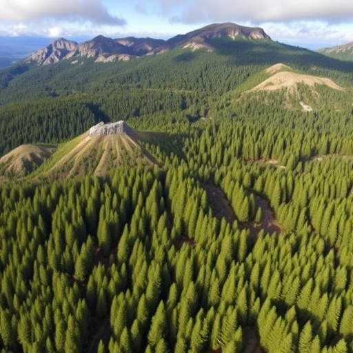
In a groundbreaking study poised to redefine conservation priorities, researchers have unveiled a comprehensive mapping of multifunctionality within the remote Patagonian forest landscapes. This work exposes the existence of high-value ecosystems extending far beyond formally protected zones, highlighting an urgent need to reassess current environmental safeguarding strategies. The research team, led by Hernández-Moreno et al., employed cutting-edge remote sensing techniques alongside sophisticated ecological modeling to chart a landscape characterized by immense ecological complexity and interwoven ecosystem services.
Patagonia, a region known for its vast wilderness and biodiversity, has long been considered a global conservation priority. However, much of its protection has historically focused on designated national parks and reserves. By integrating multispectral satellite imagery with in situ biodiversity inventories, the authors revealed how ecosystem multifunctionality — the simultaneous provision of multiple ecosystem services such as carbon storage, biodiversity support, and water regulation — is distributed heterogeneously across this vast terrain. Their findings challenge the assumption that only protected areas harbor critical ecological functions, suggesting that unprotected regions contribute substantially to landscape-wide resilience and service delivery.
The methodology underpinning this research involved high-resolution remote sensing datasets processed through advanced machine learning algorithms to disaggregate complex ecological patterns. This enabled differentiation between forest types, successional stages, and structural diversity at an unprecedented spatial scale. Subsequently, the research incorporated biodiversity metrics, including species richness and endemism indices, alongside ecosystem service proxies like above-ground biomass and soil carbon content. Such multidimensional mapping provided a holistic perspective on how different landscape elements synergize to sustain ecological functions.
One particularly striking revelation was the prominence of matrix forestlands, areas traditionally viewed as less critical due to their non-protected status and fragmented nature. These lands exhibited disproportionately high multifunctionality scores, indicative of their role as buffers and corridors that maintain ecological connectivity. Such corridors are essential under scenarios of climate change, enabling species migrations and gene flow, thereby enhancing adaptive capacity. This insight fundamentally reevaluates the spatial distribution of conservation value, advocating for a landscape-scale approach rather than isolated park-centric policies.
In addition to biophysical analysis, the study integrated socio-ecological dimensions by mapping human land use and impact gradients. This intersectional perspective illuminated conflicts and complementarities between conservation objectives and local livelihoods. For example, areas under sustainable forestry practices showed promising multifunctional capacities while supporting economic activities, suggesting pathways to harmonize development and biodiversity conservation.
Scientists also emphasized the dynamic nature of these ecosystems, subject to disturbance regimes such as wildfires and pest outbreaks. Incorporating temporal datasets allowed the team to observe resilience patterns and recovery trajectories across different forest stands. These dynamics are crucial for anticipating future ecosystem service provisions, especially under projected increases in extreme climatic events. Hence, the study not only captures a static snapshot but imparts predictive insights into ecosystem functionality amid ongoing environmental change.
The implications of this work extend beyond Patagonia, offering a replicable framework for multifunctionality assessment in other global biodiversity hotspots. By transcending simplistic protected area delineations, such approaches can inform more nuanced and just conservation policies that respect indigenous territories, promote sustainable resource use, and enhance ecological equity. This paradigm shift urges stakeholders — from policymakers to local communities — to reimagine conservation as an integrative endeavor embedded within multifunctional landscapes.
Moreover, the ability to quantify ecosystem services at fine scales equips decision-makers with actionable data to prioritize investments and monitor conservation outcomes. The researchers highlight opportunities to integrate their findings into global initiatives such as the Post-2020 Global Biodiversity Framework, contributing to targets on ecosystem restoration and climate mitigation. The multilayered maps generated serve as vital tools for aligning conservation with carbon offset programs, water security measures, and biodiversity safeguards.
While the technology and analytic sophistication of the study are remarkable, the researchers caution that mapping alone is insufficient without transformative governance. Strengthening institutional frameworks, fostering cross-sectoral collaborations, and incorporating local knowledge systems are imperative to translate scientific insights into on-the-ground conservation successes. They advocate for adaptive management strategies that can respond flexibly to emerging data and environmental conditions.
The study also underscores ethical considerations in conservation planning, particularly recognizing the rights and roles of indigenous peoples who have historically shaped and stewarded these landscapes. Engaging these communities as partners rather than passive beneficiaries aligns conservation with social justice and cultural preservation, fostering inclusive stewardship models.
Future directions highlighted by the team include expanding temporal monitoring to capture more granular trends in ecosystem service fluctuations and integrating new remote sensing technologies such as LiDAR and hyperspectral imaging. These advancements promise even more detailed assessments of forest structure and function, enhancing predictive modeling under various climate scenarios.
In conclusion, Hernández-Moreno and colleagues’ research represents a pivotal advancement in our understanding of Patagonian forest ecosystems, revealing that valuable ecological functions permeate beyond the boundaries of protected areas. By marrying state-of-the-art remote sensing with robust ecological frameworks, this study ignites a transformative narrative in conservation science — one that champions multifunctional, equitable, and dynamic landscapes as the future of global biodiversity stewardship.
Subject of Research:
Ecological multifunctionality of forest landscapes in Patagonia and its implications for conservation beyond protected areas.
Article Title:
Mapping multifunctionality in remote Patagonian forest landscapes reveals high-value ecosystems beyond protected areas.
Article References:
Hernández-Moreno, Á., Potapov, P., Soto, D.P. et al. Mapping multifunctionality in remote Patagonian forest landscapes reveals high-value ecosystems beyond protected areas. Commun Earth Environ (2026). https://doi.org/10.1038/s43247-026-03515-x
Image Credits: AI Generated
DOI: 10.1038/s43247-026-03515-x
Keywords:
Patagonia, forest multifunctionality, ecosystem services, remote sensing, biodiversity conservation, landscape connectivity, ecological resilience, climate adaptation.
