

Tuesday, October 20, 2026
Science
No Result
View All Result
  • Login
  • HOME
  • SCIENCE NEWS
  • CONTACT US
  • HOME
  • SCIENCE NEWS
  • CONTACT US
No Result
View All Result
Scienmag
No Result
View All Result
Home Science News Earth Science

Mapping groundwater potential zones using GIS, remote sensing and analytical hierarchy process (AHP) in Pader and Kitgum Districts, Uganda

October 20, 2026
in Earth Science
Violet Maxwell
By Violet Maxwell Scienmag Editorial Profile - Natural Hazards
Reading Time: 2 mins read
0
Satellites and Smart Maps Reveal Where Water Hides Beneath Northern Uganda

Satellites and Smart Maps Reveal Where Water Hides Beneath Northern Uganda

65
SHARES
587
VIEWS
Share on FacebookShare on Twitter
ADVERTISEMENT

A geospatial study in northern Uganda mapped 67.24% of Kitgum District as having very low to low groundwater potential, while 85.5% of Pader District was classified as high to very high potential. The findings, summarized in the study’s abstract, concern preliminary groundwater exploration across Kitgum and Pader districts in the Acholi subregion, where the researchers identified substantial differences between the two mapped areas.

The study integrated Geographic Information Systems, remote sensing and the Analytic Hierarchy Process (AHP) to generate a groundwater-potential map. Six thematic layers—rainfall, drainage density, slope, soil type, geology, and land use/land cover—were selected based on their reported hydrogeological influence and the availability of data. After standardization and assignment of normalized weights, the researchers used weighted-overlay analysis in ArcGIS Pro 3.1.0 to combine the layers. The resulting map divided the study area into five categories: very low, low, medium, high and very high groundwater potential.

Kitgum’s mapped area was described as predominantly having very low to low potential, with the abstract identifying higher drainage density and steeper slopes as constraints. Pader showed a contrasting modeled pattern: 85.5% of its area was placed in the high or very high categories, which the researchers associated with gentler slopes and higher rainfall that they said enhanced infiltration capacity. These are characteristics identified by the model and its AHP weighting framework, rather than direct measurements of groundwater volume at every mapped location.

For validation, the researchers compared the model with yield data from 18 existing boreholes. They reported a 75.0% alignment between model classifications and actual well performance and described this as confirming the model’s reliability at an acceptable level. The study is presented as a preliminary GIS-based assessment for data-scarce environments, and its map is intended as a scientific basis for more targeted groundwater exploration. The available evidence comes from the abstract of an open-access, peer-reviewed article shared in an early version subject to further editing; it does not provide the full model inputs, weighting values, detailed borehole results or an uncertainty analysis. The validation sample of 18 boreholes and the preliminary nature of the assessment also limit the precision with which the mapped zones can be interpreted.

Subject of Research: Preliminary GIS and AHP assessment of groundwater potential in Kitgum and Pader districts, Uganda

Article Title: Mapping groundwater potential zones using GIS, remote sensing and analytical hierarchy process (AHP) in Pader and Kitgum Districts, Uganda

Article References: Dirie, A. A., Mohamed, A. A., & Kannapiran, A. (2026). Mapping groundwater potential zones using GIS, remote sensing and analytical hierarchy process (AHP) in Pader and Kitgum Districts, Uganda. Discover Sustainability. https://doi.org/10.1007/s43621-026-04943-7

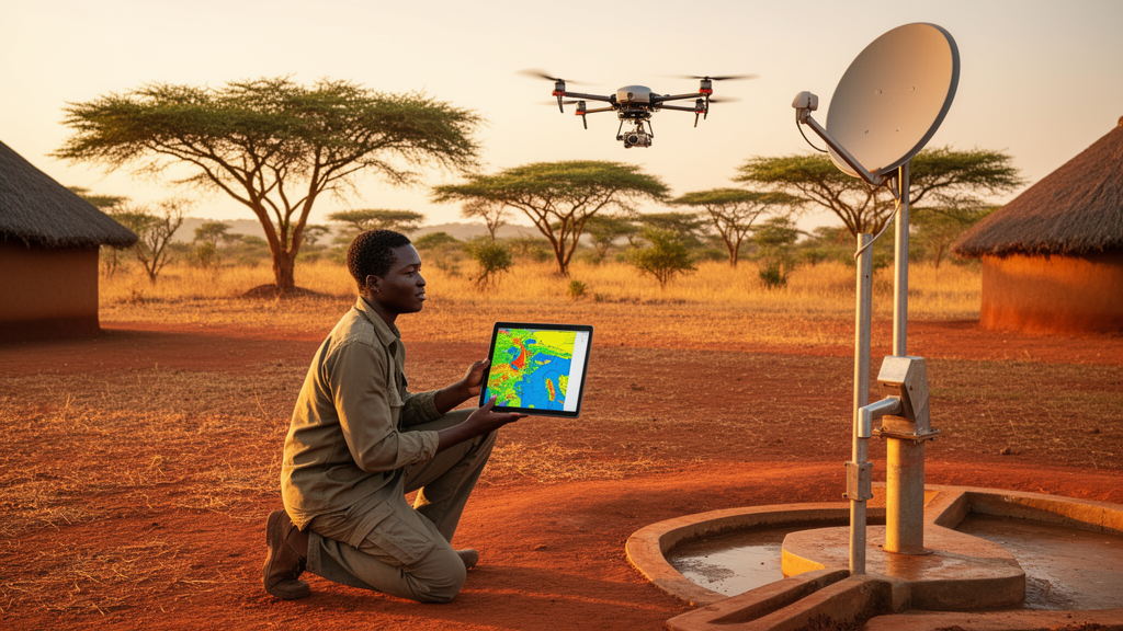
Image Credits: AI Generated

DOI: 10.1007/s43621-026-04943-7

Keywords: groundwater potential, Kitgum District, Pader District, Uganda, geographic information systems, remote sensing, analytical hierarchy process, weighted overlay analysis, borehole validation, water-resource mapping, Mapping, groundwater

Cite Scienmag News

Violet Maxwell. (October 20, 2026). Mapping groundwater potential zones using GIS, remote sensing and analytical hierarchy process (AHP) in Pader and Kitgum Districts, Uganda. Scienmag. https://scienmag.com/mapping-groundwater-potential-zones-using-gis-remote-sensing-and-analytical-hierarchy-process-ahp-in-pader-and-kitgum-districts-uganda/


Violet Maxwell. "Mapping groundwater potential zones using GIS, remote sensing and analytical hierarchy process (AHP) in Pader and Kitgum Districts, Uganda." Scienmag, 20 October 2026, https://scienmag.com/mapping-groundwater-potential-zones-using-gis-remote-sensing-and-analytical-hierarchy-process-ahp-in-pader-and-kitgum-districts-uganda/. Accessed 20 October 2026.

Violet Maxwell. "Mapping groundwater potential zones using GIS, remote sensing and analytical hierarchy process (AHP) in Pader and Kitgum Districts, Uganda." Scienmag. October 20, 2026. https://scienmag.com/mapping-groundwater-potential-zones-using-gis-remote-sensing-and-analytical-hierarchy-process-ahp-in-pader-and-kitgum-districts-uganda/

Tags: analytical hierarchy processAnalytical Hierarchy Process in water resource managementapplication of GIS and remote sensing in sustainable water managementborehole validationgeographic information systemsGIS-based groundwater explorationgroundwatergroundwater potentialgroundwater potential mapping in Ugandagroundwater resource classification in Pader and Kitgum districtshydrogeological influence factors in groundwater mappingimpact of slope and drainage density on groundwater potentialKitgum Districtland use and soil type influence on groundwater rechargemappingPader Districtregional groundwater potential zone mappingremote sensingremote sensing for hydrogeological studiesthematic layers for groundwater potential assessmentUgandaWater resource mappingweighted overlay analysisweighted overlay analysis in ArcGIS
Share26Tweet16
Previous Post

Monte Carlo simulations compare deuterium-ion primary damage in doped tungsten targets

Next Post

Four plasma proteins associated with mortality in UK Biobank prostate cancer cohort

Related Posts

Jujube Seed Waste Transformed Into High-Performance Epoxy Composites
Earth Science

Laboratory study finds strength and wear trade-offs in jujube-seed epoxy composites

October 20, 2026
Sugarcane Molasses Holds the Key to Cheaper Ethanol, Review Finds
Earth Science

Review identifies fermentation variables and optimization priorities for sugarcane-molasses ethanol

October 20, 2026
Machine Learning Meets Econometrics to Map Europe’s Path to Sustainable Development
Earth Science

An intersection of machine learning and advanced econometric techniques to analyse sustainable development in Europe through resource efficiency, institutional quality, and ICT

October 20, 2026
China’s Grain for Green program: satellite data reveal carbon gains and water pressures on the Loess Plateau
Earth Science

Satellite study links Grain for Green afforestation on China’s Loess Plateau to carbon gains and water pressures

October 20, 2026
Training, Trust and Land Rights Decide Whether Ethiopian Farmers Save Their Soil
Earth Science

Household study identifies factors associated with soil and water conservation adoption in Ethiopia’s Jema Watershed

October 20, 2026
Parcel Maps on Paper: Ethiopian Farmers See Fewer Land Disputes, But Credit Remains Out of Reach
Earth Science

Ethiopian study finds uneven household perceptions of parcel-based cadastral mapping

October 20, 2026
Next Post
Four Blood Proteins May Signal Death Risk in Prostate Cancer Survivors

Four plasma proteins associated with mortality in UK Biobank prostate cancer cohort

  • Mothers who receive childcare support from maternal grandparents show more optimized

    Mothers who receive childcare support from maternal grandparents show more parental warmth, finds NTU Singapore study

    27656 shares
    Share 11059 Tweet 6912
  • University of Seville Breaks 120-Year-Old Mystery, Revises a Key Einstein Concept

    1061 shares
    Share 424 Tweet 265
  • Bee body mass, pathogens and local climate influence heat tolerance

    682 shares
    Share 273 Tweet 171
  • Researchers record first-ever images and data of a shark experiencing a boat strike

    546 shares
    Share 218 Tweet 137
  • Groundbreaking Clinical Trial Reveals Lubiprostone Enhances Kidney Function

    531 shares
    Share 212 Tweet 133
Science

Embark on a thrilling journey of discovery with Scienmag.com—your ultimate source for cutting-edge breakthroughs. Immerse yourself in a world where curiosity knows no limits and tomorrow’s possibilities become today’s reality!

RECENT NEWS

  • Four plasma proteins associated with mortality in UK Biobank prostate cancer cohort
  • Mapping groundwater potential zones using GIS, remote sensing and analytical hierarchy process (AHP) in Pader and Kitgum Districts, Uganda
  • Monte Carlo simulations compare deuterium-ion primary damage in doped tungsten targets
  • Laboratory tests map compressive-strength trends in EICP-treated loess

Categories

  • Agriculture
  • Anthropology
  • Archaeology
  • Athmospheric
  • Biology
  • Biotechnology
  • Blog
  • Bussines
  • Cancer
  • Chemistry
  • Climate
  • Earth Science
  • Editorial Policy
  • Marine
  • Mathematics
  • Medicine
  • Pediatry
  • Policy
  • Psychology & Psychiatry
  • Science Education
  • Science News
  • Social Science
  • Space
  • Technology and Engineering

Subscribe to Blog via Email

Enter your email address to subscribe to this blog and receive notifications of new posts by email.

Join 5,150 other subscribers

© 2025 Scienmag - Science Magazine

Welcome Back!

Login to your account below

Forgotten Password?

Retrieve your password

Please enter your username or email address to reset your password.

Log In
No Result
View All Result
  • HOME
  • SCIENCE NEWS
  • CONTACT US

© 2025 Scienmag - Science Magazine

Discover more from Science

Subscribe now to keep reading and get access to the full archive.

Continue reading