


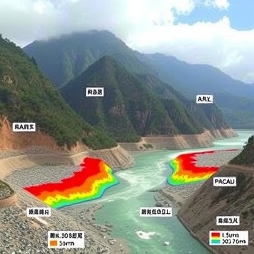
In the steep valleys of southwestern China, a landslide does not need to bury a river permanently to create a disaster. It may only need to block the channel temporarily. Water then accumulates behind the natural barrier, raising pressure on an unstable dam until erosion cuts a breach and releases a surge of water, rock, soil and shattered vegetation downstream. A new study of the Yizhong River Basin in Deqin County, Yunnan, suggests that this sequence can generate flows substantially more powerful than conventional hydrological calculations predict. Under an extreme-rainfall scenario, the researchers simulated an instantaneous peak discharge of 927.2 cubic metres per second at the breach—15.3 per cent higher than the theoretical estimate of 804.2 cubic metres per second. The result points to a dangerous weakness in standard risk assessments: treating a dam-break debris flow as a flood may overlook the way a confined mountain gorge concentrates energy and accelerates the disaster chain.
The Yizhong River is a particularly revealing natural laboratory because it runs through a high-relief landscape dominated by steep slopes and a narrow, V-shaped gully. Such terrain can collect unstable rock and sediment on the valley sides while leaving little room for a flood to spread laterally. During intense rainfall, slope failures can inject this material into the channel, forming a temporary landslide dam. The blockage changes the river from a moving stream into a reservoir, at least for a short time. As water rises, it saturates and weakens the dam, increases pore-water pressure within the accumulated sediment and begins to erode a channel across its crest. Once the breach deepens, discharge rises rapidly, potentially transforming a relatively localized slope failure into a high-energy outburst flood laden with debris. Downstream, that flow can entrain additional sediment from the bed and banks, increasing its volume and destructive reach.
The study, published in Natural Hazards, examined this linked process rather than isolating one component of it. The authors combined a gradual-breaching calculation model with Massflow dynamic simulations to reconstruct how a landslide blockage could evolve under extreme rainfall. The breach model represents the progressive enlargement of an opening in the temporary dam as flowing water removes material. That calculation supplies the changing release conditions—the breach width, depth and discharge—to a dynamic mass-flow model. Massflow then tracks the movement of the resulting water-sediment mixture across complex terrain. Unlike a simple peak-flow formula, a dynamic simulation can account for topographic confinement, changes in flow depth and velocity, and the conversion of stored water and sediment potential energy into downstream motion. The researchers tested rainfall scenarios with exceedance probabilities of 1 per cent and 0.5 per cent, commonly interpreted as events with a one-in-100-year and one-in-200-year annual probability, respectively, although those labels do not mean such storms occur only once in a century or two.
The central finding emerged from the more extreme 0.5 per cent exceedance-probability scenario. At the point where the landslide dam breaches, the simulated instantaneous peak discharge reached 927.2 cubic metres per second. The corresponding theoretical calculation produced 804.2 cubic metres per second. The difference was summarized by a dynamic amplification factor, α, of about 1.15. In practical terms, the researchers propose multiplying conventional estimates by roughly 1.15 in comparable steep-gorge settings to compensate for the energy effects that simplified methods can miss. The factor is not a universal constant, and the study does not imply that every landslide dam will produce a 15 per cent increase. Instead, it is a site-informed measure of the discrepancy between a conventional discharge estimate and a terrain-sensitive simulation for the Yizhong River disaster chain.
That discrepancy arises partly from the gorge’s “funnel effect.” In a broad floodplain, rising water can spread sideways, losing depth and momentum as it occupies a larger area. In a confined V-shaped valley, the walls restrict that spreading. The flow remains concentrated, and the same volume of water is forced through a narrower cross-section. Basic continuity principles describe the effect: for a given discharge, reducing the flow area requires a higher mean velocity. In a debris flow, the consequences are more complicated because the moving mass is not water alone. Sediment concentration changes density and resistance, while collisions among grains and interactions with the channel bed dissipate some energy and can also promote surging. The study’s simulations indicate that the Yizhong terrain limits lateral dispersion and favours a rapid transfer from gravitational potential energy stored behind the blockage to kinetic energy in the downstream surge.
The danger is amplified by the chain-like nature of the event. A landslide may be the initiating disturbance, but the hazard that reaches settlements, roads or bridges can be governed by what happens afterward. Water stored behind the blockage adds a flood component; breach erosion releases it abruptly; the released flow can scour and carry more sediment; and deposition farther downstream can raise the riverbed or divert the current toward areas that were not initially in the main channel. A dam-break debris flow therefore changes its own conditions as it moves. Its discharge, density and momentum are not fixed at the moment of failure. This is why an assessment based only on the volume of the initial landslide, or only on rainfall-runoff relationships, can underestimate the eventual hazard. The Yizhong analysis treats the event as a connected sequence in which each stage modifies the next.
The findings also challenge a familiar approach to mountain protection: placing static barriers across channels and assuming that interception alone will control the threat. Conventional check dams, retention basins and sediment barriers can be effective when they are designed for expected volumes and velocities, but a rapidly released, sediment-rich surge may overtop, erode around or overwhelm structures that do not account for transient energy. The authors argue that mitigation in high-energy gorges should place greater emphasis on dynamic energy dissipation. That could include structures designed to withstand impact and overflow, stepped or multi-stage systems that reduce velocity progressively, protected spillways, reinforced channel margins and sufficient space for deposition where it can occur without redirecting the flow toward communities. The study’s result does not prescribe a single engineering solution; it provides a quantitative warning that design discharge and energy should be based on the full breach-and-runout process rather than on a static peak value alone.
The implications extend beyond the Yizhong basin. Similar topography occurs across southeastern Tibet and other high-relief mountain regions, where steep slopes, intense rainfall and narrow channels coexist with roads, hydropower infrastructure and scattered settlements. Climate change adds uncertainty because changes in rainfall intensity can alter both the probability of slope failure and the amount of water available to fill a temporary dam. The paper does not establish a climate trend for Yunnan, nor does its modelling demonstrate that extreme rainfall will increase everywhere. It does, however, highlight why hazard systems need to be sensitive to rainfall thresholds, slope movement and river blockage at the same time. Satellite interferometry, rainfall radar, rain gauges, ground sensors and rapid field surveys could help identify the early stages of a blockage, while numerical forecasts could estimate how a breach might propagate through the valley. Because the most dangerous transition may occur quickly, warning systems would need to connect observation and evacuation decisions with minimal delay.
There are important limits to what the reported number can tell emergency planners. The 927.2-cubic-metre-per-second peak is a modelled result for a defined basin, terrain configuration and rainfall scenario, not a direct measurement of a recent outburst. Predictions depend on assumptions about the size and composition of the landslide dam, its hydraulic properties, the rate at which water erodes the breach and the frictional behaviour of the debris mixture. Small changes in grain size, moisture, channel geometry or breach location can alter the timing and magnitude of a surge. The authors therefore present the dynamic amplification factor as a reference for similar environments, not as a replacement for local investigation. They report that data generated and analysed in the study are available from the corresponding author on reasonable request, which could allow further testing and comparison with other mountain basins.
What makes the study consequential is not simply the difference between two large numbers, but the mechanism behind it. A mountain river can conceal a temporary reservoir inside a pile of landslide debris, then release that stored energy through a narrow gorge where the flow has little opportunity to spread. The resulting hazard is a moving, evolving system rather than a single flood wave. By coupling gradual breach calculations with dynamic mass-flow modelling, the researchers show how a seemingly modest correction to discharge estimates can represent a much larger shift in assumptions about safety. In landscapes where extreme rainfall can destabilize slopes and where valleys concentrate human infrastructure, accounting for that additional energy may determine whether a barrier merely stands in the path of a surge—or is designed to help communities survive it.
Cite Scienmag News
Violet Maxwell. (August 27, 2026). Mapping Dam-Break Debris-Flow Risks in Yunnan’s High-Mountain Yizhong River Basin. Scienmag. https://scienmag.com/mapping-dam-break-debris-flow-risks-in-yunnans-high-mountain-yizhong-river-basin/
Violet Maxwell. "Mapping Dam-Break Debris-Flow Risks in Yunnan’s High-Mountain Yizhong River Basin." Scienmag, 27 August 2026, https://scienmag.com/mapping-dam-break-debris-flow-risks-in-yunnans-high-mountain-yizhong-river-basin/. Accessed 3 September 2026.
Violet Maxwell. "Mapping Dam-Break Debris-Flow Risks in Yunnan’s High-Mountain Yizhong River Basin." Scienmag. August 27, 2026. https://scienmag.com/mapping-dam-break-debris-flow-risks-in-yunnans-high-mountain-yizhong-river-basin/


