


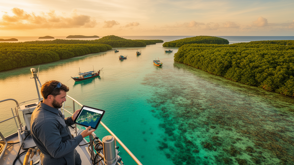
Indonesia presides over the largest archipelago on Earth, a scatter of more than seventeen thousand islands whose shallow waters shelter some of the most productive ecosystems on the planet. Yet until recently, no one could say with confidence, at national scale and in high resolution, exactly how much coral reef, seagrass and mangrove the country holds, or how those areas are shifting from year to year. A new study published in One Ecosystem has changed that, delivering the first government-endorsed, high-resolution national maps of all three ecosystems for 2018 and 2021, and laying the spatial groundwork for a system of ocean accounting designed to put marine nature on the same footing as GDP.
The effort, led by Indonesia’s Ministry of Marine Affairs and Fisheries in collaboration with the Geospatial Information Agency, the National Research and Innovation Agency and Rekam Nusantara, was anything but a routine mapping exercise. It required coaxing data out of five separate ministries and agencies, each the custodian of a different slice of the marine picture, and reconciling them under a single task force established by ministerial decree in 2023. Data were pooled in a cloud-based database with formal sharing procedures, and quality control was anchored to a new Indonesian national standard, SNI 9257:2024, which specifies metadata and quality requirements for geospatial information on shallow coastal and benthic habitats.
The technical core of the project relied on satellite imagery at a resolution fine enough for accounting purposes. Coral reefs and seagrass beds were mapped from SPOT 6 and 7 imagery, which resolves features at roughly five to six metres, far sharper than the 30-metre Landsat data that has historically constrained large-scale mapping. Before classification, the imagery underwent geometric correction, sun glint removal and water column correction using the Lyzenga algorithm, which exploits the different rates at which red, green and blue light attenuate through seawater to strip out the darkening effect of depth. Without this correction, an identical patch of reef looks darker in deeper water, confusing automated classifiers; with it, the reflectance signal reflects the substrate itself rather than the water above it.
Once corrected, the shallow benthic zone from the shoreline to the reef crest was clipped from each scene, enhanced through density slicing into as many as ten segments, and converted into binary ecosystem maps using thresholds trained on field data from Biak Numfoor in Papua. Mangroves followed a different route: analysts digitised them on screen in ArcGIS under the national standard SNI 7717:2020, using false-colour composites to make the forests stand out, and falling back on Sentinel-2 imagery where cloud cover compromised the SPOT scenes. Ground-truthing teams then snorkeled survey transects in Central Java, Central Papua and the Maluku islands, along with five marine protected areas including Raja Ampat and the Anambas Islands, recording habitat classes and cover percentages at fixed intervals to validate the maps.
The headline numbers are striking. Indonesia’s mangroves, already the most extensive in the world, expanded from 3,329,459.72 hectares in 2018 to 3,364,769.05 hectares in 2021, a gain of more than 35,000 hectares. Coral reefs grew from 1,212,207.46 to 1,216,249.74 hectares, and seagrass meadows from 273,122.60 to 273,950.87 hectares. But the national totals conceal a more troubling story told by the study’s Sankey analysis of ecosystem transitions: in several fisheries management areas, mangroves were converted to non-mangrove land uses, while reef and seagrass areas slipped into macroalgae and bare substrate. Degradation hotspots clustered in Fisheries Management Areas 571, 573, 711, 713, 714, 715 and 716, with the heaviest mangrove loss in FMA 716, seagrass decline concentrated in FMA 711 and coral reef loss in FMA 714.
The drivers behind those localised declines are overwhelmingly human. In FMA 711, mangroves have been converted for aquaculture and other uses, while seagrass beds suffer from pollution, port development and boat traffic. In FMA 714, destructive fishing practices and unsustainable tourism have battered the reefs. By contrast, the mangroves of FMA 718, the largest and healthiest in the country and a critical nursery ground underpinning Indonesia’s fish production, expanded over the study period, largely because their remoteness shields them from development pressure. The pattern is a familiar one in conservation: where people and infrastructure press hardest, ecosystems retreat, even as national averages look healthy.
Why does precision mapping matter so much? Because ecosystem extent is the denominator in nearly every calculation of what nature delivers. Coral reefs blunt wave energy and shelter coastlines from erosion; seagrass meadows bury an estimated 10 to 18 percent of the organic carbon locked into the global ocean; mangroves stabilise shorelines and buffer floods. A nationwide literature review cited in the study values these services at roughly 12,145 US dollars per hectare per year for coral reefs, 14,953 for seagrass and 18,544 for mangroves. Multiply those figures by an uncertain map and the error propagates straight into policy. Ocean accounts, aligned with the UN System of Environmental-Economic Accounting, are designed to close that gap by linking ecosystem extent and condition to the location of economic activity and human beneficiaries.
The study also exposes how wildly previous estimates diverged. Independent global datasets, built on coarser imagery, produced mangrove and seagrass figures that differed substantially from Indonesian government maps, while coral reef estimates varied by more than a million hectares depending on the source, partly because some classifications mistook sand, rubble and seagrass for reef. The new maps, derived from consistently higher-resolution imagery and validated against field data, are intended to end that ambiguity and serve as the official baseline. They are the first national seagrass maps produced at high resolution under government leadership, a notable milestone given that the only prior Indonesian-led effort relied on moderate-resolution Landsat 8 data in 2018.
The practical payoff extends across marine spatial planning, protected area management and fisheries. Ocean accounts give planners a systematic way to track whether marine protected areas are actually meeting conservation goals, to quantify the economic case for expanding them, and to inform decisions on marine use permits and catch limits. Because the accounts are spatially explicit and maintained over time, they can flag early warnings of overfishing or habitat degradation and trigger timely intervention. The authors acknowledge the hurdles that remain: training datasets drawn from 30-metre Landsat imagery did not always match the spectral and radiometric characteristics of the 5-metre SPOT scenes, ground-truthing was limited to priority sites by budget constraints, and data remain scattered across institutions.
The way forward, the team argues, demands regular satellite image acquisition, whether through government purchase or international partnership, alongside site-specific classification algorithms for reefs and seagrass and a commitment to update the maps at least every three years. Funded in part by the UK’s Blue Planet Fund through the Global Ocean Accounts Partnership, the project stands as a test case for other maritime nations wrestling with the same question: how to make the invisible value of coastal ecosystems visible in the ledgers that drive decisions. For Indonesia, the maps are more than pictures of green forests and blue reefs. They are the first entries in an account book meant to ensure that the country’s marine wealth is counted, and therefore protected, before it is spent.
Subject of Research: National-scale satellite mapping of Indonesia's coral reef, seagrass and mangrove ecosystems to support ocean accounting and marine management
Article Title: National-scale mapping of ecosystems to improve ocean accounting for marine and coastal management in Indonesia
Article References: Gunawan, T. S., Hamidah, M., Rahayu, A. K., Septiani, N. N., Pingkan, J., Hermansyah, A., Farhan, M., Sholihah, R., Arundina, A. B., Minarni, D. R., Susanti, R., Gustiar, G. G., Kusumastuti, D. N., Maharani, G. R., Nurhakim, M. D., Khalishah, P. V., Rahman, I. F., Nugianto, N., Hakim, A., … Yulianto, I. (2025). National-scale mapping of ecosystems to improve ocean accounting for marine and coastal management in Indonesia. One Ecosystem, 10, Article e155166. https://doi.org/10.3897/oneeco.10.e155166
Image Credits: AI Generated
DOI: 10.3897/oneeco.10.e155166
Keywords: Indonesia, ocean accounting, coral reefs, mangroves, seagrass, remote sensing, Sentinel-2, SPOT satellite imagery, marine spatial planning, ecosystem services, marine protected areas, fisheries management
Cite Scienmag News
Violet Maxwell. (October 18, 2026). Indonesia Maps Its Vast Coastal Ecosystems from Space to Build the Nation’s First Ocean Accounts. Scienmag. https://scienmag.com/indonesia-maps-its-vast-coastal-ecosystems-from-space-to-build-the-nations-first-ocean-accounts/
Violet Maxwell. "Indonesia Maps Its Vast Coastal Ecosystems from Space to Build the Nation’s First Ocean Accounts." Scienmag, 18 October 2026, https://scienmag.com/indonesia-maps-its-vast-coastal-ecosystems-from-space-to-build-the-nations-first-ocean-accounts/. Accessed 18 October 2026.
Violet Maxwell. "Indonesia Maps Its Vast Coastal Ecosystems from Space to Build the Nation’s First Ocean Accounts." Scienmag. October 18, 2026. https://scienmag.com/indonesia-maps-its-vast-coastal-ecosystems-from-space-to-build-the-nations-first-ocean-accounts/


