


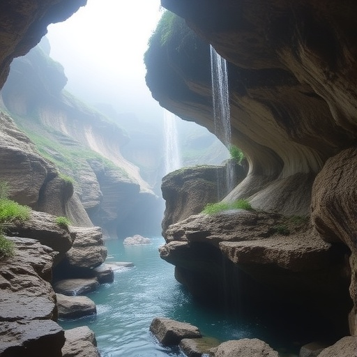
Karst landscapes are often described as nature’s hidden plumbing: rain disappears into cracks, sinkholes and caverns, then reappears far underground as springs and subterranean rivers. In southwestern China, where vast carbonate-rock formations dominate the terrain, that concealed plumbing system governs water supplies for communities and ecosystems while remaining extraordinarily difficult to monitor. A new study in Hydrogeology Journal has used hydrogen and oxygen isotopes to trace how water moves through a typical subterranean river basin, revealing that the system is not controlled by a single route. Instead, it operates through two contrasting pathways—one fast enough to transmit storm runoff within a short time, and another slow, buffered route that quietly maintains river flow through the dry season.
The research by Jingyu Huang and Mo Xu focuses on the isotopic fingerprints carried by water molecules. Hydrogen and oxygen occur naturally in several forms, or isotopes, and the ratios of these isotopes in precipitation change according to temperature, elevation, moisture source and evaporation. Scientists express these variations as δD and δ¹⁸O values, measured relative to an international standard. Because water does not lose its isotopic identity entirely as it travels through the landscape, these measurements can act like tracers. Comparing rainfall with spring water, streams and subterranean river samples allows researchers to determine whether underground flow is dominated by recent storms, older stored water or a mixture of several sources. In a karst environment, where channels are irregular and mostly invisible, this chemical evidence can reveal connections that conventional surface monitoring misses.
The study found that karst water displayed a clear seasonal rhythm, although the pattern was not simply a direct reflection of rainfall. Isotopic enrichment was greatest during the transitional seasons, when precipitation was moderate and hydrological conditions were comparatively stable. Enrichment was lower during the wet season and lowest during the dry season. In practical terms, the isotopic composition of the water changed as seasonal rainfall, storage and flow conditions shifted, but the underground system prevented those signals from passing straight through unchanged. The researchers describe the natural isotope fractionation as limited overall, meaning that processes such as evaporation and condensation did not radically alter the water’s original signature. Dry-season samples showed somewhat stronger evaporation effects, consistent with longer residence times, reduced flow and greater exposure to evaporation before water entered or moved through the karst system.
One of the most revealing patterns emerged in the spring water. Its δ¹⁸O values displayed an elevation effect: water associated with higher elevations was generally more isotopically depleted than water from lower elevations. This occurs because rising air cools, moisture condenses and heavier isotopes are preferentially removed from the atmosphere, leaving subsequent precipitation increasingly lighter. In mountainous southwestern China, that relationship provides a geographic clue about where recharge may have occurred. The signal was not perfect, because monsoon moisture sources, local topography and underground mixing can complicate the pattern, but it supplied an important spatial framework. The researchers also observed progressive isotopic depletion in subterranean river water downstream. Rather than remaining chemically uniform along its hidden course, the river became isotopically lighter as it traveled, indicating that additional water entered the system or that existing water was progressively mixed with sources carrying more depleted signatures.
The strongest buffering influence came from the karst vadose zone, the unsaturated region between the land surface and the groundwater table. This zone is often portrayed as a simple passage through which rainwater travels downward, but in karst it can function as a complex reservoir and mixing chamber. Water may pause in soil, fractures, enlarged cavities and the epikarst—the highly weathered uppermost part of the carbonate rock—before continuing downward. Earlier rainfall can remain stored while new precipitation arrives, blending signals from different storms and seasons. According to the isotope evidence, this process substantially smooths the sharp chemical changes that would otherwise follow individual rainfall events. As a result, karst water maintains a more stable isotopic composition than precipitation, even though the basin remains highly responsive to intense storms.
To identify the dominant sources feeding the subterranean river, the researchers applied Bayesian mixing analysis, a statistical approach that estimates the likely contribution of different water sources while accounting for uncertainty in isotope measurements and source signatures. The model indicated that baseflow was the principal contributor. In this study, baseflow included water emerging from epikarst springs, descending springs and surface streams that remained connected to the underground system. Direct precipitation entering the subterranean river as an immediate component contributed less than 10 percent. That finding challenges the intuitive idea that a rainstorm mainly fills a hidden river by dropping water directly into open karst conduits. Instead, much of the river’s ordinary flow appears to arrive after water has passed through, accumulated within and mixed across the shallow karst system.
The results nevertheless show that direct and rapid storm infiltration remains hydrologically important. During heavy rainfall, water can bypass much of the storage capacity of the soil and vadose zone through sinkholes, fractures and conduits. This creates a rapid conduit-flow pathway capable of transmitting storm runoff through the subsurface. Such a pathway explains why karst rivers and springs can rise abruptly after intense rainfall, sometimes producing flash floods even when the surface drainage network appears limited. The second pathway is slower: precipitation infiltrates gradually, is temporarily stored and mixes with older water before reaching the subterranean river. This gradual infiltration pathway supplies baseflow and acts as a natural regulator, releasing water after the wet season has ended. The basin therefore combines speed and storage—rapid transport during storms and delayed delivery during dry periods.
That dual behavior has major implications for water safety and resource management. Karst groundwater can be an abundant and renewable source, but its rapid conduits also make it vulnerable to sudden contamination. Pollutants deposited at the surface may travel quickly underground with little filtration, while the same system can conceal the location and timing of water movement. At the other end of the spectrum, the vadose zone and epikarst provide storage that sustains water availability between rainfall events. Understanding which parts of a basin transmit water rapidly and which parts buffer and release it gradually could help authorities protect recharge areas, anticipate flood pulses and estimate how much water remains available during drought. Isotopic monitoring may be particularly valuable because it can track hydrological changes without requiring every underground channel to be mapped directly.
The researchers’ conclusions extend beyond one subterranean river basin. They offer a conceptual model for understanding karst water across southwestern China, one of the world’s most extensive karst regions and an area where seasonal rainfall contrasts sharply with dry-season water demand. The findings suggest that the apparent stability of karst water is not evidence of a simple or isolated aquifer; it is the result of mixing, storage and delayed transfer within the critical zone. At the same time, the rapid response of conduits reveals a hidden hazard beneath that stability. By combining δD, δ¹⁸O, spatial sampling and Bayesian source apportionment, the study demonstrates how isotope hydrology can turn an invisible underground network into a readable record of movement. The message is both scientifically striking and practical: the future of karst-water management depends on recognizing that one landscape can carry water through two very different clocks—one measured in storm hours, the other in the slow seasonal rhythm of groundwater storage.
Cite Scienmag News
Violet Maxwell. (August 26, 2026). Hydrogen and Oxygen Isotopes Reveal Karst Water’s Hydrological Cycle in Southwestern China. Scienmag. https://scienmag.com/hydrogen-and-oxygen-isotopes-reveal-karst-waters-hydrological-cycle-in-southwestern-china/
Violet Maxwell. "Hydrogen and Oxygen Isotopes Reveal Karst Water’s Hydrological Cycle in Southwestern China." Scienmag, 26 August 2026, https://scienmag.com/hydrogen-and-oxygen-isotopes-reveal-karst-waters-hydrological-cycle-in-southwestern-china/. Accessed 4 September 2026.
Violet Maxwell. "Hydrogen and Oxygen Isotopes Reveal Karst Water’s Hydrological Cycle in Southwestern China." Scienmag. August 26, 2026. https://scienmag.com/hydrogen-and-oxygen-isotopes-reveal-karst-waters-hydrological-cycle-in-southwestern-china/


