


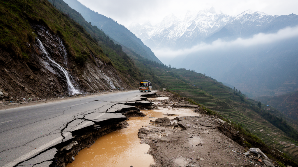
Deep in the Lesser Himalayas of Nepal, a stretch of the Kali Gandaki Road corridor near the village of Sirubari in Myagdi District keeps failing, monsoon after monsoon, and engineers have long struggled to explain why. A new forensic geotechnical and geophysical investigation, published in Discover Geoscience, has now dissected the slope with an unusually thorough toolkit: three electrical resistivity tomography profiles spanning more than 1,200 meters in total, two rotary core boreholes drilled to 15 meters, an extensive laboratory testing program, and coupled numerical modeling of seepage and slope stability. The verdict is stark. The slope is not merely marginal; it is actively failing, with computed factors of safety of 0.858 on the hillside and 0.857 on the valley side under monsoon groundwater conditions, both well below the threshold of 1.0 that separates stable ground from moving ground.
The stakes extend far beyond a single hillside. Landslides are the deadliest natural hazard in Nepal, concentrated in the middle Himalayan districts where steep terrain, fragile geology, and intense monsoon rainfall converge. The Himalayan belt as a whole, a tectonically active arc stretching 2,400 kilometers, suffers landslide damages exceeding one billion US dollars annually and claims hundreds of lives each year. Nepal occupies roughly 800 kilometers of this arc, and approximately 83 percent of its territory is steeply sloping. The Kali Gandaki corridor, which follows the river of the same name toward the Chinese border, is a lifeline for about seven million people across 24 hilly districts, connecting them to markets and economic opportunity. When a slope like Sirubari’s repeatedly collapses, entire communities lose their connection to the outside world.
The Sirubari site sits at a geologically telling location: the boundary between the Lesser Himalayan Sequence and the Higher Himalayan Sequence. The Lesser Himalayan rocks here are low-grade metamorphic units, chiefly quartzite, phyllite, schist, and gneiss, and phyllite in particular has a well-documented susceptibility to landsliding. These rocks dip generally northward, sub-parallel to the regional fabric associated with the Main Central Thrust, making the rock mass anisotropic and prone to weakness under saturated conditions. Earthquakes readily fracture these relatively weak formations, and the fractured rock then accumulates loose debris that heavy rainfall can mobilize. In other words, the site combines a structurally weakened bedrock foundation with a thick blanket of loose, water-hungry debris, a combination that forensic studies elsewhere in the Himalayas have repeatedly flagged as dangerous.
To see inside the slope, the research team deployed electrical resistivity tomography using the classic Wenner electrode array, chosen for its depth of investigation, its precision in both horizontal and vertical detail, and its favorable signal-to-noise ratio. Three two-dimensional profiles, ERT-1, ERT-2, and ERT-3, were run across the landslide zone with a combined array length of 1,237 meters. The field data were inverted with the RES2DINV software, converging to root-mean-square misfits of 2.8 to 3.5 percent, comfortably below the 5 percent threshold generally accepted as evidence of reliable inversion quality. The resulting resistivity sections revealed a layered subsurface: organic colluvial topsoil a few meters thick, unsaturated boulder-dominated colluvium, saturated silty colluvium, and beneath it all, fractured phyllite bedrock grading from unsaturated to fully saturated with depth.
The most consequential finding was the sheer thickness of the colluvial mantle. In the central sections of the ERT profiles, the loose debris deposits exceed 21 meters, and locally may reach 30 meters, before the fractured phyllite bedrock is encountered. Multiple slip surfaces were identified within this mass, confirmed both in the field and in the resistivity inversions. Crucially, the geophysical interpretation was not left to stand alone. The team drilled two boreholes, BH-1 and BH-2, each to 15 meters, and extracted the resistivity values at the borehole locations to calibrate the ERT sections against the actual lithological logs. The sandy colluvium encountered in both holes corresponded to resistivity values of 80 to 300 ohm-meters, while the measured groundwater levels, 5.45 meters deep in BH-1 and just 1.13 meters in BH-2, aligned spatially with the boundary between high- and low-resistivity zones in the profiles.
The boreholes themselves told a consistent story. Neither intercepted bedrock within 15 meters, corroborating the ERT evidence of exceptionally deep colluvium. The material was overwhelmingly sand, between 73.45 and 96.50 percent, with gravel content of 0 to 7.51 percent and fines ranging from 2.86 to 24.39 percent. Natural moisture content ranged from 17.52 to 23.58 percent, indicating moderate to high moisture retention throughout the mass, exactly what one would expect from a slope sitting atop a shallow water table. Specific gravity values of 2.65 to 2.72 are typical of phyllite-derived material, confirming the debris’s provenance. Direct shear tests yielded friction angles between 24 and 32 degrees and cohesion between roughly 2 and 14 kilonewtons per square meter, with the weakest samples, those from 4 to 10 meters depth in BH-2, showing the highest fines content and the lowest strength.
With the subsurface architecture established, the team built a coupled numerical model in GEOSTUDIO. A SEEP/W finite element simulation computed steady-state pore water pressures through the saturated and unsaturated colluvial profile, using van Genuchten hydraulic conductivity functions estimated from the grain size distributions and hydraulic conductivities of 10 to the minus 4 to 10 to the minus 5 meters per second for the colluvium, against only 10 to the minus 8 meters per second for the phyllite. The pore pressure field was then passed to SIGMA/W for effective stress redistribution, and both were fed into SLOPE/W, which performed limit equilibrium analysis using the Morgenstern-Price method, satisfying both force and moment equilibrium. The critical slip surface emerged at 18 to 22 meters depth, a deep-seated failure plane buried within the colluvial mass, and the computed factors of safety of 0.857 to 0.858 confirmed that the slope is in active failure under monsoon conditions.
The mechanism that emerges from this convergence of evidence is groundwater-driven, not structurally driven. Monsoon rainfall infiltrates the thick, permeable sandy colluvium and then ponds above the low-permeability phyllite bedrock, building up pore water pressures at depth. Rising pore pressure reduces effective stress, and with it the shear strength available along potential failure surfaces, a mechanism long recognized in colluvial slopes in the Alps and the Himalayas alike. The authors note that because the baseline factor of safety is already well below unity with design parameters drawn from the middle of the measured strength range, the diagnosis of active failure holds even if the weakest measured values are used. Large tension cracks observed near the crown of the landslide provide independent field confirmation of the substantial stresses within the moving soil mass.
The forensic team is candid about the limits of the investigation. The boreholes stopped at 15 meters without reaching bedrock, so the deep-seated failure surface is inferred from converging indirect evidence rather than directly observed; no inclinometers were installed to measure shear zone movement; the seepage modeling assumed steady-state rather than transient monsoon conditions; and no systematic rock mass characterization of the phyllite was performed. As follow-up priorities, they recommend slope inclinometers, deeper boreholes of 30 to 35 meters to intercept the colluvium-bedrock contact, transient seepage modeling driven by daily rainfall records, and a formal probabilistic sensitivity analysis of the strength and groundwater parameters.
The mitigation prescription follows directly from the diagnosis. Because groundwater lowering is the dominant control on stability, the primary recommendation is subsurface drainage: horizontal drains installed at 10-meter spacing to depress the water table, complemented by concrete-lined surface drains along the slope crest to intercept runoff before it infiltrates. These are paired with soil nail reinforcement on a 1.5 by 1.5 meter grid, 8 meters long and inclined at 20 degrees, and bioengineering measures for surface protection, with a design target factor of safety of at least 1.3 for the permanent slope. The urgency is underscored by national trends: more than 800 rainfall-induced closures were documented across 41 Nepali highways during the 2024 monsoon alone. For the seven million people who depend on corridors like the Kali Gandaki road, the Sirubari study offers something rare in Himalayan landslide management, a site-specific, evidence-based account of exactly why a slope keeps failing, and a technically grounded path toward fixing it.
Subject of Research: Groundwater-driven recurrent slope failure along the Kali Gandaki Road corridor in the Lesser Himalayas of Nepal
Article Title: Forensic geotechnical–geophysical investigation of groundwater-driven recurrent slope failure along the Kali Gandaki Road corridor, Lesser Himalayas, Nepal
Article References: KC, R., Mahato, A. B., Acharya, A., Ojha, B., Subedi, M., Misra, J., & Acharya, I. P. (2026). Forensic geotechnical–geophysical investigation of groundwater-driven recurrent slope failure along the Kali Gandaki Road corridor, Lesser Himalayas, Nepal. Discover Geoscience, 4(1), Article 311. https://doi.org/10.1007/s44288-026-00680-6
Image Credits: AI Generated
DOI: 10.1007/s44288-026-00680-6
Keywords: landslides, Nepal, Himalayas, groundwater, slope stability, electrical resistivity tomography, geotechnical engineering, phyllite, colluvium, pore water pressure, Kali Gandaki corridor, monsoon
Cite Scienmag News
Violet Maxwell. (October 9, 2026). Groundwater Is Quietly Dismantling a Lifeline Highway in Nepal’s Himalayas. Scienmag. https://scienmag.com/groundwater-is-quietly-dismantling-a-lifeline-highway-in-nepals-himalayas/
Violet Maxwell. "Groundwater Is Quietly Dismantling a Lifeline Highway in Nepal’s Himalayas." Scienmag, 9 October 2026, https://scienmag.com/groundwater-is-quietly-dismantling-a-lifeline-highway-in-nepals-himalayas/. Accessed 9 October 2026.
Violet Maxwell. "Groundwater Is Quietly Dismantling a Lifeline Highway in Nepal’s Himalayas." Scienmag. October 9, 2026. https://scienmag.com/groundwater-is-quietly-dismantling-a-lifeline-highway-in-nepals-himalayas/


