


On the winding mountain roads of South Africa’s Limpopo Province, the ground itself is quietly plotting against the asphalt. Along the R37 and R555 corridors, which slice through the rugged terrain of the Fetakgomo-Tubatse Municipality, steep road cuts expose fractured rock, weathered quartzite and ancient geological structures that can give way without much warning. Now, a team of researchers from the University of Limpopo has produced one of the first regional-scale landslide susceptibility maps for this geologically treacherous corner of the Bushveld Igneous Complex, and their results carry a surprising twist: a decades-old mathematical approach built on uncertainty outperformed a cutting-edge machine-learning algorithm at predicting where the next slope failure is most likely to occur.
The study, published in the journal Discover Geoscience, was conducted by Fumani Nkanyane and Fhatuwani Sengani, who set out to answer a deceptively simple question: which modelling technique best captures landslide risk in terrain where geology, rather than climate or topography alone, dominates slope behaviour? To find out, they pitted three fundamentally different approaches against one another using the same data, the same landslide inventory and the same validation framework. The contenders were the Analytical Hierarchy Process, or AHP, a structured expert-judgment method; Fuzzy Logic, an uncertainty-based technique that embraces gradual transitions rather than sharp thresholds; and XGBoost, an ensemble machine-learning algorithm that has swept through geospatial prediction problems in recent years.
The stakes are far from academic. Landslides rank among the most destructive geological hazards in mountainous regions worldwide, and the Fetakgomo-Tubatse Municipality presents an especially challenging case. The area sits within the Eastern Limb of the Bushveld Igneous Complex, a vast layered intrusion of mafic and ultramafic rocks interbedded with sandstones and quartzites of the Transvaal Supergroup. Major structures such as the Steelpoort Fault and the Thabazimbi-Murchison Lineament cut through the landscape, introducing discontinuities that act as ready-made failure planes. Elevations range from roughly 490 to 2,331 metres above sea level, and the semi-arid climate concentrates its modest 400 to 600 millimetres of annual rainfall into intense summer storms that can rapidly raise pore-water pressures in weakened slopes.
To build their models, the researchers first compiled an inventory of 100 documented landslide events, identified through field surveys, photographic documentation and interpretation of high-resolution satellite imagery from Google Earth and Landsat 8. The inventory captured mostly shallow translational failures and rockfalls affecting engineered road cuts and natural slopes. Each landslide was georeferenced as a point at the crown of the failure, and the dataset was randomly split into 70 percent for model training and 30 percent for independent validation. The team then assembled ten conditioning factors known to influence slope stability: slope angle, aspect, elevation, lithology, soil type, rainfall, land use and land cover, and proximity to roads, rivers and geological lineaments. All layers were standardised to a common 30-metre grid resolution derived from the Shuttle Radar Topography Mission digital elevation model.
Each modelling philosophy handled these inputs in its own distinctive way. The AHP method, introduced by Thomas Saaty in 1980, relies on expert-derived pairwise comparisons to weight each factor’s relative importance, and the team’s comparison matrix achieved a consistency ratio of 0.074, comfortably within the accepted threshold of 0.10. Fuzzy Logic took a different route, assigning each pixel a membership value between 0 and 1 that expresses its degree of belonging to the fuzzy set of landslide-susceptible ground. Rather than forcing terrain into rigid classes, membership functions allowed susceptibility to fade gradually across the landscape, and the layers were combined using a fuzzy gamma operator set at 0.90, a compromise between the strict intersection and liberal union of fuzzy sets. XGBoost, by contrast, learned directly from the data, building a sequence of decision trees in which each new tree corrected the errors of its predecessors, with regularisation terms built in to prevent overfitting.
When the maps were validated against the held-out landslide data, the results were striking. The Fuzzy Logic model achieved the highest predictive performance, with a Receiver Operating Characteristic Area Under the Curve, or ROC-AUC, of 0.769. The AHP model followed closely at 0.757, while XGBoost trailed at 0.739. A confusion matrix analysis reinforced the ranking: Fuzzy Logic posted the highest overall accuracy at 0.7708, followed by AHP at 0.7292 and XGBoost at 0.6857. Notably, both AHP and Fuzzy Logic significantly outperformed the no-information rate, meaning their classifications were far better than random guessing, whereas XGBoost’s accuracy merely matched the majority-class baseline. McNemar’s tests confirmed that the differences between predicted and observed classifications were statistically significant for all three models.
Why did the old-school uncertainty approach beat the machine? The authors attribute Fuzzy Logic’s edge to its ability to represent the continuous, progressive nature of slope instability. In mountainous terrain, landslides rarely obey discrete thresholds; instead, they emerge from gradual interactions between slope geometry, lithological weathering, structural discontinuities, rainfall infiltration and human excavation. Fuzzy membership functions capture those soft transitions, whereas conventional weighted overlays impose hard class boundaries. XGBoost’s comparatively modest showing likely reflects the reality of data-scarce environments: machine-learning algorithms typically need large, representative landslide inventories to generalise well, and a 100-event inventory in a geologically heterogeneous setting offers limited training material. The finding challenges the widespread assumption that artificial intelligence automatically trumps expert-informed methods in every hazard-mapping context.
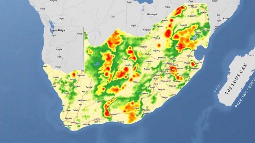
The maps themselves tell a coherent geological story. Under the AHP model, 40.48 percent of the municipality fell into the low susceptibility class and 56.76 percent into the moderate class, with just under 3 percent classified as high or very high. The Fuzzy Logic model redistributed those figures dramatically, placing 82 percent of the area in the very low class while elevating 12.4 percent to high susceptibility, concentrated in the north-eastern region along the R37 and its tributaries. XGBoost identified roughly 13 percent of the district as high or very high susceptibility. Across all three models, the danger zones clustered in the same places: steep road-cut sections where excavations have disturbed natural slope equilibrium, weathered quartzite units with reduced shear strength, and slopes intersected by joints, faults and bedding planes that act as potential failure surfaces. Field observations confirmed rockfalls and combined sliding-toppling failures in exactly these locations.
The practical implications extend well beyond Limpopo Province. The high-susceptibility zones identified along the R37 and R555 give provincial engineers a spatially explicit priority list for slope monitoring, drainage management and road maintenance, and the study’s framework is explicitly designed to be transferable to other mountainous regions where layered intrusions, fault systems and infrastructure development intersect. The authors acknowledge limitations that future work should address: the 30-metre DEM may miss small-scale terrain features, event-based rainfall intensity was not modelled, expert weighting in AHP inevitably introduces some subjectivity, and a larger landslide inventory would strengthen any machine-learning application. They suggest that integrating geotechnical parameters such as shear strength and cohesion, along with higher-resolution topographic data and climate-change projections, could further sharpen predictive reliability.
Perhaps the study’s most valuable contribution is its methodological honesty. By testing three paradigms head-to-head in the same terrain, Nkanyane and Sengani have demonstrated that model choice should be guided by geological context and data availability rather than by fashion. In structurally complex, data-limited environments, uncertainty-based modelling and well-calibrated expert judgment remain formidable tools, and the best hazard assessments may come from combining them with machine learning rather than replacing them. As climate variability intensifies rainfall extremes and infrastructure expansion pushes roads ever deeper into unstable mountainsides, that lesson resonates far beyond the Bushveld.
Subject of Research: GIS-based comparative landslide susceptibility mapping using AHP, Fuzzy Logic and XGBoost in the Fetakgomo-Tubatse Municipality, South Africa
Article Title: Application of GIS techniques for landslide susceptibility mapping in the mountainous regions of Fetakgomo-Tubatse Municipality
Article References: Nkanyane, F., & Sengani, F. (2026). Application of GIS techniques for landslide susceptibility mapping in the mountainous regions of Fetakgomo-Tubatse Municipality. Discover Geoscience, 4(1), Article 297. https://doi.org/10.1007/s44288-026-00649-5
Image Credits: AI Generated
DOI: 10.1007/s44288-026-00649-5
Keywords: landslide susceptibility, GIS, Fuzzy Logic, AHP, XGBoost, machine learning, Bushveld Igneous Complex, South Africa, slope stability, road-cut slopes, ROC-AUC, disaster risk reduction
Cite Scienmag News
Violet Maxwell. (October 10, 2026). Fuzzy Logic Outperforms AI in New South Africa Landslide Risk Maps. Scienmag. https://scienmag.com/fuzzy-logic-outperforms-ai-in-new-south-africa-landslide-risk-maps/
Violet Maxwell. "Fuzzy Logic Outperforms AI in New South Africa Landslide Risk Maps." Scienmag, 10 October 2026, https://scienmag.com/fuzzy-logic-outperforms-ai-in-new-south-africa-landslide-risk-maps/. Accessed 10 October 2026.
Violet Maxwell. "Fuzzy Logic Outperforms AI in New South Africa Landslide Risk Maps." Scienmag. October 10, 2026. https://scienmag.com/fuzzy-logic-outperforms-ai-in-new-south-africa-landslide-risk-maps/


