


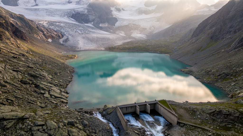
Deep in the Alps, some of the most effective flood defenses are not concrete dams or engineered levees but the quiet, still surfaces of lakes and reservoirs. A new study published in Hydrology and Earth System Sciences by Jonas Götte, Paul C. Astagneau, and Manuela I. Brunner of ETH Zurich and the WSL Institute for Snow and Avalanche Research reveals just how powerful these standing water bodies are at taming floods, and how their influence depends critically on the timescale at which floods are measured. The findings carry immediate consequences for how engineers and hydrologists estimate the extreme flows that determine the size of bridges, spillways, and flood protection infrastructure across mountain regions.
The core of the problem lies in a long-standing gap in flood data. Floods triggered by intense convective storms can develop in a matter of hours, especially in small catchments, meaning that the true instantaneous peak flow, the maximum flow occurring at a single moment, can be far higher than the average flow recorded over a whole day. Yet sub-daily streamflow records are far less common than daily ones, so hydrologists have spent more than a century trying to estimate instantaneous peak flows from daily data. The classic approach, dating back to Fuller’s work in 1914, relates the ratio between daily mean flows and instantaneous peaks, known as the peak ratio, to catchment characteristics such as area, elevation, and slope. Small catchments typically show a large gap between hourly and daily peaks, while in large basins the two converge.
What has been missing from this picture, the researchers argue, is the role of lakes and reservoirs. Both types of water bodies are known to modulate streamflow: reservoirs dampen floods depending on their storage capacity, management practices, and the return period of the flood, while lakes stabilize baseflow and reduce streamflow variability. Both buffer short, intense floods better than long-lasting ones, because the volume of a brief event is limited. But no one had systematically assessed how this attenuation differs between daily and hourly flood peaks, and therefore how water bodies reshape the peak ratio itself across a large spatial domain.
To close this gap, the team combined two complementary approaches. The first was a set of four local case studies with streamflow gauges both upstream and downstream of a water body, allowing the effect of the water body to be isolated from other catchment influences. Three of these were reservoirs in Bavaria, Germany, namely Perlsee, Vilstalsee, and Mertsee, used primarily for flood protection and recreation, and the fourth was the Walensee in Switzerland, a large natural and unregulated lake. The Bavarian records, available at 15-minute resolution, span 38 to 56 years after reservoir construction, while the Walensee data cover 49 years at hourly resolution. The second approach was a large-sample analysis of 183 Swiss catchments drawn from the CAMELS-CH dataset, each with hourly streamflow records extending from the 1981 to the 2024 hydrological year, a maximum of 44 years of data.
The case studies delivered a striking result. When the researchers fitted generalized extreme value distributions to annual maximum flows and estimated flood quantiles for return periods of 2 to 25 years, they found that sub-daily peak discharge is attenuated far more strongly than daily peak discharge. For floods with a 10-year return period, the downstream-to-upstream ratio was between 0.12 and 0.33 lower for sub-daily flows than for daily flows, corresponding to reductions in sub-daily peaks of up to 70 percent. Daily peaks, by contrast, changed by amounts ranging from a 55 percent decrease at Perlsee to a 9 percent increase at Walensee, the latter explained by the fact that the downstream catchment is 77 percent larger than the upstream one. Even in the Walensee case, where tributaries complicate the picture, the lake’s suppression of sub-daily peaks was unmistakable.
The consequence of this differential dampening is remarkable: downstream of reservoirs, daily and hourly flood peaks become nearly identical. For three of the four case studies, the difference between 10-year daily and sub-daily flood estimates was less than 10 percent downstream of the water body, compared with much larger gaps upstream. In the Mertsee case, the daily-to-sub-daily ratio still rose from 0.5 to 0.7, a substantial convergence even if not complete. In practical terms, a reservoir acts like a filter that strips out the sharp, short-lived spikes in flow while leaving the slower, day-scale component of the flood largely intact, flattening the hydrograph into a form where the distinction between hourly and daily maxima almost disappears.
The large-sample analysis across Switzerland confirmed that this is not a local curiosity. The ratio between daily and hourly 10-year flood peaks, the D/H ratio, increases with catchment area, as expected from classical flood scaling, but it also approaches 1 in catchments strongly influenced by water bodies. Of the 29 catchments in which more than 70 percent of the area drains into a standing water body, 28 had a D/H ratio above 0.85, indicating great similarity between daily and hourly high flows. To disentangle the effects of area and water-body influence, the team trained a random forest model to predict the D/H ratio from seven catchment characteristics. The best-performing model, explaining 67 percent of the variability, used just four predictors: the contributing area percentage, catchment area, geological permeability, and biogeographical region, with the first two dominating in importance.
Partial dependence analysis revealed a clear threshold. Below a contributing area percentage of 60 percent, meaning less than 60 percent of the catchment lies above the water body, the predicted D/H ratio changes only marginally. Above that threshold, the ratio rises sharply, indicating that water bodies only exert their full harmonizing effect when they command a large share of the catchment’s flow-generating area. The team then trained a model on weakly influenced catchments and applied it to strongly influenced ones: while it predicted the weakly influenced catchments well, with errors below 0.1 for 91 percent of them, it systematically underestimated the D/H ratio in strongly influenced catchments, with 80 percent of predictions off by more than 0.1 and a median error of minus 0.20. Ignoring water bodies, in other words, produces systematically wrong estimates of how similar daily and hourly floods are.
The implications for flood estimation are profound. In strongly regulated catchments, daily flood peaks turn out to be a good proxy for hourly peaks, meaning that instantaneous peak flows can plausibly be estimated from daily data where sub-daily records are unavailable. Conversely, in near-natural catchments, especially small ones, hourly peaks can substantially exceed daily peaks, and applying relationships calibrated elsewhere could badly misestimate design floods. The study also exposes a blind spot in large-sample hydrology. Commonly used catchment descriptors aggregate water-body information into lumped statistics such as total reservoir volume or the percentage of land covered by water, but ignore the spatial organization of the water bodies within the catchment. A large reservoir high in the headwaters may have enormous storage capacity yet limited buffering power if its inflow area covers only a small fraction of the catchment. The authors argue that the fraction of the catchment above the water body, a metric that can be derived even when detailed management information is lacking, should become a standard descriptor, and that lakes and reservoirs, whose attenuation effects they show to be very similar, should be treated consistently rather than one being included and the other excluded as unnatural.
The researchers acknowledge limitations. A few catchments with small hydropower reservoirs and limited storage showed low peak ratios despite high contributing area percentages, suggesting that active storage capacity should be considered alongside spatial position. The FARL index, developed in the United Kingdom, performs poorly for deep Alpine reservoirs whose depth-to-area ratios make surface area a poor proxy for storage. And because Switzerland’s largest catchments all lie downstream of Lake Geneva or Lake Constance, the sample lacks large near-natural basins, complicating the separation of area and water-body effects. Nevertheless, the central pattern is robust: standing water bodies dampen hourly flood peaks far more than daily ones, and where they dominate a catchment, they erase the very distinction that a century of peak-ratio research has tried to quantify. As climate change intensifies Alpine storms and flood defenses are redesigned, the still waters behind dams and in mountain lakes may deserve far more credit, and far more careful accounting, than they have traditionally received.
Subject of Research: The scale-dependent attenuation of daily versus hourly flood peaks by lakes and reservoirs in Alpine catchments
Article Title: The influence of lakes and reservoirs on estimated flood peaks at hourly vs. daily timescale in the Alps
Article References: Götte, J., Astagneau, P. C., & Brunner, M. I. (2026). The influence of lakes and reservoirs on estimated flood peaks at hourly vs. daily timescale in the Alps. Hydrology and Earth System Sciences, 30(19), 6235-6248. https://doi.org/10.5194/hess-30-6235-2026
Image Credits: AI Generated
DOI: 10.5194/hess-30-6235-2026
Keywords: flood peaks, lakes, reservoirs, Alps, hydrology, instantaneous peak flow, flood frequency analysis, catchment area, random forest, Switzerland, flood attenuation, streamflow
Cite Scienmag News
Violet Maxwell. (October 9, 2026). Alpine Lakes and Reservoirs Flatten Hourly Flood Peaks Far More Than Daily Ones. Scienmag. https://scienmag.com/alpine-lakes-and-reservoirs-flatten-hourly-flood-peaks-far-more-than-daily-ones/
Violet Maxwell. "Alpine Lakes and Reservoirs Flatten Hourly Flood Peaks Far More Than Daily Ones." Scienmag, 9 October 2026, https://scienmag.com/alpine-lakes-and-reservoirs-flatten-hourly-flood-peaks-far-more-than-daily-ones/. Accessed 9 October 2026.
Violet Maxwell. "Alpine Lakes and Reservoirs Flatten Hourly Flood Peaks Far More Than Daily Ones." Scienmag. October 9, 2026. https://scienmag.com/alpine-lakes-and-reservoirs-flatten-hourly-flood-peaks-far-more-than-daily-ones/


