


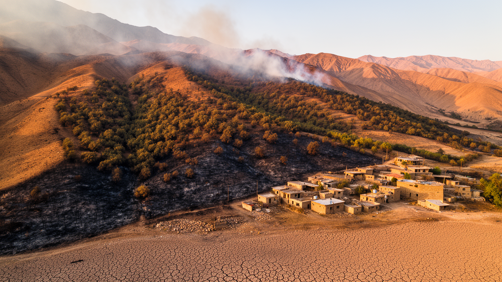
High in the Zagros Mountains of western Iran, an ancient arc of oak woodland is being squeezed from every direction. A new spatially explicit study of these semi-arid mountain forests has produced one of the most detailed multihazard exposure maps ever attempted for the region, and its conclusions are stark: more than half of the forested landscape now falls into the high or very high exposure categories when nine interacting environmental and socioecological threats are considered together. The research, published in Environmental Monitoring and Assessment, argues that the vulnerability of the Zagros cannot be understood hazard by hazard, because drought, fire, floods, landslides, dust storms, extreme heat, wind, water stress and social pressures compound one another across the terrain.
The study, led by Davood Mafi-Gholami of the Standard Research Institute in Karaj, with Abolfazl Jaafari of Iran’s Research Institute of Forests and Rangelands and Binh Thai Pham of the University of Transport Technology in Hanoi, addresses a persistent blind spot in forest vulnerability science. Most vulnerability assessments, the authors note, still rest on single-hazard frameworks, even though the Intergovernmental Panel on Climate Change has repeatedly emphasized that real-world risk emerges from the interaction of climatic, environmental and human stressors. In a region where climate change and intensifying land use are accelerating ecological degradation, a single-lens approach risks underestimating the pressure on ecosystems that are already operating close to their physiological limits.
To build a more faithful picture, the team constructed a geographic information system-based multicriteria framework that integrates nine factors contributing to exposure: drought, actual evapotranspiration, wildfire, high-speed winds, maximum temperature, floods, landslides, dust storms and social vulnerability. Each hazard layer was standardized and then harmonized to a common 30-meter resolution, allowing the signals of very different phenomena, from atmospheric moisture demand to slope instability, to be combined cell by cell into a single continuous exposure index across the forest landscape. The choice of a fine spatial grain matters, because hazard intensity in mountain terrain can change dramatically over distances of a few hundred meters as elevation, aspect and land cover shift.
Weighting the relative importance of nine heterogeneous stressors is one of the most contested steps in composite risk mapping, and the researchers approached it through a structured expert elicitation process using Delphi-derived weights within a multicriteria decision analysis. This technique, long established in GIS-based decision support, iteratively refines expert judgments until they converge, producing a transparent set of relative weights that can be applied consistently across the entire study area. It also makes the model auditable: because the weights and the standardization procedures are explicit, other research teams can reproduce the index or adapt it to other mountain forest systems facing similar combinations of pressures.
Perhaps the most important technical feature of the study is that its outputs were tested against the real world rather than accepted on faith. The authors compiled 448 independent disturbance records, drawing on documented locations of oak decline, field-observed forest degradation sites and wildfire hotspots distributed across the Zagros. When these records were overlaid on the exposure index, 75 percent of them fell within the high and very high exposure classes. For a purely synthetic composite index, that level of agreement with independently mapped disturbance is a meaningful validation result, and it suggests the framework is capturing genuine spatial structure in where the forests are actually breaking down rather than merely producing a smooth statistical artifact.
Among the nine hazards, drought emerged as the dominant contributor to exposure, followed by wildfire and social vulnerability. That ordering tells a coherent ecological story. The Zagros woodlands, dominated by drought-sensitive oak species such as Quercus brantii, have experienced repeated severe droughts in recent decades, and satellite-based monitoring has documented substantial canopy losses associated with them. Prolonged water stress weakens trees, and weakened trees are in turn more flammable and more susceptible to pests and pathogens, which is one mechanism by which the region’s well-documented oak decline phenomenon is thought to propagate. Meanwhile, social vulnerability, reflecting the capacity of forest-dependent communities to absorb and recover from shocks, ranked third, underscoring that in this landscape ecological risk and human risk are inseparable.
The second major finding concerns canopy structure, which forms the conceptual core of the paper’s title. The researchers found that exposure increased consistently as canopy cover declined, with sparsely forested stands showing both the greatest concentration and the greatest spatial continuity of high-risk zones. This is more than a correlation of degraded land with degraded conditions. Canopy cover functions as a physical regulator of the microclimate beneath it: closed canopies moderate surface temperatures, reduce evaporative demand, protect soils from erosion, and slow the spread of fire by interrupting continuous fuel beds. As canopies thin, these buffering functions erode, and the underlying land becomes simultaneously hotter, drier, more erosion-prone and more fire-prone, feeding a feedback loop that pushes stands further from recovery.
The spatial pattern of this feedback is what makes the new index operationally valuable. Because exposure was computed at 30-meter resolution, the map distinguishes between isolated high-risk pixels and large contiguous zones where high exposure dominates the landscape. Continuity matters for managers: a fragmented high-risk patch may be stabilized through targeted interventions, whereas an extensive connected zone of sparsely canopied, drought-stricken, fire-prone forest represents a landscape-scale degradation corridor in which restoration efforts must be prioritized and concentrated. The authors position the framework as a practical decision support tool for exactly this purpose, applicable to restoration planning, climate adaptation, risk management and conservation prioritization in climate-sensitive mountain forests far beyond Iran.
The broader scientific significance of the work lies in its treatment of the exposure component of vulnerability. In the widely used vulnerability frameworks of sustainability science, vulnerability is decomposed into exposure, sensitivity and adaptive capacity, and the exposure term has often been the least spatially refined. By building a high-resolution, multi-stressor, validated exposure surface and then explicitly relating it to canopy structure, the study demonstrates that forest architecture is not merely a passive attribute of the ecosystem but an active regulator of how much environmental hazard the system actually experiences. That reframing has direct implications for how vulnerability models are parameterized, since stand structure data from remote sensing can now inform not only sensitivity estimates but exposure estimates as well.
For the Zagros forests themselves, the message is urgent. The region sits at a climatic crossroads where projections indicate continued warming and shifting precipitation regimes, and prior studies have shown that anthropogenic activities amplify wildfire occurrence across the eco-region. The new exposure map does not predict the future, but it identifies where the accumulated weight of drought, fire, dust, floods, landslides, heat, wind and social fragility is already greatest, and where the loss of canopy cover is converting scattered stress into concentrated, self-reinforcing risk. In a warming century, the authors suggest, protecting and restoring canopy structure in the most exposed zones may be among the most cost-effective levers available for keeping these irreplaceable mountain forests, and the communities that depend on them, from crossing thresholds from which recovery is no longer possible.
Subject of Research: Multihazard exposure assessment and the role of canopy structure in forest vulnerability in the Zagros forests of Iran
Article Title: Spatially explicit assessment of multihazard exposure in the Zagros forests of Iran: the role of canopy structure in the exposure component of forest vulnerability
Article References: Mafi-Gholami, D., Jaafari, A., & Pham, B. T. (2026). Spatially explicit assessment of multihazard exposure in the Zagros forests of Iran: the role of canopy structure in the exposure component of forest vulnerability. Environmental Monitoring and Assessment, 198(9), Article 1019. https://doi.org/10.1007/s10661-026-15874-1
Image Credits: AI Generated
DOI: 10.1007/s10661-026-15874-1
Keywords: Zagros forests, multihazard exposure, forest vulnerability, drought, wildfire, oak decline, canopy cover, GIS multicriteria analysis, social vulnerability, climate change, Iran, spatial modeling
Cite Scienmag News
Violet Maxwell. (October 18, 2026). Drought, Fire and People Converge to Threaten Iran’s Ancient Zagros Forests, New High-Resolution Risk Map Reveals. Scienmag. https://scienmag.com/drought-fire-and-people-converge-to-threaten-irans-ancient-zagros-forests-new-high-resolution-risk-map-reveals/
Violet Maxwell. "Drought, Fire and People Converge to Threaten Iran’s Ancient Zagros Forests, New High-Resolution Risk Map Reveals." Scienmag, 18 October 2026, https://scienmag.com/drought-fire-and-people-converge-to-threaten-irans-ancient-zagros-forests-new-high-resolution-risk-map-reveals/. Accessed 18 October 2026.
Violet Maxwell. "Drought, Fire and People Converge to Threaten Iran’s Ancient Zagros Forests, New High-Resolution Risk Map Reveals." Scienmag. October 18, 2026. https://scienmag.com/drought-fire-and-people-converge-to-threaten-irans-ancient-zagros-forests-new-high-resolution-risk-map-reveals/


