


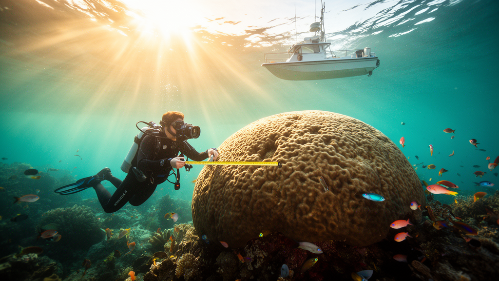
Some of the most remarkable organisms on Earth are also among the least documented. Scattered across the world’s tropical reefs are coral colonies so large that a single individual can span more than 20 metres, weigh many tonnes and have been growing since before the Industrial Revolution. These giants are living monuments — centennial, and in some cases millennial, coral colonies that embody resistance and resilience in a rapidly changing ocean. Yet many may disappear before they are ever recorded. A new global citizen-science initiative called Map the Giants, launched in January 2024 and described in the journal Nature Conservation, is racing to change that by mobilising divers, researchers and ocean enthusiasts to locate, document and help protect the largest coral colonies on the planet.
The urgency behind the project is difficult to overstate. In 2025, coral reefs were reported as the first Earth system to exceed the central estimated thermal tipping point of 1.2 °C above pre-industrial levels, and with continued warming they are considered virtually certain — more than 99% — to cross critical thresholds even if temperatures stabilise at 1.5 °C within the next decade. Coral reefs occupy less than 0.1% of the ocean surface yet rank among the most biodiverse ecosystems on Earth, and more than 44% of warm-water coral species are currently considered at risk. Climate change, pollution, disease outbreaks, destructive fishing and coastal development exert pressures that can affect virtually every coral colony worldwide. Against this backdrop, the exceptionally large colonies that have survived these escalating threats may hold some of the most valuable clues to what enables long-term persistence in a warming ocean.
What makes giant corals scientifically extraordinary is the combination of their size, age and ecological roles. Growth rates among reef-building scleractinian corals vary enormously: fast-growing Acroporidae can extend 100 to 150 millimetres per year, whereas massive species such as Porites lobata grow at roughly 10 millimetres per year and Diploastrea heliopora at just 3 to 6 millimetres per year. Lifespans differ just as dramatically. Fast-growing Pocillopora verrucosa may reach only about four years and Acropora hemprichii 13 to 24 years, yet some Porites colonies can exceed 1,000 years, and Diploastrea heliopora colonies 2.6 metres in height have been dated at over 600 years. Such long-lived colonies provide high-resolution archives of past climate and environmental conditions through their skeletons, and their large three-dimensional structures support diverse associated organisms. Their longevity may reflect strong resistance and resilience via refugia, tolerance, acclimatisation, genotypic differences, adaptation or epigenetics — traits that could prove critical as reefs face unprecedented thermal stress.
Despite their scientific and conservation relevance, exceptionally large coral colonies have received surprisingly little dedicated attention. A few notable examples hint at what is out there: a giant Porites reported off Taiwan measuring 31 metres in circumference and 12 metres in height, another Porites documented off Australia at 10.4 metres in circumference and 5.3 metres in height, and a giant Pavona decussata studied in Japan measuring 50.9 metres in length. One of the few areas where a systematic effort has been made is the reef surrounding Ta’U Island in American Samoa, where surveys identified roughly 400 colonies over 5 metres in diameter, including a Porites 22.4 metres in diameter, 8 metres in height and 69.2 metres in circumference — an area later dubbed the Valley of Giants by NOAA. Culturally, these corals may act as charismatic organisms analogous to monumental trees, which are valued and protected for ecological and symbolic reasons, yet no individual marine organism has received comparable protection.
Map the Giants was conceived to fill this gap at a scale that conventional scientific surveys alone could never achieve. The project has three linked aims: to crowd-source reports of potential giant colonies from divers, citizens and researchers; to validate and prioritise verified colonies for targeted, multidisciplinary field studies; and to collaborate with stakeholders to explore protection measures for colonies of outstanding value. The initiative is designed and managed in line with the ten European Citizen Science Association principles, actively involving people from diverse backgrounds who may submit one-off reports or act as long-term stewards of specific colonies by providing periodic photo and video updates. Benefits are reciprocal: scientists gain scalable, otherwise unattainable data and access to rare colonies, while contributors gain skills, recognition and a deeper understanding of reef vulnerability.
The project’s technical backbone is a user-centred web platform that reduces friction from initial interest to action. Grounded in user-centred design principles — clarity, progressive disclosure, error prevention, accessibility and timely feedback — the website guides users through a gradual journey of learning the basics, preparing a report and finally visualising validated sightings on an interactive map hosted on the ESRI ArcGIS Online platform. A dedicated Learn page advances ocean literacy with accessible overviews of coral reef ecology, growth forms and health conditions, while a How to Monitor page explains the reporting protocol, including best practices to avoid damaging colonies and the reef, drawing on the Green-Fins Code of Conduct. Outreach extends beyond the website through presentations for diving groups, scuba exhibitions, podcasts, radio interviews and immersive 360° VR videos that showcase giant colonies in emotionally impactful ways.
Defining what counts as a giant coral required a careful technical trade-off. The project adopts Done’s description of a coral colony as the limestone skeleton plus the living polyp tissue produced by replication of the primary zooid and all its descendants, and sets a size threshold: a colony qualifies if it measures at least 5 metres in one of its two-dimensional projected linear lengths and presents continuous live tissue and/or a continuous skeleton. Branching colonies are currently excluded because this growth form often develops into monospecific thickets covering extensive areas via fragmentation, making it difficult to determine whether a reported structure represents a single connected genotype without genetic studies. The minimum size ensures inclusion of both particularly slow-growing species and fast-growing corals that have reached unusual sizes, where reports may be especially important given the short lifespans and susceptibility of certain fast-growing species.
To accommodate contributors with different levels of experience, the protocol offers two complementary methodologies. The simple methodology is designed for participants who encounter a giant coral opportunistically during recreational activities and includes the minimum data required for validity: an estimate of colony size assigned to one of three classes (5–10 m, 10–20 m, > 20 m), growth form, location, depth and photographs. The advanced methodology targets more experienced contributors, adding detailed taxonomic identification, environmental parameters such as water temperature, and a structured assessment of colony health encompassing the proportion of live tissue, bleaching status, growth anomalies and observations of potentially harmful organisms such as Crown-of-Thorns Seastars, corallivorous Drupella snails and the overgrowing Terpios hoshitota sponge. Contributors can also submit reports derived from drone surveys, which have proven valuable for locating potential giant colonies over larger shallow-water areas before dedicated in-water surveys confirm the findings.
Addressing common criticisms of citizen science — particularly concerns about inaccuracy and unreliability — all data are manually filtered through a multi-expert validation workflow. Photos are checked and entries are assessed for compliance with the project’s definition by two to three researchers independently; when initial assessments differ, validators discuss the case and reach consensus, ensuring borderline cases are resolved consistently rather than by a single rater. Within a few days, a personalised follow-up email assigns the report an ID number, provides feedback and may request additional material. Once validated, submissions appear on the interactive map with a Map the Giants pin, associated data, photos and the specific licence for reuse. Privacy is handled with particular care: public-facing GPS coordinates are rounded to two decimal places by default, with full-precision data available upon request, addressing concerns about over-tourism at sensitive sites.
The first 18 months demonstrate that the approach works. The project received 195 submissions from 22 countries — 146 from citizen scientists and 49 from dedicated expeditions — and after multi-expert review, 136 entries were validated and incorporated into the public database, an overall validation rate of 69.3% that underscores the importance of expert assessment. Contributors routinely exceeded minimum data requirements: in practice, no submission provided only the mandatory fields, all validated entries eventually included GPS coordinates, and 80% provided at least one specific measurement rather than relying solely on size-class estimates. Bleaching status was reported for 157 entries and water temperature for 124 submissions. Notably, submissions have come from 22 countries with no reports yet from the Atlantic Ocean, indicating a need to expand outreach in regions where giant colonies may be less common as a result of long-standing pressures. Looking ahead, the team plans to trial making GPS coordinates mandatory, explore machine learning to reduce observer bias during validation, develop a dedicated native mobile application, and expand into currently unreached areas. Each validated record carries a persistent identifier allowing updates through follow-up submissions, so the fate of these giants can be tracked over time. As the database expands, Map the Giants could support increasingly robust ecological analyses, inform conservation planning and even enable heritage-orientated protection measures for exceptional colonies — broadening the concept of which organisms are considered worth protecting, and turning the ocean’s oldest corals into powerful ambassadors for reef conservation.
Subject of Research: Marine biology, citizen science, coral reef conservation
Article Title: Map the Giants: a new citizen-science portal to map, study and protect the largest coral colonies
Article References: Siena, F. M., Gabbiadini, A., Fallati, L., Galli, P., & Montano, S. (2026). Map the Giants: a new citizen-science portal to map, study and protect the largest coral colonies. Nature Conservation, 63, 127-151. https://doi.org/10.3897/natureconservation.63.182923
Image Credits: AI Generated
DOI: 10.3897/natureconservation.63.182923
Keywords: citizen science, coral reefs, marine conservation, ocean literacy, giant corals, biodiversity, climate change, Giants, citizen-science, portal, protect, largest
Cite Scienmag News
Violet Maxwell. (October 17, 2026). Map the Giants: Citizen Scientists Race to Chart the Ocean’s Largest Coral Colonies. Scienmag. https://scienmag.com/map-the-giants-citizen-scientists-race-to-chart-the-oceans-largest-coral-colonies/
Violet Maxwell. "Map the Giants: Citizen Scientists Race to Chart the Ocean’s Largest Coral Colonies." Scienmag, 17 October 2026, https://scienmag.com/map-the-giants-citizen-scientists-race-to-chart-the-oceans-largest-coral-colonies/. Accessed 17 October 2026.
Violet Maxwell. "Map the Giants: Citizen Scientists Race to Chart the Ocean’s Largest Coral Colonies." Scienmag. October 17, 2026. https://scienmag.com/map-the-giants-citizen-scientists-race-to-chart-the-oceans-largest-coral-colonies/


