


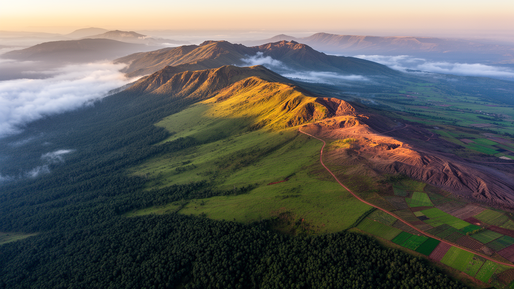
High in the southeastern highlands of Ethiopia, the Bale Mountains rise through an extraordinary ladder of life: dense montane forest giving way to Afro-alpine moorland and glacier-carved plateaus that harbor species found nowhere else on Earth. A new study published in Environmental Monitoring and Assessment shows that this celebrated landscape is being reshaped at a pace that satellite records can now capture with remarkable clarity. Using multi-temporal imagery processed in Google Earth Engine, researchers from Wollega University tracked how land use and land cover changed between 2000 and 2025, and then connected those changes to measurable shifts in vegetation health and biodiversity patterns across the region.
The team classified land cover for three time points: Landsat imagery from 2000 and 2012, and Sentinel-2 imagery from 2025. Rather than relying on manual interpretation, they applied a random forest algorithm, a machine learning method that builds hundreds of decision trees and merges their outputs to assign each pixel to a land cover class. Random forest classifiers have become a mainstay of remote sensing because they handle complex, non-linear relationships between spectral bands and land cover types while remaining robust to noise in training data. By moving the entire classification workflow into Google Earth Engine, the researchers could process large archives of satellite data in the cloud, avoiding the computational bottlenecks that traditionally limited regional land cover mapping.
The results document a landscape under growing anthropogenic pressure. Forest, grassland, and Afro-alpine ecosystems all declined over the twenty-five-year record, while farmland, built-up areas, and bare land expanded. Each of these conversions matters for different reasons. Forest loss removes the shaded, moisture-retaining habitats that support much of the region’s endemic fauna. Grassland conversion eliminates grazing grounds that sustain both wildlife and pastoral livelihoods. The contraction of Afro-alpine zones, which crown the massif and shelter specialized cold-adapted species, signals that even the most remote high-altitude habitats are not insulated from human expansion.
To assess ecosystem condition beyond simple land cover categories, the researchers turned to vegetation indices derived from the Moderate Resolution Imaging Spectroradiometer, or MODIS, sensor aboard NASA’s Terra and Aqua satellites. Two indices anchored the analysis: the Normalized Difference Vegetation Index, which exploits the contrast between red and near-infrared reflectance to estimate the density and vigor of green vegetation, and the Enhanced Vegetation Index, which corrects for atmospheric effects and soil background reflectance to provide a more stable measure of photosynthetic activity, particularly in areas with high biomass. Tracking these indices seasonally across the study period revealed a troubling trajectory: dry-season greenness declined, and the recovery of vegetation during the wet season weakened, especially after 2012. That timing suggests the ecosystem is losing its capacity to rebound between dry periods, a hallmark of accumulating stress.
The authors interpret these vegetation trends as evidence of combined pressure from land-use expansion and climatic variability. Weakened wet-season recovery is particularly significant because it indicates that rainfall is no longer translating into vegetation regrowth as effectively as it once did. Degraded soils, reduced organic matter, and the loss of deep-rooted perennial vegetation can all blunt the response of a landscape to favorable growing conditions. When that pattern coincides with the direct conversion of natural habitat to farmland and settlement, the result is a landscape that is simultaneously shrinking and functioning less efficiently.
Landscape metrics added a structural dimension to the analysis. Fragmentation increased across the study period, reflected in higher patch density, greater edge effects, and reduced connectivity among remaining habitat blocks. These are not abstract statistics. Patch density measures how many discrete fragments a habitat type has been broken into, and rising values mean continuous forest and grassland are being carved into smaller, more isolated islands. Edge effects describe the altered microclimatic and ecological conditions along fragment boundaries, where increased light, wind exposure, and human access degrade conditions for interior-dwelling species. Reduced connectivity means the stepping stones that once allowed animals and plants to move between habitat patches are disappearing, a process with well-documented consequences for gene flow, dispersal, and long-term population viability.
The biodiversity analysis drew on species occurrence records from the Global Biodiversity Information Facility and iNaturalist, two crowdsourced repositories that aggregate millions of georeferenced observations from scientists and citizen naturalists worldwide. When the researchers overlaid these records on their land cover maps, a clear pattern emerged: biodiversity observations are increasingly concentrated in remnant natural habitats. This concentration indicates habitat contraction, with species being squeezed into ever-smaller refugia as the surrounding matrix converts to agriculture and settlement. For the Bale Mountains, which support iconic endemic species such as the Ethiopian wolf and the mountain nyala, this pattern raises the vulnerability of species already restricted to narrow altitudinal and ecological ranges.
The authors are careful to note an important limitation: while the spatial associations between land cover change, vegetation stress, and biodiversity concentration are strong, causal relationships cannot be established from these data alone. Occurrence records from citizen science platforms are unevenly distributed, reflecting where people observe rather than where species actually occur, and the temporal resolution of biodiversity data does not always align with the satellite record. Nevertheless, the convergence of independent lines of evidence, from land cover classification to vegetation indices to species records, paints a coherent picture of an ecosystem under compounding stress.
What makes this study notable beyond its regional findings is the methodological integration it demonstrates. By combining cloud-based land cover mapping, time-series vegetation indices, landscape fragmentation metrics, and crowdsourced biodiversity data within a single analytical framework, the researchers show how modern geospatial tools can deliver ecosystem monitoring that would once have required years of fieldwork and expensive computation. Google Earth Engine has democratized planetary-scale analysis, allowing research teams with modest resources to process archives that span decades and continents. The Bale Mountains study illustrates how that capability can be directed at conservation questions with real urgency.
The implications for conservation are direct. The authors argue for strategies focused on habitat protection, restoring connectivity between fragmented remnants, and promoting sustainable land management practices that reduce pressure on remaining natural ecosystems. As the Bale Mountains face continued agricultural expansion and climatic variability, the satellite record now provides a baseline against which future change can be measured. Whether that record shows stabilization or continued decline will depend on decisions made in the coming years, both within Ethiopia and in the international conservation community that has long recognized the Bale Mountains as one of Africa’s most important biodiversity hotspots.
Subject of Research: Land use and land cover dynamics and their impacts on ecosystem health and biodiversity in the Bale Mountains, Ethiopia
Article Title: Geospatial and Google Earth Engine-based assessment of land use and land cover dynamics and its impacts on ecosystem health and biodiversity in the Bale Mountains, Ethiopia
Article References: Werati, G. T., Wolteji, B. N., & Sori, M. D. (2026). Geospatial and Google Earth Engine-based assessment of land use and land cover dynamics and its impacts on ecosystem health and biodiversity in the Bale Mountains, Ethiopia. Environmental Monitoring and Assessment, 198(9), Article 995. https://doi.org/10.1007/s10661-026-15847-4
Image Credits: AI Generated
DOI: 10.1007/s10661-026-15847-4
Keywords: Bale Mountains, Ethiopia, land use land cover change, Google Earth Engine, remote sensing, habitat fragmentation, biodiversity, NDVI, random forest classification, ecosystem health, Geospatial, Google
Cite Scienmag News
Margaret Porter. (October 17, 2026). Satellites Reveal Shrinking Wilds in Ethiopia’s Bale Mountains. Scienmag. https://scienmag.com/satellites-reveal-shrinking-wilds-in-ethiopias-bale-mountains/
Margaret Porter. "Satellites Reveal Shrinking Wilds in Ethiopia’s Bale Mountains." Scienmag, 17 October 2026, https://scienmag.com/satellites-reveal-shrinking-wilds-in-ethiopias-bale-mountains/. Accessed 17 October 2026.
Margaret Porter. "Satellites Reveal Shrinking Wilds in Ethiopia’s Bale Mountains." Scienmag. October 17, 2026. https://scienmag.com/satellites-reveal-shrinking-wilds-in-ethiopias-bale-mountains/


