


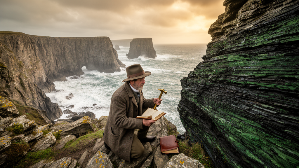
On the southernmost tip of England, a rugged Cornish headland hides one of the most enigmatic assemblages of rocks in the entire country. The Lizard District, a peninsula of roughly 210 square kilometers, is composed of a slab of ancient oceanic lithosphere containing rock types found nowhere else in England. For more than two hundred years, this small corner of Cornwall has drawn geologists to its storm-battered cliffs, and a new historical review by Carl N. Drummond of Purdue University Fort Wayne, published in the History of Geo- and Space Sciences, traces how scientific understanding of the region evolved during its first sixty-five years of study, from 1818 to 1883. The story captures a pivotal transition in the history of geology, from field-based observation with hammer and notebook to the revolutionary power of the polarizing microscope.
Modern geologists now understand the Lizard as an obducted ophiolite, a fragment of oceanic crust and underlying mantle rocks thrust onto the southern margin of the continent of Avalonia during the Variscan orogeny, as the Rheic Ocean closed in the early Paleozoic era. The tectonostratigraphy is remarkably complete: sheeted dykes sit atop the crustal Crousa gabbro, which is underlain by a highly sheared Moho transition zone and the Traboe cumulate complex, all resting above a mantle sequence of serpentinized lherzolite, harzburgite, and dunite peridotites. The entire sequence was thrust over a metamorphic sole, including the Landewednack amphibolite, and a complex mélange containing fragments of the Man of War Gneiss and the Mullion Island pillow lavas. Yet when the first geologists arrived in the early nineteenth century, none of this framework existed. There was no understanding of the distinction between oceanic and continental lithosphere, no theory of plate tectonics, and no coherent way to interpret the region’s complexly faulted and metamorphosed rocks.
The earliest significant survey was conducted in 1818 by Ashurst Majendie, a founding member of the Geological Society of London, who set out to map the boundaries and position of the serpentine formation around the Lizard Promontory. Working along the coast from Loe-Bar to the Helford estuary, Majendie recognized the contacts between what are now known as the Old Lizard Head Series, the Landewednack amphibolite, the serpentinized peridotite, and the Crousa gabbro, producing the first geological map of the region. Given the uniqueness of the rocks, the structural complexity of the peninsula, and the primitive analytical techniques of the day, his map is remarkably congruent with modern surveys in the positions of its major lithologic boundaries, even though the nature of the contacts and the ages of the rock bodies remained beyond his grasp.
In the summer of 1819, Adam Sedgwick, recently appointed Woodwardian Professor of geology at Cambridge, toured Cornwall in the company of the Reverend William R. Gilby, publishing his results in 1822. Sedgwick was drawn to the region because it differed so essentially from every other part of Cornwall, and he hoped to convey a correct notion of the great mineral masses that successively presented themselves along the coast. Tracing the cliffs clockwise from the Helford estuary to Mullion Cove, Sedgwick encountered the serpentine that stretches six or eight miles from coast to coast and occupies about one-third of the peninsula. He was repeatedly confounded by the poorly defined contacts between lithologies, noting that rocks at the junctions of formations were often in an advanced stage of decomposition. At Kennack Cove he struggled to describe the rapid alternation of mineral aggregates that seemed to mutually penetrate one another, and near Karak Clews he was surprised to find rocks suddenly cut off by the reappearance of serpentine, wedged between nearly perpendicular faces of the altered peridotite.
Sedgwick also left vivid descriptions of the region’s celebrated geomorphic features, including the Devil’s Frying Pan below the village of Cadgwith, which he called a magnificent natural amphitheater formed by the decomposition of serpentine, with a natural bridge of the same rock spanning the gulf where the sea had forced a passage into the chasm. Modern mapping shows that outcrops of the Lizard Peridotite, the Landewednack Amphibolite, and the Kennack Granite all occur within the circumference of that depression, details that Sedgwick suggested but could not fully resolve. He ultimately concluded that the great plateau of the Lizard was not composed of stratified rocks, and that the serpentine belonged to the class of transitional rather than primitive rocks within the classification system of his era. Notably, he and Gilby also recorded white quartz pebbles in the alluvium capping the downs north of Coverack, deposits now understood to be the Neogene Crousa gravels, though few nineteenth-century geologists considered their origin.
Subsequent workers built incrementally on these foundations. In 1822 the Reverend John Rogers read a paper to the Royal Geological Society of Cornwall, arguing that an accurate knowledge of so complex a district could only be attained by repeated examination, though his brief study of the eastern coast added relatively little beyond the four-fold division of the rocks into Devonian clay slates, amphibolite schist, gabbro, and serpentine. In 1839 Henry T. De la Beche, the first director of the Ordnance Geological Survey, published a nearly seven-hundred-page report on the geology of southwest England. Within it he recognized that the mica slates of the Lizard were of very different character from the great schistose systems of Cornwall and Devon, distinguishing the Old Lizard Head Series from the Devonian schists to the north. He also proposed that the hornblende slate had formed a basin into which the serpentine and gabbro had been poured in a state of fusion, an interpretation that was clearly incorrect but understandable given the synclinal geometry of the western coast and the difficulty of recognizing the region’s pervasive faulting.
By the 1870s, attention had shifted to the microscopic world. In 1876, professors William King and Thomas H. Rowney of Queens College Galway analyzed the Lizard serpentinite to counter the claim that serpentine was an original chemical precipitate, concluding instead that it was the product of chemical changes, which they termed methylosis, effected in a preexisting rock near the surface of the earth. King and Rowney were seasoned controversialists, having correctly identified the famous pseudofossil Eozoön canadense as interlayered calcite and serpentine of abiotic origin, and King was also celebrated for recognizing the Neanderthal as a species distinct from modern humans. Their study produced one of the most striking illustrations in nineteenth-century geology, a surrealistic composite of twenty-two distinct microscopical features, and they reviewed a series of ovoid and branching textures in the Lizard serpentine, finding them to be mineralogical rather than organic in origin.
The decisive breakthrough came from the Reverend Thomas G. Bonney of St. John’s College, Cambridge, who read the first large-scale petrographic study of the Lizard to the Geological Society of London in May 1877. Armed with the polarizing microscope, Bonney combined extensive coastal fieldwork with detailed examination of thin sections, hoping to explain phenomena with which the appliances of earlier workers could not deal. He recognized five distinct lithologies and worked out temporal relationships among them, concluding that the serpentine was originally an igneous rock formed after the metamorphism of the amphibolite, that serpentinization was complete before later intrusions, and that the dark trap dykes were the youngest rocks of the peninsula. His microscopic examinations of serpentine from fourteen locations led him to the conclusion that the Lizard serpentine was an altered olivine rock, comparing a specimen from Coverack Cove with lherzolite he collected from the type locality at Etang de Lherz in the French Pyrenees. He attributed serpentinization to the gradual decomposition of olivine by slowly infiltrated water, an interpretation broadly aligned with the methylosis concept of King and Rowney, though modern science now understands the process as a moderate to high temperature metamorphic reaction of forsterite with water and excess silica to form the serpentine mineral lizardite.
Bonney returned to the Lizard in the spring of 1882 to study the metamorphic schists, identifying a third granulitic group alongside the talco-micaceous and hornblende schists and mapping the faulted boundary between the Old Lizard Head Series and the amphibolite east of Polpeor. He observed that faults abound in the Lizard District, noting them in almost every cove and sea-chasm, echoing the observations Sedgwick had made six decades earlier. Some of his interpretations proved remarkably prescient, while others, such as his reading of current-bedding in the hornblende schists and his insistence on a conformable sedimentary sequence, were later overturned. Yet by the close of 1883, the stage had been set for the vigorous debates of the late nineteenth and early twentieth centuries, and the Lizard’s ancient ocean floor had begun, at last, to yield its secrets.
Subject of Research: History of nineteenth-century geological investigations of the Lizard ophiolite complex in Cornwall, England
Article Title: Geological investigations of the Lizard District, Cornwall, England: 1818–1883
Article References: Drummond, C. N. (2025). Geological investigations of the Lizard District, Cornwall, England: 1818–1883. History of Geo- and Space Sciences, 16(2), 65-79. https://doi.org/10.5194/hgss-16-65-2025
Image Credits: AI Generated
Keywords: Lizard District, Cornwall, ophiolite, geology history, serpentine, Adam Sedgwick, Thomas Bonney, petrography, Variscan orogeny, oceanic crust, metamorphism, Henry De la Beche
Cite Scienmag News
Violet Maxwell. (October 9, 2026). How Victorian geologists cracked Cornwall’s mysterious slab of ancient ocean crust. Scienmag. https://scienmag.com/how-victorian-geologists-cracked-cornwalls-mysterious-slab-of-ancient-ocean-crust/
Violet Maxwell. "How Victorian geologists cracked Cornwall’s mysterious slab of ancient ocean crust." Scienmag, 9 October 2026, https://scienmag.com/how-victorian-geologists-cracked-cornwalls-mysterious-slab-of-ancient-ocean-crust/. Accessed 9 October 2026.
Violet Maxwell. "How Victorian geologists cracked Cornwall’s mysterious slab of ancient ocean crust." Scienmag. October 9, 2026. https://scienmag.com/how-victorian-geologists-cracked-cornwalls-mysterious-slab-of-ancient-ocean-crust/


