


Beneath the town of Solotvyno in western Ukraine, one of Europe’s most unusual environmental emergencies is unfolding in near-total darkness. A vast salt dome, mined for centuries and abandoned to the floods, is quietly dissolving away. Groundwater is eating the rock salt from the inside, brine is leaking into aquifers, the land surface is sinking, and salty water is creeping toward the Tisza River, which flows through Romania, Hungary, and Slovakia. A new study published in Hydrogeology Journal has now delivered the most complete picture yet of this subterranean crisis, combining an autonomous underwater robot, an arsenal of geophysical surveys, and sophisticated flow and geochemical modeling into a single integrated diagnosis.
The scale of the problem is stark. Salt mining at Solotvyno reaches back centuries, with deeper workings in mines 7, 8, and 9 extending to 430 meters during the nineteenth and twentieth centuries. Stability problems, collapses, and flooding eventually forced closures, and an attempt to stabilize mine 7 by artificially flooding it in 1953 backfired spectacularly, triggering numerous large sinkholes. By 2010 the situation had escalated into a state-level emergency. Satellite radar measurements show ground subsidence generally exceeding 2 centimeters per year, with specific zones deforming at up to 102 centimeters per year. In 2008, salt levels in the Tisza spiked dramatically, and the contamination was traced back to Solotvyno, confirming that the hazard is not merely local but transboundary.
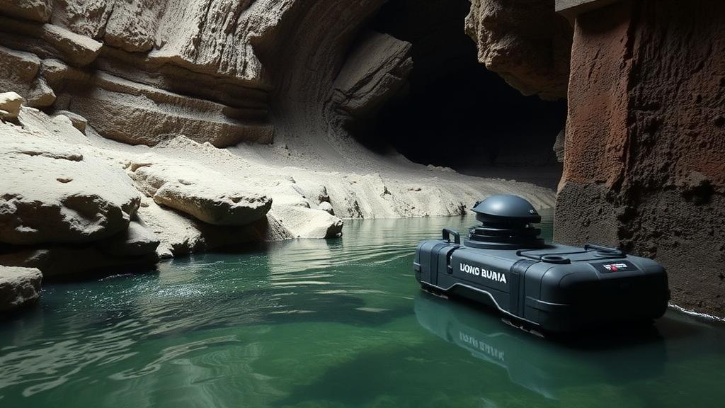
To see inside the flooded workings, the research team deployed UX-1Neo, a second-generation autonomous underwater vehicle developed through the UNEXUP project led by the University of Miskolc in Hungary. The torpedo-shaped robot, rated to 500 meters depth, carries sonars, cameras, a structured light system capable of millimeter-accurate mapping, inertial and doppler navigation, and sensors for pH, electrical conductivity, temperature, and dissolved oxygen. Between the two flooded shafts it completed 14 dives, three in ventilation shaft 9 and eleven in shaft 10, producing three-dimensional maps, high-resolution video, and eight water samples from varying depths in shaft 10.
The robotic findings were a mixture of reassurance and alarm. The main vertical structures of both shafts appeared intact within accessible depths, but the horizontal passages told a different story. At 306 meters below ground in shaft 10, the entrance to a side passage was blocked and showed signs of structural instability, while another passage at 366 meters was obstructed 55 meters in, its origin undetermined and possibly a collapse or debris inflow. These blockages matter because they conceal the salt cavities most relevant to sinkhole formation and hint at ongoing degradation within the wider mine network. The dives also revealed sharply different salinity stratification between the shafts: a halocline, the boundary between fresh and saturated brine, sat at roughly 60 meters in shaft 9 but 140 meters in shaft 10, implying a pressure difference of about 1 to 1.5 bar and limited hydraulic connection between the two. Intense salt crystallization observed below the halocline in shaft 10 suggests the interface has fluctuated over time, rising and falling with recharge conditions.
While the robot probed the depths, geophysicists mapped the shallow subsurface from the surface. The team acquired dozens of electrical resistivity tomography profiles totaling more than 22 kilometers, supplemented by very low frequency radio-magnetotellurics and horizontal loop electromagnetics, all precisely positioned with RTK GPS. Resistivity methods are ideal here because brine-soaked clays, fresh gravels, and air-filled voids have dramatically different electrical signatures. The surveys delineated the coarse Tisza river terraces, traced the thinning of alluvial sediments toward Mount Magura, and, crucially, imaged the protective clay layer known locally as pallag that naturally caps the salt body and limits freshwater infiltration.
That pallag layer, the geophysics showed, is compromised. Near the mine, profiles revealed a very low resistivity zone of 1 to 10 ohm-meters corresponding to saline clays, and embedded within it, angular anomalies of 4000 to 5000 ohm-meters, interpreted as air-filled voids, possibly unflooded mine galleries or karst cavities. Combined with historical records of mining disruption and failed dewatering galleries, the data support the conclusion that breaches and hydraulic windows in the pallag now serve as primary pathways for water ingress, accelerating dissolution of the salt beneath and driving the observed surface deformation.
To quantify what all this means for water movement, the team built a chain of three linked models. A regional groundwater flow model, constructed with archive data from 395 wells drilled between 1922 and 1982 and calibrated against monitoring from June 2020 to May 2022, simulated flow across a 24.6 square kilometer domain, with fault zones represented as narrow bands of elevated hydraulic conductivity. A density-driven transport model using the SEAWAT code then coupled MODFLOW flow equations with MT3DMS solute transport to capture the physics of saturated brine, roughly 360 grams of salt per liter in the mine cavities, sitting beneath fresher water. The simulations identified two main salt-loading mechanisms: direct leakage from the flooded mines at 13 to 15 cubic meters of brine per day, and diffuse discharge through subsidence-damaged pallag zones at around 2000 cubic meters of moderately saline water per day, together delivering roughly 11.2 metric tons of salt to the groundwater system daily.
The water balance translates to an alarming rate of salt loss: the equivalent of 5.0 to 5.5 cubic meters of rock salt dissolving every day, or about 2000 cubic meters annually. Each cubic meter removed enlarges the underground cavities, which promotes further subsidence, which in turn increases permeability and lets in more freshwater, a self-reinforcing feedback loop. The modeled contaminant plume already spans nearly a square kilometer, encompassing the catchments of the Glod and Mlinsky streams, and projections indicate chloride concentrations exceeding 450 milligrams per liter in the Quaternary aquifer within decades. Areas where subsidence exceeds 10 millimeters per year show disproportionately high salt fluxes, suggesting that surface collapse features act as focused recharge points funneling water straight toward the dissolving dome.
The final piece of the puzzle was geochemical. Using stable isotopes of oxygen and hydrogen alongside major ion chemistry from 49 monitoring points sampled monthly over a year, the team applied NETPATH mixing models to apportion the water in each sample among distinct endmembers: fresh groundwater, saline mine water, and Tisza River water. Isotopic plots showed clear mixing trajectories, with evaporation effects evident in the low slopes of the water lines. The results revealed a heterogeneous contamination landscape. Groundwater near the Black Moor, a saline pond formed by subsidence, carried the highest mine water contribution at 27.4 percent, marking it as the most vulnerable zone. The Black Moor pond itself, despite its salty character, proved to be roughly 93 percent fresh groundwater with about 7 percent mine water, demonstrating how even small brine inputs can dominate water chemistry. Other wells remained nearly pristine, with mine water contributions as low as 0.2 percent, while one sample showed substantial river infiltration, hinting that the Tisza sometimes acts as a hydraulic barrier rather than a victim.
For the river itself, the news is cautiously reassuring. The downstream Tisza sample retained 93.3 percent of its original composition, with only 1.97 percent mine water and 4.71 percent well shaft water, indicating that the river’s enormous dilution capacity is currently limiting the impact despite measurable contamination. Saturation index calculations confirmed that halite remains strongly undersaturated throughout the system, guaranteeing continued dissolution, while carbonate and silica minerals modulate water chemistry through secondary precipitation and exchange reactions. The authors argue that their integrated framework, robot, geophysics, and models working in concert, offers a transferable template for other abandoned mine sites, and point toward concrete mitigations: sealing mine openings, managed artificial recharge to build hydraulic barriers, strict regulation of groundwater abstraction near the dome, and intensified monitoring of the subsidence zones where the pallag’s protective integrity has already failed.
Subject of Research: Hydrogeological assessment of the flooded Solotvyno salt mine hazard in Transcarpathia, Ukraine
Article Title: Integrating geophysical and underwater robotic surveys with transport and geochemical modeling to assess the Solotvyno salt mine hazard in the Transcarpathia province of Ukraine
Article References: Mikita, V., Szabó, N. P., Nádasi, E., Eid, M. H., & Szűcs, P. (2026). Integrating geophysical and underwater robotic surveys with transport and geochemical modeling to assess the Solotvyno salt mine hazard in the Transcarpathia province of Ukraine. Hydrogeology Journal. https://doi.org/10.1007/s10040-026-03181-5
Image Credits: AI Generated
DOI: 10.1007/s10040-026-03181-5
Keywords: Solotvyno salt mine, Ukraine, hydrogeology, autonomous underwater robot, UX-1Neo, geophysical surveying, electrical resistivity tomography, groundwater contamination, salt dissolution, Tisza River, NETPATH mixing model, SEAWAT transport modeling
Cite Scienmag News
Violet Maxwell. (October 2, 2026). Robots Dive Into a Drowning Ukrainian Salt Mine to Track a Slow-Motion Environmental Disaster. Scienmag. https://scienmag.com/robots-dive-into-a-drowning-ukrainian-salt-mine-to-track-a-slow-motion-environmental-disaster/
Violet Maxwell. "Robots Dive Into a Drowning Ukrainian Salt Mine to Track a Slow-Motion Environmental Disaster." Scienmag, 2 October 2026, https://scienmag.com/robots-dive-into-a-drowning-ukrainian-salt-mine-to-track-a-slow-motion-environmental-disaster/. Accessed 2 October 2026.
Violet Maxwell. "Robots Dive Into a Drowning Ukrainian Salt Mine to Track a Slow-Motion Environmental Disaster." Scienmag. October 2, 2026. https://scienmag.com/robots-dive-into-a-drowning-ukrainian-salt-mine-to-track-a-slow-motion-environmental-disaster/


