


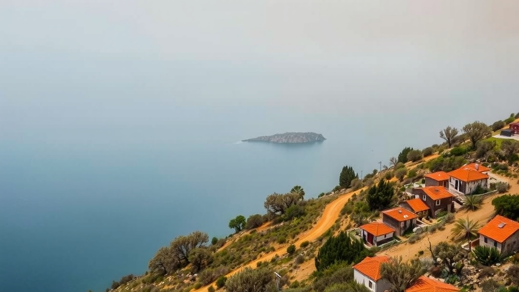
Sardinia, the second-largest island in the Mediterranean Basin, already battles roughly 2,900 wildfire ignitions every year, and a small fraction of those fires accounts for more than half of the land burned. Now, a new open-access study published in the journal Natural Hazards suggests that the decades ahead could transform the island’s fire regime in ways that fire managers are only beginning to grasp. By coupling high-resolution climate projections with sophisticated fire spread simulations, an international team of researchers has produced some of the most detailed spatial maps yet of how global warming will reshape wildfire danger and hazard across a fire-prone Mediterranean landscape.
The research, led by Michele Salis and Liliana Del Giudice of Italy’s National Research Council Institute of BioEconomy, together with colleagues from Spain, Iran and other institutions, focused on two time windows: a historical baseline from 1985 to 2014 and a near-future period from 2035 to 2064. The team drew on three state-of-the-art climate models from the Coupled Model Intercomparison Project Phase 6, known as CMIP6, namely ACCESS-ESM1-5, EC-EARTH3 and MPI-ESM1-2-HR, each run under three Shared Socioeconomic Pathways spanning low to very high greenhouse gas emissions. What sets this study apart is the resolution: the raw climate model output, which arrives at a coarse scale of tens of kilometers, was statistically downscaled to a grid of just one square kilometer using a two-step technique combining parametric quantile mapping with geostatistical regression, before feeding into fire danger calculations and fire spread modeling.
To quantify fire danger, the researchers applied the Canadian Forest Fire Weather Index System, the same harmonized method used across Europe by the European Forest Fire Information System since 2007. The FWI integrates daily maximum temperature, minimum relative humidity, wind speed and cumulative precipitation into a single rating of potential fire intensity, and it depends on three fuel moisture codes that track the dryness of fine fuels, duff and deep organic layers. The team also calculated the Daily Severity Rating, a metric that amplifies the influence of extreme FWI values and estimates how difficult a fire burning that day would be to suppress. Both indices were computed for every pixel of the island on every day of the two study periods, for each climate model and each emissions scenario.
The signal that emerged was consistent across all three models, though its magnitude varied. Under the historical baseline, days with very high FWI values were rare, concentrated almost entirely in the May-to-October fire season, when high and very high danger conditions already accounted for roughly 43 to 46 percent of days. By the 2035-2064 period, the picture shifts dramatically. Under the highest emissions scenario, SSP5-8.5, the EC-EARTH3 model projected that very high FWI days would more than double during the fire season, climbing from about 4.6 percent to 10.8 percent of days, while the ACCESS model showed a rise from 4.0 to 10.1 percent. Even the more conservative MPI model projected a near doubling, from 4.5 to 8.2 percent. The Daily Severity Rating told a parallel story, with very high severity days under EC-EARTH3 rising from 8.4 percent to 17.1 percent of fire-season days under the worst-case pathway.
Underlying these danger trends is a straightforward climatic mechanism. All models project warmer and drier conditions for Sardinia, with maximum temperature increases reaching up to about 3.3 degrees Celsius annually and 3.9 degrees during the fire season under high emissions. Precipitation declines across the board, particularly in western and central sectors of the island, and the number of rainy days drops markedly, especially during the hottest months, pointing to longer and more frequent dry spells that desiccate fuels. Intriguingly, the analysis of wind conditions on extreme danger days showed that the projected increase in very high fire weather comes mostly from more days with low and moderate winds rather than stronger winds, suggesting that rising temperatures and reduced rainfall, not windier conditions, will be the dominant drivers of intensifying fire risk.
But the study went a crucial step beyond danger indices. Weather alone does not make a wildfire; fires need ignitions, flammable fuels and terrain that allows spread. To capture those interactions, the team built a probabilistic fire simulation framework using the Minimum Travel Time algorithm, which computes the fastest possible paths of fire growth across a landscape and calculates spread rates with the Rothermel surface fire model, while crown fire initiation follows the Van Wagner approach. The researchers ran tens of thousands of simulated fire footprints, 50,000 under baseline conditions alone, at a fine 150-meter resolution, randomly drawing weather streams, wind directions and fire durations from frequency distributions derived for three weather zones covering northern, central and southern Sardinia. Ignition points were placed according to probability grids built from two decades of historical fire records, and fuel moisture inputs were anchored in field measurements collected on the island, including live fuel moisture values between 65 and 100 percent depending on vegetation type.
The hazard outputs are striking. Under historical conditions, the models simulated an average annual burned area of roughly 11,700 to 15,400 hectares, consistent with the observed mean of about 14,700 hectares per year, or 0.65 percent of the island’s surface. In the future simulations, that figure nearly doubles or more. Under EC-EARTH3 and SSP5-8.5, the average annual area burned jumps to approximately 33,590 hectares, a 250 percent increase over the baseline, while ACCESS projects more than 30,000 hectares per year under the two higher-emission scenarios. Crown fire area, a measure of the most intense and dangerous fire behavior in forests, rises from between roughly 730 and 1,060 hectares per year historically to as much as about 2,020 hectares per year under the worst-case combination of model and scenario.
Perhaps most important is where these changes unfold. Historically, burn probability hotspots have been concentrated in southern Sardinia, with annual burn probabilities exceeding 4 hectares per square kilometer in localized zones. The future projections show those hotspots expanding in both magnitude and extent, pushing into western and interior regions of the island. Under SSP5-8.5, much of the island shifts toward higher burn probability classes, with localized increases above 10 hectares per square kilometer in the main southern hotspot zones. Crown fire probability rises in parallel, with the most pronounced gains in southern and western Sardinia, where some areas reach values exceeding 8.5 hectares per square kilometer. This westward and inland expansion matters because those regions, including areas hit by major fires such as the Montiferru blaze of 2021, are already among the most fire-affected parts of the island, and inland zones lack the moderating influence of the sea that cushions coastal areas.
One of the study’s most thought-provoking findings is a caveat about what fire danger indices can and cannot tell us. Despite the systematic rise in FWI values, the simulated average flame length and average fire size did not increase consistently from the historical to the future period, partly because the extra extreme-danger days occurred disproportionately under low and moderate winds. The authors stress that extreme fire weather is necessary but not sufficient for large wildfires: a blaze must also start, escape initial suppression and find continuous fuels to spread across. Simply equating projected FWI maps with future fire risk, as some earlier studies have done, therefore overstates the certainty of the picture. Probabilistic spread modeling, which integrates weather, ignitions, fuels and landscape connectivity, provides a far more realistic estimate of where fire exposure will actually grow.
The researchers acknowledge limitations, notably that fuel layers and ignition patterns were held constant to isolate the climate signal, an assumption that could either understate or overstate future hazard depending on how land abandonment, fuel accumulation and fire activity themselves evolve. Still, the message for the Mediterranean is unambiguous. The authors argue that suppression-oriented strategies alone cannot cope with the projected intensification, and they call for proactive, integrated risk management: landscape-scale fuel treatments, grazing, prescribed burning, fire-resilient land-use mosaics and spatial planning that accounts for expanding fire-prone zones. As record seasons sweep southern Europe, with more than one million hectares burned across the EU in 2025 alone, Sardinia’s high-resolution glimpse of the future offers both a warning and a practical roadmap for landscapes on the front line of a warming world.
Subject of Research: Projected effects of climate change on wildfire danger and hazard in Sardinia, Italy
Article Title: Climate change will reshape future wildfire danger and hazard in Sardinia, Italy
Article References: Climate change will reshape future wildfire danger and hazard in Sardinia, Italy. (n.d.). https://doi.org/10.1007/s11069-026-08320-5
Image Credits: AI Generated
DOI: 10.1007/s11069-026-08320-5
Keywords: wildfire, climate change, Sardinia, Mediterranean Basin, Fire Weather Index, burn probability, fire spread modeling, CMIP6, SSP scenarios, crown fire, Daily Severity Rating, fire management
Cite Scienmag News
Sloane Callahan. (September 25, 2026). Sardinia’s Fire Future: Climate Change Set to Nearly Double Wildfire Danger on Mediterranean Island. Scienmag. https://scienmag.com/sardinias-fire-future-climate-change-set-to-nearly-double-wildfire-danger-on-mediterranean-island/
Sloane Callahan. "Sardinia’s Fire Future: Climate Change Set to Nearly Double Wildfire Danger on Mediterranean Island." Scienmag, 25 September 2026, https://scienmag.com/sardinias-fire-future-climate-change-set-to-nearly-double-wildfire-danger-on-mediterranean-island/. Accessed 25 September 2026.
Sloane Callahan. "Sardinia’s Fire Future: Climate Change Set to Nearly Double Wildfire Danger on Mediterranean Island." Scienmag. September 25, 2026. https://scienmag.com/sardinias-fire-future-climate-change-set-to-nearly-double-wildfire-danger-on-mediterranean-island/


