


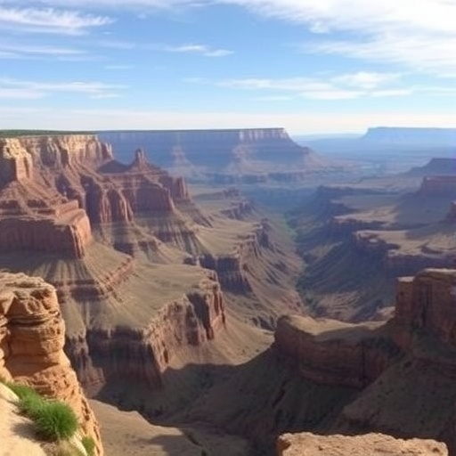
Scientists have uncovered evidence that a colossal cliff system once stretched across ancient North America, potentially exposing the deeply buried rocks at the heart of the Grand Canyon almost a billion years before the modern canyon was carved by the Colorado River. The proposed landscape, known as the Great Escarpment of Laurentia, may have extended for thousands of kilometres across what are now parts of the western and central United States. According to a new study led by researchers at the University of Southampton, the escarpment formed during the breakup of Rodinia, a supercontinent that began fragmenting approximately 800 million years ago. Its creation may have triggered a period of extraordinary erosion, removing vast quantities of rock and reshaping the geological architecture of the North American continent.
The discovery offers a possible explanation for one of the most enduring mysteries in the geology of the Grand Canyon: why such an immense interval of Earth’s history appears to be missing from its rock record. The canyon exposes layers spanning roughly two billion years, yet more than half of that geological record is absent in many locations. This dramatic gap is part of the Great Unconformity, a worldwide erosional boundary separating ancient crystalline basement rocks from much younger sedimentary formations. The new research proposes that the basement exposed in the Grand Canyon was not simply revealed by the relatively recent action of the Colorado River. Instead, it may have been progressively exhumed as an ancient escarpment retreated inland over tens of millions of years.
An escarpment is a long, steep slope or cliff that separates areas of different elevation. Modern examples include the Great Escarpment of southern Africa and similar high-relief margins in Brazil, India and Antarctica. These features commonly develop along the edges of continents when tectonic forces stretch and fracture the crust. As continental blocks begin to separate, the crust near the new margin can rise, creating high ground adjacent to steep slopes. The resulting topography generates powerful gravitational and climatic gradients: rivers descend rapidly, weathering intensifies, and glaciers or seasonal runoff can remove enormous volumes of material. The Southampton-led team argues that a comparable process occurred along the western edge of Laurentia, the ancient continental core that later became much of North America.
The formation of the Laurentian escarpment was linked to Rodinia’s disassembly. When a supercontinent begins to break apart, hot material from Earth’s mantle can rise beneath the crust, causing regional uplift. Faulting then divides the crust into blocks, while newly forming rifts and continental margins produce steep changes in elevation. In western Laurentia, this combination of tectonic uplift and rifting may have created kilometre-high cliffs and a broad mountainous rim. The highlands would have supplied rivers with steep gradients and abundant energy, allowing them to cut downward and carry sediment away from the continental interior. Over time, erosion would have shifted the escarpment inland, stripping away layers that had accumulated above the deeply ancient basement.
To reconstruct this vanished landscape, the researchers combined plate-tectonic reconstructions with models of landscape evolution. Plate reconstructions provide estimates of how continents were positioned hundreds of millions of years ago, before later movements altered their configuration. Landscape-evolution models simulate how rock is removed by rivers, glaciers and other processes in response to uplift and changing topography. By comparing the predicted position of the ancient continental margin with the distribution of basement rocks and evidence for large-scale erosion, the researchers found that the Grand Canyon region occupied a position comparable to that of several modern continental escarpments. The model suggests that erosion may have removed as much as eight kilometres of rock in some areas, a staggering amount that would have required a long-lived tectonic landscape rather than a brief episode of surface wear.
This interpretation is consistent with geological evidence indicating that the southwestern United States experienced five to ten kilometres of erosion long before the modern canyon appeared. Ancient minerals and sedimentary remnants preserve clues about the rocks that once covered the region, while the ages and compositions of exposed basement rocks reveal how deeply buried material reached the surface. The process is known as exhumation, meaning the gradual uncovering of rocks that formed deep within Earth’s crust. Exhumation can occur when tectonic uplift raises buried rocks and erosion removes the overlying material. In the Grand Canyon area, the proposed escarpment would have acted as a vast natural engine for exhumation, bringing ancient crystalline rocks into view long before the Colorado River began cutting the canyon’s present course.
The study also helps explain why the Great Unconformity is not uniform across the southwestern United States. In some places, the boundary represents the removal of enormous thicknesses of rock, while nearby areas preserve a more complete geological sequence. A single continent-wide event cannot easily account for this variation. The researchers argue that the geometry and persistence of the Laurentian escarpment could provide the missing explanation. Areas closest to the uplifted rim would have experienced steep slopes, vigorous stream erosion and possibly glacial stripping, whereas regions farther inland or protected by different crustal structures would have undergone less severe denudation. In this view, the Great Unconformity records not one simple moment of erosion, but the uneven response of a continent to tectonic breakup and the development of a massive topographic boundary.
The consequences of the escarpment may have extended far beyond the rocks now visible in Arizona. A mountainous rim around western Laurentia could have reorganised drainage networks, determining the direction in which rivers transported sediment and the basins where that sediment accumulated. It may also have influenced how and when marine waters entered the continent as sea levels rose. These changes occurred before the Cambrian explosion, the interval beginning around 539 million years ago when complex animal life diversified rapidly in the fossil record. The delivery of nutrients and sediment into shallow seas, along with the creation and destruction of coastal environments, can influence marine ecosystems over geological timescales. Although the new study does not claim that the escarpment directly caused the Cambrian explosion, it identifies a major landscape feature that may have affected the physical settings in which early complex life evolved.
The researchers say that comparing the ancient Grand Canyon landscape with active escarpments elsewhere on Earth provides a new way to understand how continental interiors change. Modern escarpments are not static walls; they migrate through time as erosion lowers their slopes and rivers carry material toward the ocean. Their long-term evolution reflects a balance between tectonic uplift, rock resistance, climate, drainage and glacial activity. The proposed Great Escarpment of Laurentia may have followed the same pattern, retreating inland while exposing progressively older rocks. This framework could also be applied to other regions where vast gaps in the rock record have been attributed to poorly understood episodes of erosion. By linking the Great Unconformity to the rise and retreat of a continental-scale escarpment, the study presents the Grand Canyon not merely as a river-carved gorge, but as the surviving expression of a far older tectonic landscape.
The findings, published in the journal Geology, suggest that the Colorado River may have carved the final dramatic canyon into terrain whose essential geological preparation had already occurred hundreds of millions of years earlier. The river’s incision remains central to the formation of the modern Grand Canyon, but the new research places that process within a much longer history of continental breakup, uplift, exhumation and erosion. The ancient cliff system disappeared as a recognisable landform, yet its effects remain recorded in the exposed basement rocks, missing strata and sediment pathways of North America. Understanding that hidden history could help geologists reinterpret other ancient landscapes where erosion has erased more evidence than it preserved, revealing how the forces that break continents apart can also bring their deepest rocks to the surface.
News Publication Date: 19-Aug-2026
Web References: https://doi.org/10.1130/G55133.1
References: Geology, DOI: 10.1130/G55133.1
Cite Scienmag News
Russell Cooper. (August 19, 2026). Ancient U.S. mega-escarpment may explain the Grand Canyon’s missing billion years. Scienmag. https://scienmag.com/ancient-u-s-mega-escarpment-may-explain-the-grand-canyons-missing-billion-years/
Russell Cooper. "Ancient U.S. mega-escarpment may explain the Grand Canyon’s missing billion years." Scienmag, 19 August 2026, https://scienmag.com/ancient-u-s-mega-escarpment-may-explain-the-grand-canyons-missing-billion-years/. Accessed 3 September 2026.
Russell Cooper. "Ancient U.S. mega-escarpment may explain the Grand Canyon’s missing billion years." Scienmag. August 19, 2026. https://scienmag.com/ancient-u-s-mega-escarpment-may-explain-the-grand-canyons-missing-billion-years/


