


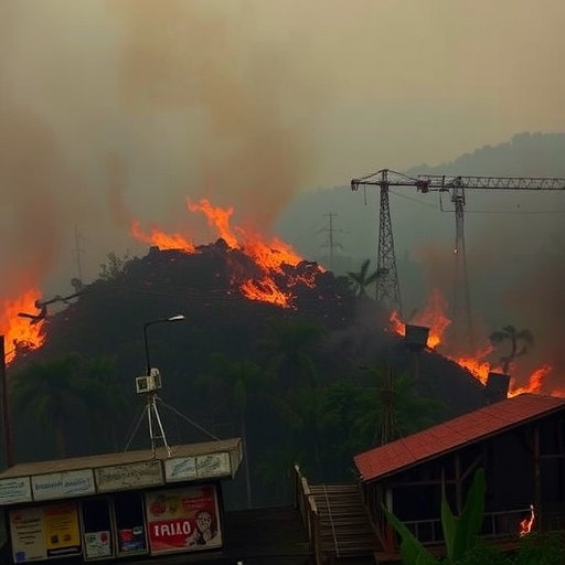
Wildfires in equatorial Southeast Asia can start small and rapidly evolve into region-wide disasters—but scientists have now mapped how that transformation happens. Focusing on the devastating 2015 fires, researchers traced the earliest detectable fire origins using satellite observations to better understand which ignition areas eventually grew into the largest events.
The study, published in Environmental Research Letters, responds to a key knowledge gap: even when fires burn millions of hectares, the earliest “where” and “why” behind their expansion are often poorly resolved. By reconstructing fire development across the region, the team estimated roughly 74,500–75,000 origin points organized into nearly 15,000 interconnected fire networks.
A central discovery is that large fires frequently do not have a single birthplace. Instead, about 84% of the analyzed fire networks contained multiple origin points, implying that many of the biggest catastrophes formed when several independent ignitions expanded and later merged into larger systems.
To reveal these patterns, the researchers applied network analysis to satellite-derived fire data, treating each ignition and its subsequent spread as links within a broader system. This framework allowed them to connect spatial wildfire behavior with environmental and human influences rather than relying on simplistic assumptions about single-source fires.
When the team examined drivers associated with ignition, natural landscape conditions and atmospheric dryness emerged as the strongest predictors of where fires began. The findings extend the idea that human activity is important, while also showing that ecological and climatic settings help determine which ignition opportunities become major outbreaks.
Lead author Adrian Dwiputra emphasizes that wildfire risk is “dynamic,” not only complex. In the study’s decomposition of fire behavior, human-linked signals were relatively stronger at origin points, whereas natural-linked signals became more influential during spread.
Coauthor Ping Yowargana highlights the climate relevance: atmospheric dryness is expected to increase with climate change. That shift could alter assumptions about tropical forest resilience to disturbances, especially if drier conditions limit recovery after ignitions.
The authors also report actionable implications for prevention. Because many large fires originate across multiple hotspots before merging, reducing expansion in high-origin-likelihood areas could lower the probability of future catastrophic wildfire networks.
For people managing fire-prone landscapes—alongside policymakers and modelers aiming to forecast fire risk and ecological impacts—this work provides a sharper map of ignition vulnerability across tropical terrain.
Cite Scienmag News
Violet Maxwell. (July 17, 2026). Uncovering Causes Behind Southeast Asia’s Catastrophic Wildfires. Scienmag. https://scienmag.com/uncovering-causes-behind-southeast-asias-catastrophic-wildfires/
Violet Maxwell. "Uncovering Causes Behind Southeast Asia’s Catastrophic Wildfires." Scienmag, 17 July 2026, https://scienmag.com/uncovering-causes-behind-southeast-asias-catastrophic-wildfires/. Accessed 3 September 2026.
Violet Maxwell. "Uncovering Causes Behind Southeast Asia’s Catastrophic Wildfires." Scienmag. July 17, 2026. https://scienmag.com/uncovering-causes-behind-southeast-asias-catastrophic-wildfires/


