


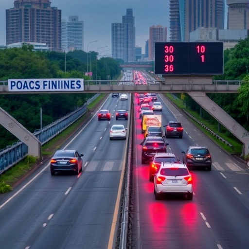
For five years, motorists traveling the Shah Alam Expressway in Malaysia have been crashing at the same handful of locations, and a new study has revealed that the type of vehicle involved is the single greatest factor determining whether those crashes leave behind only twisted metal or a grieving family. Researchers at Universiti Teknologi MARA applied an arsenal of advanced statistical and geospatial tools to 2,823 accidents that occurred along the 34.5-kilometre corridor between Pandamaran and Sri Petaling from 2013 to 2017, producing one of the most detailed portraits yet assembled of how space, time, and vehicle physics conspire to turn an ordinary highway into a recurring tragedy. Their work, published in The Open Transportation Journal, merges spatial hotspot detection with ordinal logistic regression to cut through the fog of aggregate statistics and deliver a blunt message: generic road safety campaigns will accomplish little unless they are aimed at the handful of black spots and vehicle classes that generate a wildly disproportionate share of the human toll.
The analytical backbone of the study rests on spatiotemporal modeling, a technique that refuses to treat “where” and “when” as separate questions. In conventional traffic research, it is common to either map accident coordinates to find geographic clusters or to chart monthly totals to expose seasonal trends, but such slicing artificially breaks phenomena that are intrinsically fused. A collision is not just a point on a map; it is an event whose likelihood and severity are molded by the rush-hour congestion at that exact interchange, by the angle of the setting sun at that particular longitude and hour, and by the mixture of vehicles streaming out of a toll plaza at a specific moment. Spatiotemporal analysis stitches these dimensions together, often by dividing the study region into grid cells or road segments and attaching a time stamp to each incident, then looking for cells where the count of accidents exceeds what chance alone would predict, and tracking how those hot cells migrate, pulse, or remain stubbornly fixed as the calendar advances. The research team applied this logic through a combination of kernel density estimation to visualize accident intensity on the road network, global Moran’s I testing to confirm that the overall pattern was not random, and local indicators of spatial association, notably the Getis-Ord Gi* statistic, to pinpoint exactly which road segments were the worst offenders. The resulting z-score of 3.086 with a p-value of 0.002 confirmed beyond reasonable doubt that the clustering was real and that it operated at small spatial scales, on the order of a few hundred meters of pavement, rather than evenly dispersed across the entire expressway.
What emerged from this mapping exercise was a set of three persistent accident black spots that reappeared across all five years like a stubborn stain. The segment from kilometre 40.5 to 40.9, for reasons that the geometry of its toll plaza and interchange layout begins to explain, stood out in both eastbound and westbound directions. Eastbound traffic also suffered concentrated mayhem at the short windows of KM27.0 to 27.4 and KM47.5 to 47.9, while westbound drivers repeatedly collided at KM49.0 to 49.4. Some of these segments logged up to 32 crashes in a single year, an extraordinarily dense figure for stretches of road that measure less than half a kilometre. When the researchers cross-referenced these coordinates with the physical layout of the expressway, the correlation with toll plazas and major interchanges was unmistakable. Toll areas force vehicles to decelerate, change lanes, merge, and then accelerate again, all within a compressed distance while drivers divert attention to payment transactions, lane selection, and signage. Interchanges introduce weaving sections where entering and exiting flows cross paths at divergent speeds. The combination of these cognitive and physical loads appears to push drivers past a threshold where minor mistakes metastasize into collisions, and the data argue that the threshold is both spatially localized and temporally stable.
Even as the spatial pattern remained stubborn, the overall volume of accidents oscillated in a way that hints at the limits of past interventions. The single-year peak of 728 accidents in 2013 was followed by a roughly 30 percent decline across 2014 and 2015, a drop that might initially suggest that safety countermeasures or public awareness campaigns were succeeding. Yet the numbers rebounded above 500 per year in 2016 and 2017, erasing much of the earlier gain. This sawtooth trajectory warns against celebrating short-term statistical noise; it implies that the underlying risk structure on the expressway was never dismantled, only temporarily suppressed, perhaps by a transient mix of enforcement blitzes, economic shifts affecting traffic volume, or weather patterns. The fact that the black spots themselves never moved suggests that the fundamental driver of accident frequency is not a fluctuating variable like driver mood or annual rainfall but something physically baked into the road environment at those specific chainages. If authorities are to break this cycle, the study implies, they must reshape the asphalt, signage, and traffic flow logic at these few sites, not rely on citywide slogans or generalized speed-limit postings.
While spatial analysis explained where and when crashes occur, the question of why some crashes kill while most merely dent fenders demanded a completely different statistical tool: ordinal logistic regression. This method is designed for outcome variables that fall into ordered categories, in this case a severity ladder ranging from property-damage-only (the baseline), through minor injury and severe injury, up to fatal. The model estimates the odds of a crash escalating to the next severity rung given a set of predictor variables. The researchers tested four such predictors—vehicle type, weather, attributed crash cause, and time of day—across each study year individually, which allowed them to see whether the importance of these factors shifted over time. The approach is particularly valuable in road safety research because it avoids collapsing severity into a crude binary like “fatal or not” and thus preserves statistical power to detect influences that push the distribution toward more serious but non-fatal injury. When applied to the Shah Alam Expressway data, the regression models returned an unambiguous verdict: the type of vehicle involved in a crash swamps all other measured variables in its ability to forecast how severe that crash will be.
In 2013, the model produced an odds ratio greater than 20 for motorcyclists when compared to the reference category of other vehicle types. An odds ratio of that magnitude is rarely encountered in observational safety studies and signals that a motorcyclist involved in a collision on this expressway was, in that year, more than twenty times as likely to sustain a serious or fatal injury than an occupant of a car, van, or bus. The physics behind this number is unforgiving: a motorcycle offers zero structural protection, leaving the rider’s body to absorb kinetic energy directly, and on a high-speed expressway where differential velocities between motorcycles and heavy vehicles can be large, even a glancing blow can transfer lethal force. By 2014 and 2015 the statistical spotlight shifted to heavy lorries with three or more axles, which emerged as the strongest predictor of severe outcomes. These vehicles, fully laden, can weigh forty times more than a passenger car, and when their enormous momentum is involved in a collision, the result is often catastrophic for everyone in the lighter vehicle regardless of seatbelts, airbags, or crumple zones. What the regression picks up here is not that lorry drivers crash more often, but that when they do, the damage tends to radiate far beyond the truck itself, elevating the severity of the entire event.
By 2017, the ordinal logistic regression revealed an even more alarming pattern: nearly every vehicle category—cars, motorcycles, and heavy lorries alike—was significantly associated with higher injury severity relative to the baseline. This broadening of risk suggests that the safety environment on the expressway deteriorated in a comprehensive way that year, perhaps through higher average speeds, degraded road surfaces, increased traffic density, or a mix of all three. It also underscores that focusing exclusively on the most extreme vehicle types, while essential, is insufficient; passenger cars, which represent the bulk of traffic, cannot be ignored as a vector of serious injury when the system is under strain. Throughout all five years, weather conditions, the official attributed cause of the crash (such as “speeding” or “reckless driving”), and the time of day failed to show a consistent, statistically significant influence on severity. This does not mean that rain or darkness are irrelevant to accident causation, but it strongly suggests that once a crash is set in motion on this particular corridor, the physical variables of mass and velocity override the circumstances that triggered it. In other words, the type of metal, plastic, and human vulnerability involved at the moment of impact is what writes the medical and coroner reports.
An important nuance embedded in the modeling is the concept of proportional odds, which is the assumption that the relationship between each predictor and the outcome is the same across all severity thresholds. The researchers tested this assumption and found it held reasonably well, which means that a factor like heavy vehicle involvement does not merely separate fatal crashes from all others; it systematically pushes the outcome distribution from property damage toward minor injury, from minor to severe, and from severe to fatal in a consistent stepwise fashion. That mathematical property gives the results an elegant interpretability: when the model says heavy lorries elevate severity, it means they do so across the whole spectrum of harm, not just in the most extreme cases reported on the nightly news. This makes the findings actionable for policymakers who need to weigh the costs and benefits of interventions that might reduce not only the death count but also the crushing load of permanent disability and hospitalization that serious crashes impose on Malaysia’s healthcare system.
For a science magazine audience, the deeper message of this study lies in its demonstration that road safety is not simply a problem of reckless individuals but an emergent property of a physical system that can be measured, modeled, and ultimately re-engineered. The spatial clustering of accidents around plazas and interchanges is a signal that the road geometry and traffic control devices are placing demands on drivers that exceed the cognitive processing power of a tired or distracted human brain. Spatiotemporal analysis, with its z-scores and kernel density maps, functions as a diagnostic tool akin to an MRI, revealing the hidden structural lesions that cause symptoms years before they produce a catastrophic failure. The ordinal logistic regression, in turn, acts as a blood test that isolates the critical biomarkers—in this case, vehicle type—that predict the severity of the outcome once a failure occurs. Together, these methods shift the conversation from moralizing about “accidents” to scientifically investigating systematic risks, an intellectual move that has been the foundation of public health victories over cholera, workplace injuries, and aviation disasters.
Extending this epidemiological analogy, the fixed black spots on the Shah Alam Expressway behave very much like contaminated water pumps in a city suffering a recurrent outbreak. Just as an epidemiologist maps cholera cases to identify the pump handle that must be removed, the spatial analysis here identifies exact kilometre segments where the handle—be it a poorly designed merge, a confusing sign sequence, or a toll plaza that forces abrupt lane changes—needs to be replaced. The fact that these spots persisted for five years indicates that the system has been in a kind of stable endemic state, where the same hazardous conditions reproduce the same clusters of crashes annually. Breaking that stability demands not broad-spectrum antibiotics like a new speed limit sign posted at random, but site-specific surgery: re-grading the geometry, installing automated enforcement tailored to the precise conflict patterns, separating streams of traffic with physical barriers, and redesigning toll plazas to minimize decision points.
The study also raises provocative questions about vehicle mix policy that go well beyond Malaysia. The repeated finding that heavy lorries dominate severity in some years while motorcycles dominate in others points to the value of dynamic safety management, where the mix of allowed vehicles, their speed governors, and their dedicated lanes might be adjusted not just by static regulation but by time-of-day or day-of-week according to traffic density. Imagine an expressway where, during the morning peak when the density of small motorcycles is highest, an adaptive lane-use system converts a shoulder into a motorcycle-exclusive corridor with a reduced speed differential relative to adjacent traffic, and where heavy lorries are restricted to the leftmost lane and electronically limited to lower speeds. The technology for such active management already exists in congestion-pricing and lane-control systems on highways from Los Angeles to Singapore; applying it explicitly to mitigate severity risk factors would be a logical next step that this research implicitly endorses.
Another fascinating implication concerns the negligible role of weather. Conventional wisdom often attributes serious crashes to rain-slicked roads or blinding glare, and police reports routinely cite “wet road” as a contributing factor. Yet this study joins a growing body of literature finding that adverse weather, while increasing the frequency of minor collisions and single-vehicle run-offs, does not consistently elevate severity once a collision occurs on high-speed divided highways. The likely explanation is that heavy rain triggers a compensatory behavior—drivers slow down, increase following distances, and become hyper-vigilant—that dampens impact speeds just enough to offset the reduced friction. On a dry, clear day, by contrast, drivers may operate at the limits of the road geometry, with low margins for error, so when a crash does happen, the energy dissipation is maximal and the vehicle type, stripped of any moderating influence, fully expresses its destructive potential. This counterintuitive finding is a stark reminder that the conditions drivers fear are not always the conditions that kill them.
Looking ahead, the researchers advocate for a data-driven cycle of continuous monitoring, intervention, and re-evaluation that would make the Shah Alam Expressway a living laboratory for evidence-based road safety. They call for site-specific engineering upgrades at the identified black spots, including safer merge designs, clearer advance warning signage, and traffic flow systems that reduce the turbulence created when vehicles transition between highway speeds and toll plaza queuing. They also call for vehicle-specific policies: dedicated motorcycle lanes that provide physical separation, tighter enforcement of load and speed regulations for multi-axle heavy vehicles, and graduated licensing or access restrictions for vehicle categories that repeatedly appear in severe crashes. By treating the expressway as an integrated socio-technical system rather than a strip of asphalt that must accommodate all comers on equal terms, Malaysia could join the ranks of nations that have driven down road deaths dramatically through scientific precision rather than blunt instrument.
The statistical methods deployed in this study, while sophisticated, are entirely replicable in any jurisdiction that collects geographically coded accident data and maintains a database of road geometry. The spatial clustering routine, whether executed through ArcGIS, QGIS, or custom R scripts, requires only accident coordinates and a network layer, while the ordinal logistic regression can be run in any standard statistical package such as SPSS or Stata. The fact that a relatively small dataset of fewer than three thousand accidents spread over five years could yield such clear and actionable patterns should embolden transportation agencies in low- and middle-income countries, where road trauma is a leading cause of death, to invest in the digitization and analysis of their own accident records rather than waiting to adapt recommendations from studies conducted in highly dissimilar driving environments. A homegrown spatiotemporal map, even if coarser than the one created for Shah Alam, would likely reveal black spots that local engineers have always suspected but never quantified.
Ultimately, the Shah Alam Expressway study illustrates a principle that applies far beyond Malaysian toll roads: in a world where traffic crashes kill over 1.3 million people annually and injure tens of millions more, the greatest enemy of effective safety policy is the comfortable belief that accidents are evenly distributed acts of fate that can be addressed by generic pleas to “drive safely.” The data shout a different story. Crashes cluster like crystals on specific, identifiable stretches of road where geometry, speed, and human factors collide in an almost deterministic fashion. And when those crashes occur, the severity is written in the mass and structure of the vehicles involved, not in the clouds overhead or the hour on the clock. Until road authorities fully internalize this evidence and commit to precision-targeted, vehicle-specific interventions, the same black spots will continue to harvest the same broken bodies year after year, their coordinates an indictment of a system that too often chooses complacency over cure.
Keywords
Road traffic accidents, spatiotemporal analysis, black spots, injury severity, ordinal logistic regression, heavy vehicles, motorcycles, toll plaza, expressway safety, Malaysia
Cite Scienmag News
Grant Pearson. (July 6, 2026). Vehicle type determines fatality at Shah Alam expressway black spots. Scienmag. https://scienmag.com/vehicle-type-determines-fatality-at-shah-alam-expressway-black-spots/
Grant Pearson. "Vehicle type determines fatality at Shah Alam expressway black spots." Scienmag, 6 July 2026, https://scienmag.com/vehicle-type-determines-fatality-at-shah-alam-expressway-black-spots/. Accessed 3 September 2026.
Grant Pearson. "Vehicle type determines fatality at Shah Alam expressway black spots." Scienmag. July 6, 2026. https://scienmag.com/vehicle-type-determines-fatality-at-shah-alam-expressway-black-spots/


