In the evolving landscape of urban mobility, cycling has emerged as a vital mode of transportation, promoting health, sustainability, and convenience. Yet, for many urban cyclists, navigating through city streets to find an optimal route remains a daunting challenge. Enter BikeButler, an innovative web application developed by researchers at the University of Washington that redefines personalized bike routing. This tool transcends traditional map-based navigation apps by seamlessly integrating rich open data with advanced visual language models to curate bike routes finely tuned to individual preferences and contextual needs.
Jared Hwang, a doctoral student at the Paul G. Allen School of Computer Science & Engineering, was inspired to develop BikeButler after encountering persistent difficulties in finding satisfactory bike routes from his Capitol Hill neighborhood to the University of Washington. Despite the availability of mainstream mapping solutions like Google Maps and Strava, these platforms often prioritized bike lanes without adequately considering aspects like terrain elevation, traffic speed, greenery, or road surface quality. Realizing a gap in existing technologies, Hwang sought to harness accessible data to create more nuanced and user-centered route suggestions.
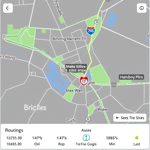
BikeButler operates by allowing cyclists to input their origin and destination points, similar to conventional mapping applications. However, its true innovation lies in its adjustable slider interface, enabling users to emphasize or de-emphasize up to eight route attributes. These attributes encompass elements such as speed limits, greenery, traffic volume, bike lane presence, and pavement quality, providing a rich palette for crafting a tailor-made cycling experience. By manipulating these sliders, riders can generate various route options that align with their immediate preferences, whether seeking a leisurely, scenic ride or a quick commute through quieter streets.
Underneath this user-friendly interface lies a sophisticated computational framework grounded in open-source and governmental data sources. The foundational map data is derived primarily from OpenStreetMap, ensuring broad coverage of Seattle’s street layout and fundamental traffic information. Nonetheless, subjective route qualities like greenery levels and pavement conditions remain poorly cataloged in existing datasets. To bridge this gap, the research team ingeniously turned to Google Street View imagery, using a cutting-edge visual language model (VLM) — a form of artificial intelligence specialized in interpreting visual data through natural language processing techniques.
The VLM was tasked with analyzing thousands of panoramic street images to assess street segments against subjective criteria, such as the extent of tree coverage and the quality of road surfaces. This AI-driven approach not only automates what would otherwise be an immense manual annotation effort but also introduces a novel methodology to evaluate urban environments with human-like interpretation. To validate the model’s accuracy, its ratings were compared with assessments from human researchers, revealing a concordance rate of approximately 60%. While this level indicates room for refinement, it also underscores the promising potential of AI to complement human judgment in urban data analytics.
After establishing comprehensive spatial and attribute databases, the team tested BikeButler with sixteen participants to evaluate its real-world applicability. Feedback gathered during these trials underscored that cyclists often possess situational preferences which fluctuate depending on context. For instance, riders undertaking a relaxed weekend excursion might prioritize safety and greenery, while weekday commuters seek efficiency and minimal route complexity. Such insights affirm that dynamic, context-sensitive routing solutions represent a crucial advancement in cycling navigation, addressing the diverse and evolving needs of urban cyclists.
Though BikeButler currently operates exclusively within the Seattle metropolitan region, its underlying framework is inherently scalable. Integrating additional geographic datasets and refining VLM training to accommodate other cities could enable widespread adoption. Yet, the system’s effectiveness remains contingent upon the quality and recency of source data. As city infrastructure evolves with new bike lanes or roadway modifications, delays in updating map sources and street imagery could temporarily impact route recommendation accuracy, a limitation acknowledged by the development team.
Looking forward, the BikeButler team envisions several pragmatic enhancements to elevate user engagement and route customization. Plans include enabling users to manually drag and adjust routes to capture subjective preferences not fully encapsulated by current data metrics, as well as incorporating options to minimize turns—a factor known to influence travel time and rider comfort. Further research will also seek to better quantify preferences related to intersections, turns, and overall route complexity, a recognition of the nuanced decision-making processes cyclists employ.
From a broader perspective, BikeButler symbolizes a transformative shift toward personalization within urban mobility technologies. Jon Froehlich, a senior professor at the Allen School and co-author of the research, emphasizes the significance of delivering individualized route choices that adapt to user contexts, whether biking with children or running errands. This approach holds promise for encouraging more people to adopt cycling by reducing barriers and insecurities associated with current routing tools.
The project’s methodology and outcomes were presented in April 2026 at the Association for Computing Machinery Conference on Human Factors in Computing Systems (CHI) in Barcelona, marking a significant milestone in human-computer interaction research in environmental and transportation domains. The interdisciplinary team responsible for BikeButler consists of computer scientists, urban planners, and student collaborators, reflecting the multifaceted challenge of urban cycling navigation and the necessity for cross-domain expertise.
Municipal planners and technology designers stand to benefit from this innovation, which integrates AI-driven image interpretation with open geographic data, revealing new possibilities for enhancing urban livability. By harnessing the rapidly expanding availability of geospatial and visual datasets, tools like BikeButler can offer more granular and empathetic insights into urban infrastructure usability, potentially influencing policy decisions and infrastructure investments.
Overall, BikeButler’s development underscores the vital role of contextual understanding and personalization in the design of transportation systems. As data-driven and artificial intelligence techniques continue to mature, they will increasingly enable the creation of urban experiences that are not only efficient but also environmentally enriching and emotionally satisfying. For cyclists navigating complex metropolitan environments, such tools represent a future where every journey is thoughtfully shaped by individual needs, fostering a more accessible, enjoyable, and sustainable urban cycling culture.
Subject of Research: Personalized bike routing using open data and AI-based street image analysis
Article Title: BikeButler: A Personalized, Context-sensitive Bike Routing Tool using Open Data and VLM-based Analyses of Street View Imagery
News Publication Date: 13-Apr-2026
Web References:
– https://bikebutler.cs.washington.edu/
– https://dl.acm.org/doi/10.1145/3772318.3791292
References: Presented at ACM CHI 2026 Conference on Human Factors in Computing Systems
Image Credits: Hwang et al./CHI 2026
Keywords
Personalized bike routing, urban cycling, open data, visual language models, Google Street View analysis, artificial intelligence, human-computer interaction, contextual navigation, smart cities, Seattle bike routes
