


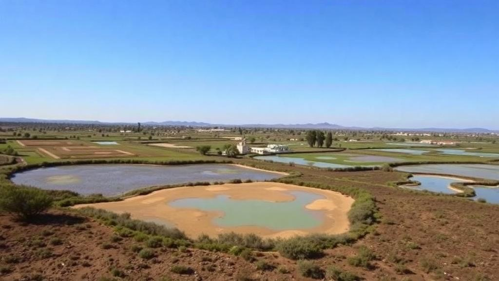
In the flat cereal plains of Zamora, in northwestern Spain, a chain of shallow saline lakes known as the Villafáfila wetlands sustains one of Europe’s most remarkable gatherings of steppe birds, including thousands of great bustards, while surrounding farmland produces some of the country’s most valued crops. A new study published in Environmental Management asks a deceptively simple question about this agricultural–wetland mosaic: which places deliver the most benefits to people, and do the people who live there see the landscape the same way scientists measure it? The answer, according to an interdisciplinary team led by Minerva Cordoves-Sánchez of the Universidad de La Frontera in Chile and the Universidad de Valladolid in Spain, is that the two perspectives overlap in important ways but diverge in others, and those divergences carry real consequences for how rural landscapes should be governed.
The research tackles a long-standing problem in ecosystem service science. Landscapes are increasingly managed not for single outputs but for multifunctionality, the capacity of an area to simultaneously supply provisioning services such as food and water, regulating services such as water purification and climate moderation, cultural services such as recreation and identity, and supporting services such as habitat maintenance and nutrient cycling. Yet most assessments of multifunctionality rely exclusively on expert-derived biophysical indicators, leaving out the people who actually inhabit, work, and value these places. The Villafáfila study was designed to close that gap by combining hard ecological measurement with stakeholder-based participatory mapping and an explicit analysis of how local actors perceive environmental risk.
Methodologically, the framework is built around the Multiple Ecosystem Services Landscape Index, or MESLI, a composite metric originally developed to quantify how many different services a landscape supplies at meaningful levels. The researchers applied this index to 32 municipalities surrounding the Villafáfila wetland, treating each municipality as a spatial unit of analysis. For each unit, they estimated biophysical indicators of ecosystem service supply alongside perceived supply and demand derived from stakeholder mapping exercises. They then computed diversity metrics to capture how evenly services were distributed within each municipality, and used similarity analysis to group municipalities according to their service profiles. This combination allowed the team to identify synergies, where multiple services rise together, and trade-offs, where enhancing one service comes at the expense of another.
The spatially explicit results reveal a clear gradient. Municipalities closest to the wetland exhibit significantly higher multifunctionality than more distant ones, forming recognizable hotspots where the density and diversity of ecosystem services peak. Crucially, the drivers of this elevated multifunctionality are not the provisioning services that dominate conventional agricultural assessments. Instead, cultural and supporting services, often overlooked in expert-based frameworks, emerge as the engines of multifunctionality in the wetland-proximate zone. The lakes and their surrounding grasslands supply aesthetic, recreational, and identity-related benefits, alongside the habitat functions that sustain the area’s celebrated bird populations, and these contributions push the nearby municipalities to the top of the multifunctionality ranking.
Perhaps the most striking finding concerns risk perception. The researchers found a strong correlation between landscape multifunctionality and the degree to which local stakeholders perceive socio-environmental risks. In other words, the places that people value most highly, and that deliver the widest array of benefits, are also the places where communities are most acutely aware of vulnerability. The risks identified in the study area include rural depopulation, biodiversity loss, and agricultural intensification, three pressures that interact in ways that can erode the very services that make the landscape valuable. Depopulation hollows out the labor and stewardship needed to maintain traditional farming practices; intensification simplifies the agroecosystem and degrades habitat; and biodiversity loss undermines both the ecological and the cultural foundations of the wetland system.
This correlation between value and vulnerability reframes the relationship between people and landscape. Rather than treating risk perception as a subjective overlay to be corrected by scientific data, the study treats it as a diagnostic signal. Communities that perceive risk in a highly multifunctional landscape are, in effect, registering their dependence on it and their sensitivity to its degradation. The authors argue, drawing on sociological theories of risk, that perceived risk is socially constructed but grounded in material reality: the physical environment shapes sense of place, and threats to that environment are experienced as threats to livelihood, identity, and well-being. Integrating this perceptual dimension into ecosystem service assessments therefore does not dilute scientific rigor; it enriches it by revealing where ecological and social priorities align or collide.
The comparison between biophysical and perceived multifunctionality also exposes mismatches between supply and demand. By mapping both, the framework visualizes where a municipality may biophysically supply a service that local stakeholders do not perceive or value, and conversely where demand for a service exceeds what the landscape can deliver. Such spatial mismatches are precisely the information that landscape planners need. A policy that targets conservation funding at biophysical hotspots alone might miss municipalities where perceived demand is high but supply is lagging, while a policy driven purely by stakeholder preference might overlook ecologically critical areas that residents take for granted. The study’s similarity analysis, which clusters municipalities by their combined service profiles, offers a way to design interventions at the scale of coherent landscape units rather than administrative boundaries drawn for other purposes.
From a practical standpoint, the authors emphasize that their methodology is rapid, cost-effective, and transferable. Participatory mapping exercises can be organized with modest resources, and the analytical pipeline, implemented in standard statistical environments, relies on publicly available geospatial data combined with stakeholder input. This makes the approach replicable in other rural and agricultural–wetland systems, from Mediterranean dehesas to deltaic farmland in Asia, where similar tensions between production, conservation, and community well-being play out. The framework’s outputs, including hotspot maps, supply–demand balance sheets, and risk perception overlays, are designed to feed directly into adaptive management and spatial planning processes, giving decision-makers a shared evidence base that incorporates both ecological performance and social relevance.
The broader significance of the work lies in its contribution to interdisciplinary landscape governance. Ecosystem service science has matured considerably over the past two decades, but critics have noted that biophysically informed valuation and sociocultural valuation still run on parallel tracks, rarely integrated in a single assessment. The Villafáfila study demonstrates a concrete template for bridging that gap. By treating stakeholder perceptions as data of equal standing with biophysical indicators, and by adding risk perception as a third analytical lens, the researchers show how a landscape can be understood simultaneously as an ecological system, an economic asset, and a lived social space. This tripartite view is essential in human-shaped landscapes, where the line between natural and managed systems is blurred and where the sustainability of ecosystem services depends on the continued engagement of rural communities.
For the Villafáfila wetlands themselves, the findings carry immediate implications. The identification of wetland-proximate municipalities as multifunctionality hotspots strengthens the case for conservation-oriented and adaptive management in and around the protected area, while the risk perception results signal that local communities are ready interlocutors who already grasp the stakes. As rural Spain confronts depopulation and agricultural restructuring, tools like this one offer a way to align policy with both ecological reality and human values, ensuring that landscapes continue to deliver food, water, biodiversity, and meaning to the people who call them home. The study stands as a reminder that the most valuable landscapes are often those that do many things at once, and that seeing them clearly requires more than one kind of knowledge.
Subject of Research: Mapping biophysical and perceived ecosystem service multifunctionality and risk perception in an agricultural–wetland landscape in Spain
Article Title: Biophysical and Perceived Multifunctionality in an Agricultural–Wetland System: Hotspots, Similarities and Risk Perceptions
Article References: Cordoves-Sánchez, M., Aponte, H., Vallejos-Romero, A., Ardura, F. S., Hernández-Navarro, S., & Cisternas, C. (2026). Biophysical and Perceived Multifunctionality in an Agricultural–Wetland System: Hotspots, Similarities and Risk Perceptions. Environmental Management, 76(9), Article 293. https://doi.org/10.1007/s00267-026-02608-9
Image Credits: AI Generated
DOI: 10.1007/s00267-026-02608-9
Keywords: ecosystem services, landscape multifunctionality, wetlands, risk perception, participatory mapping, agricultural landscapes, MESLI, Spain, biodiversity, environmental policy, rural depopulation, socio-environmental risk
Cite Scienmag News
Margaret Porter. (October 3, 2026). Where Wetlands Feed and Farms Sustain: Mapping the Hidden Multifunctionality of a Spanish Landscape. Scienmag. https://scienmag.com/where-wetlands-feed-and-farms-sustain-mapping-the-hidden-multifunctionality-of-a-spanish-landscape/
Margaret Porter. "Where Wetlands Feed and Farms Sustain: Mapping the Hidden Multifunctionality of a Spanish Landscape." Scienmag, 3 October 2026, https://scienmag.com/where-wetlands-feed-and-farms-sustain-mapping-the-hidden-multifunctionality-of-a-spanish-landscape/. Accessed 4 October 2026.
Margaret Porter. "Where Wetlands Feed and Farms Sustain: Mapping the Hidden Multifunctionality of a Spanish Landscape." Scienmag. October 3, 2026. https://scienmag.com/where-wetlands-feed-and-farms-sustain-mapping-the-hidden-multifunctionality-of-a-spanish-landscape/


