


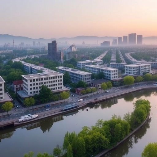
The rebuilding of cities after a major disaster can restore homes, roads, and economies—but it can also create a new and less visible threat: mounting pressure on the ecosystems that support human life. In Southwest China, researchers have examined how rapid post-earthquake urbanization altered ecological sensitivity across Deyang City, a region heavily affected by the 2008 Wenchuan earthquake. Their findings suggest that ecological sensitivity remained relatively high between 2010 and 2020, even as the city underwent extensive reconstruction and socioeconomic recovery. The study, published in Theoretical and Applied Climatology, offers a detailed look at how population movement, land-use change, vegetation conditions, rainfall, and urban development interact in a landscape where mountains, farmland, settlements, and natural hazards overlap.
Deyang occupies a strategically important position in Sichuan Province, linking the Chengdu Plain with more mountainous areas to the northwest. Its geography creates sharp environmental contrasts over relatively short distances. Lowland districts contain dense settlements, transportation infrastructure, industrial activity, and productive agricultural land, while higher-elevation areas include forests, steep slopes, river valleys, and terrain vulnerable to erosion and landslides. The Wenchuan earthquake intensified these challenges by damaging buildings and infrastructure, destabilizing slopes, and disrupting rural communities. Reconstruction subsequently accelerated urban expansion and encouraged the concentration of residents in newly developed settlements. That process improved access to services and strengthened the regional economy, but it also transformed land surfaces and changed the relationship between human activity and ecological processes.
To measure these changes, the researchers constructed ecological sensitivity evaluations for three benchmark years: 2010, 2015, and 2020. Ecological sensitivity in this context refers to the degree to which an area is likely to respond negatively to environmental disturbance or human pressure. A highly sensitive location may be more vulnerable to vegetation degradation, soil erosion, habitat fragmentation, water stress, or geological instability. The assessment combined five principal factors associated with urbanization and ecological change: population density, nighttime light intensity, annual precipitation, the normalized difference vegetation index, commonly known as NDVI, and land use. Together, these indicators provided a bridge between socioeconomic activity observed on the ground and environmental conditions measured through remote sensing and spatial datasets.
Each indicator captures a different component of the urban–environment relationship. Population density reflects the concentration of residents and the potential demand for land, water, energy, transport, and public services. Nighttime light data act as a satellite-based proxy for human activity and economic intensity, revealing areas where settlements, commercial districts, industry, and infrastructure are expanding. Annual precipitation represents an important climatic control because rainfall can support vegetation and water availability while also increasing runoff, erosion, and slope instability when concentrated on fragile terrain. NDVI, calculated from the contrast between red and near-infrared light reflected by vegetation, provides an estimate of plant vigor and ecosystem condition. Land-use data show whether space is occupied by forests, cropland, grassland, water, built-up areas, or other categories, making them essential for tracking the physical footprint of urbanization.
The study used several weighting and modelling strategies rather than relying on a single formula. The analytic hierarchy process, or AHP, incorporates expert judgment to assign relative importance to different criteria. It is useful when ecological processes are complex and cannot be described entirely through statistical relationships, but its results can depend on the assumptions of the experts involved. The entropy index method, by contrast, derives weights from the information content and variability of the data themselves. Indicators that vary substantially across the study area may receive greater objective influence. The researchers also developed an ensemble model combining AHP and entropy-based weights, and used logistic regression to examine the relationship between ecological sensitivity and the selected variables.
Logistic regression is particularly useful for estimating the probability that a location belongs to a sensitive ecological category. It can assess how the likelihood of sensitivity changes as population density, vegetation condition, rainfall, or other factors increase or decrease. The researchers evaluated the performance of the different models using the area under the receiver operating characteristic curve, or AUC. This metric measures how effectively a model distinguishes between locations with different levels of ecological sensitivity. An AUC closer to 1 indicates stronger discrimination, while a value near 0.5 suggests performance little better than random classification. By comparing AUC results, the study sought to determine which assessment approach produced the most reliable spatial pattern.
Across the decade examined, Deyang’s ecological sensitivity remained generally high and displayed pronounced geographic clustering. Sensitive zones were not distributed randomly; instead, they tended to form connected or neighboring patterns shaped by topography, land use, and the movement of people. Mountainous terrain played a major role because steep slopes and complex relief can amplify the effects of rainfall, soil disturbance, vegetation loss, and construction. At the same time, areas experiencing intense urban development faced a different combination of pressures, including the conversion of agricultural or natural land, increased impervious surfaces, and the fragmentation of ecological networks. The result was a landscape in which both remote mountain environments and rapidly changing urban–rural transition zones could require careful ecological management, although for different reasons.
The analysis identified land use, annual NDVI, and population density as the leading drivers of ecological sensitivity evolution during urbanization. Land-use change matters because replacing vegetation or farmland with buildings, roads, and other hard surfaces modifies drainage, increases runoff, fragments habitats, and reduces the capacity of soils and ecosystems to absorb disturbance. NDVI supplied a direct indication of vegetation status, linking ecological sensitivity to the condition and continuity of plant cover. Population density captured the human dimension of change, reflecting how migration and settlement concentration can intensify demand for construction land and resources. Nighttime lights and precipitation also contributed to the assessment, but the study’s findings placed particular emphasis on the interaction between human concentration, land transformation, and vegetation dynamics.
The researchers argue that the results have implications well beyond Deyang. Post-disaster reconstruction is often judged by the speed of economic recovery, the number of homes rebuilt, or the restoration of infrastructure. Those measures are essential, but they do not fully reveal whether development is occurring in locations capable of supporting long-term environmental stability. Ecological sensitivity mapping can help planners identify areas where construction should be restricted, where vegetation restoration should be prioritized, or where development must be adapted to terrain and hydrological conditions. For Deyang, the study provides a spatial basis for coordinating urban expansion, rural reconstruction, disaster-risk reduction, and ecological conservation. More broadly, it demonstrates how satellite observations, demographic information, climate data, and statistical modelling can be combined to reveal the environmental consequences of urbanization while there is still time to guide growth toward a safer and more sustainable future.
Cite Scienmag News
Violet Maxwell. (August 26, 2026). Urbanization Intensifies Ecological Sensitivity in Southwest China, Deyang City Study Finds. Scienmag. https://scienmag.com/urbanization-intensifies-ecological-sensitivity-in-southwest-china-deyang-city-study-finds/
Violet Maxwell. "Urbanization Intensifies Ecological Sensitivity in Southwest China, Deyang City Study Finds." Scienmag, 26 August 2026, https://scienmag.com/urbanization-intensifies-ecological-sensitivity-in-southwest-china-deyang-city-study-finds/. Accessed 3 September 2026.
Violet Maxwell. "Urbanization Intensifies Ecological Sensitivity in Southwest China, Deyang City Study Finds." Scienmag. August 26, 2026. https://scienmag.com/urbanization-intensifies-ecological-sensitivity-in-southwest-china-deyang-city-study-finds/


