


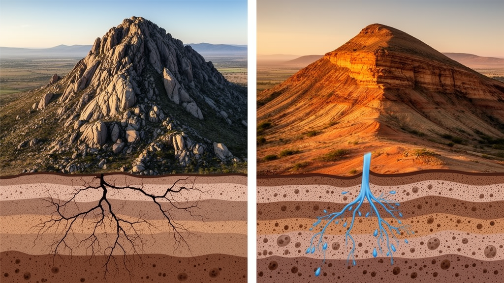
Deep beneath two of Africa’s most iconic mountain systems, water is moving in radically different ways—and the terrain above may have been quietly recording the difference all along. A new study published in Frontiers in Water compares the Ethiopian Highlands with the Drakensberg–uThukela transect of South Africa, two mountain regions chosen for their striking similarity in climate, relief, and broad geological origin, and finds that their subsurface permeability architecture, rather than topography alone, appears to organize groundwater flow in fundamentally contrasting styles. The research, led by Seifu Kebede of North-West University and Ghent University together with colleagues, offers a fresh way of reading mountains as hydrogeological documents.
The theoretical starting point is deceptively simple. Classical groundwater flow theory, dating back to József Tóth’s work in 1963, holds that recharge falling on elevated terrain moves through the subsurface along shallow, intermediate, and deep flow paths toward valleys and discharge zones. Topography, recharge, and hydraulic conductivity jointly control how these paths organize. But the relationship runs both ways: groundwater does not merely respond to topography—it actively carves it. Through seepage-driven erosion and sapping, emerging groundwater undercuts slopes, triggers collapse, and drives headward retreat of valley heads, leaving amphitheatre-shaped valleys etched into escarpments. Coupled hydrologic–geomorphic models have shown that landscapes co-evolve with their subsurface flow systems, meaning that terrain form should, in principle, carry the imprint of the architecture of the aquifer beneath.
To exploit this idea, the team selected two mountain systems broadly comparable in first-order climatic and topographic setting while differing in subsurface structure. The East African analogue centers on the Jema basin in the central to south-central Ethiopian Highlands, a Cenozoic volcanic terrain uplifted by mantle plume activity and deeply dissected. The South African counterpart is the Drakensberg escarpment-to-Indian Ocean transect encompassing the uThukela–uMngeni (UU) region, an older Karoo terrain of stacked flood basalts overlying layered sedimentary rocks. Both regions share basement rocks at depth, sedimentary units in the middle, and volcanic plateaus above, and both were shaped by plume-related volcanism and multi-stage denudation. Crucially, the comparison was restricted to subregions with similar aridity index, rainfall regime, and relief, so that differences in geomorphic expression could be interpreted more directly in terms of subsurface controls rather than climate-driven recharge contrasts.
The analysis relied on 30-meter digital elevation models processed with identical Python-based terrain analysis for both regions. Three complementary geomorphic indicators were quantified: the distribution of amphitheatre-headed valleys, slope–area scaling relationships, and channel sinuosity within wetland systems. Potential sapping-related landforms were extracted by selecting high-slope areas above the 90th percentile combined with strong concave–convex curvature above the 80th percentile, with spatial continuity evaluated within a 9-by-9-cell neighborhood. Drainage networks were extracted using a common contributing-area threshold of one square kilometer, and channel sinuosity was computed as the ratio of channel length to straight-line end-to-end distance for segments longer than 200 meters. The consistency of method was essential: any difference in the resulting geomorphic organization could then be attributed to the terrain itself rather than to analytical choices.
The results reveal systematic divergence. In the Jema sector of the Ethiopian Highlands, the extracted sapping features form laterally aligned, deeply indented valley heads along the northern plateau margin—a discontinuous but coherent zone of headward retreat associated with steep escarpment slopes, sparse tributaries, and pronounced amphitheatre-like embayments. The slope–area analysis shows that for equivalent contributing area, Jema channels consistently exhibit higher slopes than UU channels, expressed as an upward displacement of the slope–area cloud, most pronounced in the intermediate drainage-area range of roughly 10^6 to 10^8 square meters. This elevated upper envelope is consistent with theoretical expectations for landscapes influenced by subsurface flow, where groundwater emergence promotes localized incision and sustains steeper gradients. In contrast, the UU region displays a dense, highly integrated drainage network with closely spaced channels and uniform headwater development, tightly constrained slope–area distributions, and limited organized sapping expression—signatures of runoff-driven fluvial incision dominating landscape evolution.
The wetland story adds a further twist. In the South African UU region, wetlands are laterally extensive, occupying broad, low-gradient valley floors with shallow, weakly incised, and highly sinuous channels. Floodplain depressions, abandoned meanders, oxbow-like forms, and relict channels indicate active floodplain storage and strong surface–groundwater interaction. In the Jema region, wetlands are more limited and discontinuous, occurring mainly as small depressions or localized wet valley-floor pockets, with more confined channels showing fewer abandoned meanders. Taken together, the UU system expresses a shallow, laterally connected groundwater–surface water regime, while Jema shows more discrete wetland expression and spatially focused groundwater discharge consistent with deeper circulation. Remarkably, this divergence inverts expectations based on relief alone: the higher-relief UU terrain exhibits the shallower flow organization, demonstrating that relief does not control slope–area behaviour or drainage form in the absence of process controls associated with groundwater influence.
The geomorphic interpretation was then checked against independent published hydrogeological evidence, including environmental isotopes such as δ18O, δ2H, tritium, and radiocarbon, groundwater residence times, salinity distributions, hydrochemical facies evolution, regional piezometry, and structural mapping of dolerite intrusion networks. The convergence is striking. In the Ethiopian volcanic aquifers, groundwater is generally young—commonly on the order of hundreds to a few thousand years—and remains relatively fresh, implying faster circulation, greater lateral connectivity, and more effective flushing. Multiple studies indicate that groundwater in Ethiopia’s volcanic and tectonically integrated terrains moves beyond local catchment boundaries through laterally continuous volcanic aquifers, with documented inter-basin transfer between the Blue Nile and Awash basins and regional flow paths extending several tens of kilometres. Deep rift-floor waters are largely tritium-free and regionally connected along faulted volcanic blocks, and long-distance circulation helps sustain distant springs and wetlands, locally buffering hydrologically closed basins as hydro-refugia that have played a role in human evolution and dispersal.
The Karoo picture is the mirror opposite. Groundwater in the South African terrain is commonly concentrated within shallow weathered and fractured zones, with flow that is matrix-fed and fracture-controlled, and with low-discharge springs emerging where sparse, weakly connected structures intersect the surface. Recent work from the Eastern Karoo explicitly characterizes groundwater flow as discontinuous and structurally compartmentalized, with flow lines mirroring local topography—signs of limited regional connectivity. Deeper and sub-thermal groundwaters are old, with low radiocarbon, little or no tritium, and residence times that may extend to tens of thousands of years, up to 20,000 years in some cases, suggesting sluggish renewal and slow vertical exchange. High-salinity groundwater at depth further supports long residence times and limited flushing. The authors hypothesize that dense dolerite intrusions in the Karoo—locally reaching up to 30 percent by volume and forming an interconnected, anastomosed stockwork-like system—suppress lateral connectivity, acting primarily as cross-cutting barriers that deflect and compartmentalize groundwater flow rather than sustain vertically integrated regional circulation. In Ethiopia, by contrast, dyke emplacement occurs mainly as discrete plume-related swarms with cumulative dilation around one percent, while layered, interbedded volcanic sequences with scoriaceous flow tops, vesicular horizons, volcanic ash, ignimbrites, and intertrappean sediments sustain permeability with depth through laterally extensive interflow zones.
The management implications are as contrasting as the flow systems themselves. In the Ethiopian Highlands, structurally connected volcanic aquifers appear to support laterally integrated circulation, allowing recharge to move beyond local surface-water divides and re-emerge far from recharge areas. Local abstraction may therefore depend partly on recharge originating tens of kilometres away, implying that groundwater sustainability cannot be evaluated solely from local water balances and that basin-wide assessment, monitoring, and conceptualization incorporating structural controls and inter-basin transfer are required. In the South African Karoo, aquifer compartmentalization suggests that groundwater systems are more strongly controlled by local recharge, shallow storage, and catchment-scale groundwater–surface water interaction, making local to sub-catchment water balances, recharge estimation, wetland protection, and monitoring of streamflow response to abstraction the more effective management approach. The contrasting architectures also imply different modelling requirements: regional-scale conceptualization for Ethiopian volcanic systems versus local to intermediate-scale models focused on groundwater–surface water coupling for compartmentalized Karoo systems.
The novelty of the study lies not in treating any individual geomorphic feature as diagnostic of groundwater—many such features are already well recognized and non-unique when considered alone—but in evaluating whether the combined spatial organization of complementary geomorphic metrics can distinguish contrasting styles and scales of groundwater-flow organization. The approach is explicitly proposed as an exploratory, hypothesis-generating framework for screening groundwater-flow organization in data-scarce mountain environments rather than as a uniquely diagnostic method. The authors acknowledge limitations: the 30-meter DEM cannot resolve small seepage faces or fine-scale valley-head morphology, the interpretation is qualitative and does not directly quantify fluxes or hydraulic properties, and geomorphic signatures may reflect both long-term landscape evolution and present-day hydrological forcing. Future work should test the interpretations using dated geomorphic markers, palaeoclimate data, field hydrogeology, tracers, geophysics, and numerical modelling. Nevertheless, the results reinforce the value of viewing groundwater both as a driver of landscape evolution and as a system whose organization can be partly inferred from landscape form where direct data remain sparse—a perspective that could prove transformative for water security across Africa’s densely populated mountain regions.
Subject of Research: Earth Science
Article Title: Contrasting groundwater flow systems in comparable African Mountains-role of permeability structure
Article References: Kebede, S., Roopa, S., Mongala, T., & Ayalew, D. (2026). Contrasting groundwater flow systems in comparable African Mountains-role of permeability structure. Frontiers in Water, 8, Article 1925623. https://doi.org/10.3389/frwa.2026.1925623
Image Credits: AI Generated
DOI: 10.3389/frwa.2026.1925623
Keywords: groundwater, hydrogeology, geomorphology, Ethiopian Highlands, Drakensberg, Karoo, permeability, mountain hydrology, water resources, Africa, Contrasting, flow
Cite Scienmag News
Violet Maxwell. (October 16, 2026). Two African Mountains, Two Hidden Water Worlds: How Rock Architecture Shapes Groundwater Flow. Scienmag. https://scienmag.com/two-african-mountains-two-hidden-water-worlds-how-rock-architecture-shapes-groundwater-flow/
Violet Maxwell. "Two African Mountains, Two Hidden Water Worlds: How Rock Architecture Shapes Groundwater Flow." Scienmag, 16 October 2026, https://scienmag.com/two-african-mountains-two-hidden-water-worlds-how-rock-architecture-shapes-groundwater-flow/. Accessed 16 October 2026.
Violet Maxwell. "Two African Mountains, Two Hidden Water Worlds: How Rock Architecture Shapes Groundwater Flow." Scienmag. October 16, 2026. https://scienmag.com/two-african-mountains-two-hidden-water-worlds-how-rock-architecture-shapes-groundwater-flow/


