

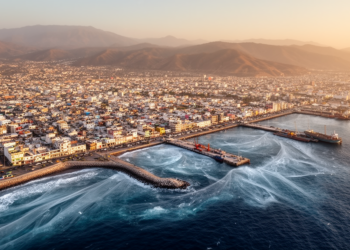
Simulations map tsunami flood risk for Mexico’s Manzanillo coast
Manzanillo, a major port city on Mexico's central Pacific coast, sits uncomfortably close to one of the planet's most active ...
Manzanillo, a major port city on Mexico's central Pacific coast, sits uncomfortably close to one of the planet's most active ...

New petrological and geochronological analysis shows that a poikilitic hornblende pyroxenite in Japan's Abukuma Mountains formed about 120 million years ...
New tsunami simulations of the poorly mapped Negros–Sulu megathrust show magnitude 8.0 to 8.9 ruptures could send waves up to ...
Researchers used physics-informed neural networks to infer heterogeneous fault friction from GPS data of Japan's 2010 Bungo slow slip event, ...
Geologists have documented only the tenth known well-preserved lawsonite eclogite on Earth, in Türkiye's Central Pontides, revealing peak subduction conditions ...
A new probabilistic seismic hazard study maps the vertical component of earthquake ground motion across El Salvador for the first ...
New numerical simulations combining 500 years of historical records and twelve fault rupture scenarios show that the low-lying islands of ...
A new study of the Guerrero gap offshore Mexico is challenging a widely held assumption about how the structure of ...

Embark on a thrilling journey of discovery with Scienmag.com—your ultimate source for cutting-edge breakthroughs. Immerse yourself in a world where curiosity knows no limits and tomorrow’s possibilities become today’s reality!