

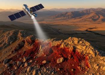
Satellite Spots Buried Iron Skarns in Eastern Türkiye Before Miners Ever Dug
A 2003 ASTER image predicted the exact locations of iron pits opened years later around Keban, revealing how band ratios, ...
A 2003 ASTER image predicted the exact locations of iron pits opened years later around Keban, revealing how band ratios, ...

Researchers have created a fast apparent resistivity-depth imaging algorithm that converts semi-airborne tipper electromagnetic data into rapid subsurface maps for ...
Finnish researchers have developed an integrated exploration workflow combining field-based heavy mineral concentration, portable XRD and XRF analyzers, and automated ...
Alluvial heavy mineral deposits in central Portugal's Castelo Branco Massif reveal anomalously high concentrations of rare earth elements, titanium, and ...
Brazilian researchers have developed a moving-window ordinary kriging algorithm that adapts its statistical model locally to produce sharper, more detailed ...
An integrated survey combining drone photogrammetry, ground magnetometry and gamma-ray spectrometry has traced anomalous gold in stream sediments of southern ...
By fusing Landsat 9 satellite imagery with field mapping and petrography, geologists have produced the first mineral exploration map of ...
A new processing strategy that interpolates irregular seismic shot points onto a regular 100-meter grid has dramatically sharpened deep crustal ...
A newly analysed carbonatite plug at Khaderpet in southern India is exceptionally enriched in light rare earth elements and occurs ...
New research shows that coarse, smoothed labels in continental-scale AI mineral prospectivity maps artificially inflate model performance while erasing high-probability ...

Embark on a thrilling journey of discovery with Scienmag.com—your ultimate source for cutting-edge breakthroughs. Immerse yourself in a world where curiosity knows no limits and tomorrow’s possibilities become today’s reality!