


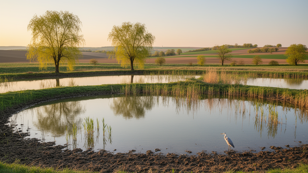
Fishponds rarely make headlines in the ecosystem services debate. They are engineered waterbodies, built for fish production, and their broader contributions to biodiversity, recreation and landscape beauty are routinely overlooked in assessments and policy discussions. Yet across Central and Eastern Europe, networks of managed ponds have shaped the landscape for centuries, and a new study from Hungary argues that these artificial pondscapes deserve far more systematic attention. Published in One Ecosystem, the research develops a spatial, proxy-indicator framework that maps the habitat-maintenance, recreational and aesthetic potential of 25 fishpond complexes across four Hungarian regions, using nothing more than freely available spatial data and standard landscape metrics.
The study addresses two persistent gaps. First, artificial freshwater systems remain under-represented in ecosystem service assessments, despite growing evidence that they can deliver multiple services alongside their production function. Second, the services that matter most for conservation, namely habitat maintenance for biodiversity and cultural services tied to recreation and aesthetics, are precisely the ones that are hardest to measure. Quantifying habitat provision across dozens of sites through direct field surveys is logistically and financially impractical, while cultural services are rooted in human perception and experience rather than in biophysical processes that can be directly measured. Resource-intensive mixed-methods approaches, combining surveys, interviews and participatory mapping, are often required, making pondscapes associated with cultural services amongst the least systematically studied freshwater systems.
To overcome these constraints, the research team turned to proxy indicators, measurable landscape features that stand in for services that cannot be easily quantified. Landscape metrics such as fractal dimension, edge density and connectivity have long been used to characterise spatial structure in ways that relate to habitat availability and biodiversity persistence. Shoreline complexity, for example, is associated with habitat heterogeneity in lentic systems, while the spacing and configuration of ponds can influence the movement and persistence of aquatic populations. Managed fishponds may not match pristine wetlands, but they can still act as stepping-stone habitats for waterbirds during migration and breeding. On the cultural side, recreation hotspots have been linked to landscape attributes associated with a higher natural environment, the presence of recreational facilities and accessibility, features that can be captured through footpath networks, road density and points of interest extracted from collaborative mapping platforms.
The framework was guided by the Common International Classification of Ecosystem Services, ensuring transparency and transferability. At the pond level, six indicators characterised structural and geometric complexity: mean patch fractal dimension, edge density, shoreline density, vegetation cover, mean nearest neighbour distance and landscape shape index. Fractal dimension captures the irregularity of pond shapes, with simple square patches scoring close to 1 and irregular patches scoring 2 or higher. Shoreline density expresses the water-land interface per unit area, offering a more reliable measure than the traditional shoreline development index, which can only compare waterbodies of the same surface area. Vegetation cover was mapped using an NDVI spectral index-based workflow to quantify the extent of cattail and reed stands that dominate most pond margins. At the landscape level, metrics calculated within a 1.5 kilometre buffer around each pondscape quantified patch isolation and fragmentation, scales that have the greatest explanatory power for habitat maintenance in the immediate surroundings of aquatic features.
Recreational potential was assessed through a different set of indicators. Within a 5 kilometre buffer around each pond complex, points of interest relevant to tourism, including accommodation, natural features and transport facilities, were extracted from OpenStreetMap using SQL queries and analysed with kernel density estimation. Road density was calculated as the total length of road segments divided by buffer area, reflecting the concentration of transport infrastructure in the landscape. The presence of protected areas from the Natura 2000 network and the Common Database on Designated Areas was scored within a 1.5 kilometre buffer, chosen because it represents a realistic walking-access zone of 10 to 20 minutes. Each protected area was assigned a score from 0 to 1, where 0 indicated wilderness protection with limited accessibility and 1 represented areas where recreation and tourism are explicitly recognised management objectives. Strictly protected nature reserves with restricted access were excluded.
Aesthetic value, perhaps the most subjective of the three service categories, was approximated through land-cover diversity, structural complexity and perceived naturalness. The Shannon Diversity Index and Shannon Evenness Index characterised richness and evenness of land-cover types, while patch richness density and perimeter-area fractal dimension captured heterogeneity and shape complexity. Perceived naturalness was expressed through the hemeroby index, a classification reflecting the level of human modification of land-cover types, with scores calibrated specifically for Hungarian land-use types. The 1.5 kilometre buffer was selected because visual-landscape research shows that perceived naturalness and scenic quality are shaped primarily by features in the middle-distance viewing zone, typically spanning 400 metres to 2.5 kilometres, the spatial extent people subconsciously integrate when evaluating landscape beauty.
Indicators were harmonised through min-max normalisation, rescaling all values to a 0 to 1 range so that no single metric disproportionately influenced the results. Indicators inversely related to service potential, such as mean nearest neighbour distance, hemeroby and landscape shape index, were inverted to align with the conceptual rule that higher values should represent higher service intensity. Unweighted totals of normalised indicators yielded service-specific indices for each category, which were then summed into a composite metric for cross-site comparison. Statistical tests, including the non-parametric Kruskal-Wallis test for regional variation and a two-sample t-test for differences between pond types, examined how service delivery varied across the 25 pondscapes.
The results revealed clear and consistent differences between regions and pond types. Barrage-dam pondscapes, concentrated in the hilly Transdanubian regions of Hungary, outperformed the round-dam ponds of the flat Great Plains in every structural indicator. Normalised fractal dimension scores reached 0.72 for barrage-dam ponds against 0.50 for round-dam ponds, edge density 0.64 against 0.41, and shoreline density 0.69 against 0.34. In raw terms, the median shoreline density of barrage-dam ponds was approximately 150 metres per hectare, significantly higher than the 95 metres per hectare observed for round-dam ponds, reflecting their elongated, irregular shapes that follow natural terrain. These irregular perimeters create diverse littoral habitats and mosaic land-cover interfaces, features widely recognised as enhancing habitat heterogeneity, ecological connectivity and biodiversity in lentic systems. Round-dam ponds, by contrast, showed regular, compact shapes that simplify water-land boundaries and limit habitat heterogeneity, particularly within monocultural agricultural surroundings.
Cultural service indicators carried the same regional signal. Points of touristic interest appeared more frequently around barrage-dam pondscapes in Transdanubia, echoing findings that heterogeneous landscapes often offer greater recreational and aesthetic value, a pattern reinforced by the region’s proximity to major destinations such as Lake Balaton. Road density, however, was markedly higher in the round-dam pondscapes of the Great Plains. The authors caution that this finding requires contextual interpretation: higher road density did not necessarily correspond to higher regional development levels, but instead reflected a fine-meshed rural road network characteristic of production landscapes rather than urban infrastructure density. A clear trade-off also emerged, where increasing road density corresponded with declining values in habitat-maintenance and aesthetic structure metrics, since road networks can fragment habitats and modify hydrology. Most Hungarian pondscapes fell within low-to-medium hemeroby levels, reflecting relatively natural conditions, though moderate human influence often improves accessibility and enables recreational use such as angling and birdwatching by providing essential infrastructure.
The framework’s practical implications extend well beyond academic assessment. Because the workflow is transparent, reproducible and efficient in data terms, it enables rapid ecosystem service screening in contexts where intensive field surveys are not feasible, and it can be scaled to other pondscapes with similar characteristics. The authors argue that such spatial assessments can support decision-making related to targeted restoration, agri-environment scheme design and broader pondscape enhancement. At the European level, the method could help identify priority areas for restoring semi-natural habitat networks under the Biodiversity Strategy for 2030, support the targeted placement of buffer strips and hedgerows within the Common Agricultural Policy 2023-27, and inform riparian restoration under the Water Framework Directive and the Nature Restoration Regulation. In Hungary, where historic pond loss and abandonment have reduced landscape connectivity and where fishpond systems face pressures to intensify, rising operational costs, labour shortages, heat stress and water scarcity, the indicator framework offers a technical basis for incentivising management practices that maintain high shoreline complexity and landscape diversity. The authors acknowledge limitations, including dependence on the CORINE land-cover dataset, which introduces scale-related mismatches, and the assumption of uniform temporal conditions that overlooks seasonal water-level fluctuations and management cycles such as periodic pond draining. Future refinements should prioritise ground-truthing proxy indicators, integrating preference-based socio-cultural data to calibrate biophysical metrics with actual human values, and extending the framework to include socio-economic variables and multi-temporal monitoring that capture the synergies and trade-offs of ecosystem services within pondscapes.
Subject of Research: Spatial proxy indicators for assessing ecosystem services in artificial pondscapes
Article Title: Application of spatial indicators to assess ecosystem services in pondscapes
Article References: Sharma, P., Krupandan, A., Stanivuk, J., Békefi, E., & Gyalog, G. (2026). Application of spatial indicators to assess ecosystem services in pondscapes. One Ecosystem, 11, Article e186690. https://doi.org/10.3897/oneeco.11.e186690
Image Credits: AI Generated
DOI: 10.3897/oneeco.11.e186690
Keywords: ecosystem services, pondscapes, landscape metrics, biodiversity, cultural services, Hungary, spatial analysis, Application, spatial, indicators, assess, ecosystem
Cite Scienmag News
Gavin Prescott. (October 16, 2026). Spatial indicators reveal hidden ecosystem services in Hungarian pondscapes. Scienmag. https://scienmag.com/spatial-indicators-reveal-hidden-ecosystem-services-in-hungarian-pondscapes/
Gavin Prescott. "Spatial indicators reveal hidden ecosystem services in Hungarian pondscapes." Scienmag, 16 October 2026, https://scienmag.com/spatial-indicators-reveal-hidden-ecosystem-services-in-hungarian-pondscapes/. Accessed 16 October 2026.
Gavin Prescott. "Spatial indicators reveal hidden ecosystem services in Hungarian pondscapes." Scienmag. October 16, 2026. https://scienmag.com/spatial-indicators-reveal-hidden-ecosystem-services-in-hungarian-pondscapes/


