


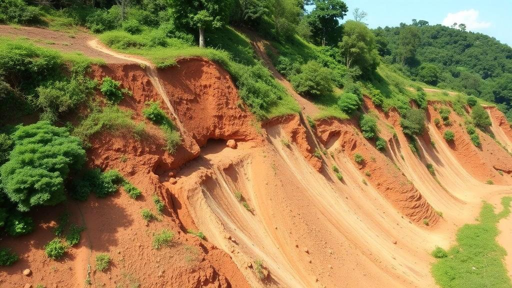
When an extreme rainfall event struck the Rio Rolante watershed in northeastern Rio Grande do Sul in January 2017, it tore hundreds of scars into steep hillsides of the Atlantic Forest, mobilizing shallow soils toward valley bottoms and even forming natural barriers along river channels whose later breaching sent flash floods into the town of Rolante. Nine years later, a team of Brazilian researchers has tracked how vegetation crept back across 85 of those mass-movement scars, and their findings reveal something subtle but consequential: the pace and shape of recovery are written into the topography itself. Slope and elevation, rather than scar shape or local curvature, emerge as the terrain attributes most clearly associated with how these damaged slopes regained their spectral signature of green, moist, soil-covered land.
The study, published in Environmental Earth Sciences, integrated annual time series of four Sentinel-2 spectral indices with topographic variables derived from the Copernicus GLO-30 digital elevation model. The researchers computed NDVI to estimate photosynthetic activity, SAVI to reduce the influence of exposed soil in degraded areas, NDMI to capture water content in vegetation and soil, and BSI to highlight unvegetated surfaces. Each index was extracted from surface reflectance imagery at 10-meter resolution within a window of plus or minus 40 days centered on January 5th each year, from 2018 through 2026, with cloud masking applied through the Scene Classification Layer. For every scar, the spatial median of each index was aggregated annually, producing 765 observations across the 85 scars and nine years.
The scars themselves were filtered from a pre-existing inventory of 335 features mapped after the 2017 event, which generated an estimated 90 to 272 millimeters of rain within just four hours. An internal buffer of 10 meters eliminated edge pixels and reduced spectral mixing with intact surroundings, while additional filters removed polygons smaller than 100 square meters and highly irregular shapes. The resulting sample of 85 scars represents roughly 25.4 percent of the original inventory and about 16.6 percent of its total mapped area of 117.56 hectares. These scars sit almost entirely over volcanic rocks of the Serra Geral Formation, underlain by extremely shallow, stony Leptosols that confine hard rock or limiting material to within 25 centimeters of the surface, a configuration that limits water storage and root penetration and creates high susceptibility to rapid saturation during extreme events.
To unify the information held in the four indices, the team ran a principal component analysis on eight regeneration variables: the annual change rates and final 2026 values of NDVI, SAVI, NDMI, and BSI, with BSI’s sign inverted so that higher values consistently meant better condition. The first two components explained 96.1 percent of the standardized variance, and k-means clustering on their scores, with the optimal number of groups determined by average silhouette width, sorted the scars into three contrasting classes. The high-regeneration group contained 42.3 percent of the scars, the medium group 31.8 percent, and the low group 25.9 percent. The high class showed the largest mean values of NDVI, SAVI, and NDMI together with the lowest BSI, while the low class occupied the opposite corner of the spectral space, with the gap between extreme groups reaching 0.201 for NDVI and 0.180 for BSI.
The temporal trajectory that emerged from nine years of monitoring was emphatically nonlinear. Mean annual NDVI climbed from 0.446 in 2018 to 0.824 in 2026, SAVI rose from 0.669 to 1.236, and NDMI more than tripled from 0.094 to 0.313, while BSI fell continuously from near zero to strongly negative values, signaling that exposed soil was progressively blanketed by regrowing vegetation. The sharpest improvements concentrated in the initial years, particularly between 2018 and 2021, after which the rates of increment leveled off. The authors attribute this stabilization partly to optical index saturation in maturing, closing canopies, a well-documented sensitivity limit of normalized indices in dense vegetation, and partly to real ecological slowing of the kind reported in post-landslide studies in Japan, where full recovery was estimated to take on the order of a decade or more.
Linear mixed models with quadratic temporal terms confirmed that curvature in the recovery trajectories was statistically real rather than a visual artifact. Likelihood ratio tests comparing models with and without the quadratic time term were highly significant for all four indices, with chi-square statistics exceeding 300 for NDVI and SAVI, 44.3 for NDMI, and 68.0 for BSI, all at p below 0.001. The models included standardized geomorphometric variables as fixed effects, interactions of linear and quadratic time with each terrain attribute, and the number of valid images per year as a quality control, while random effects for intercept and slope per scar accommodated the repeated measures structure. Residual diagnostics showed no serious violations of normality or homoscedasticity, and variance inflation factors stayed below 4, ruling out multicollinearity among predictors.
Slope left its clearest imprint on NDMI, the moisture index. Scars on gentle slopes maintained consistently higher NDMI values throughout the series, whereas scars on the steepest terrain showed the lowest values in most years. The model coefficients confirmed the pattern: the main effect of slope on NDMI was negative at beta equal to minus 0.0326 with p equal to 0.0065, and the interaction with time was also significant, indicating that although steepness reduces mean moisture levels, the leveling off of moisture recovery is less pronounced on steeper slopes. The authors note that because NDMI, like NDVI, is a normalized band-ratio index barely affected by light and shadow differences on hillsides, these contrasts reflect genuine differences in vegetation moisture rather than calculation artifacts, consistent with the greater water availability and easier seed fixation and root anchoring on less inclined surfaces reported in comparable studies.
Elevation, by contrast, primarily modulated the bare-soil trajectory. Scars at higher altitudes exhibited faster reductions in BSI over time, with the linear interaction between time and elevation negative and significant at beta equal to minus 0.0027 and p equal to 0.045, meaning the annual rate of soil-cover gain accelerated with altitude. The high-elevation class recorded a total BSI reduction of 0.310 between 2018 and 2026, against 0.228 for the low class. One plausible mechanism is the solar radiation regime imposed by the rugged Serra Gaucho relief: slopes in lower valley positions may remain shaded by opposing higher slopes for part of the day, reducing the energy available for photosynthesis, while scars higher on the slopes receive more abundant direct insolation. The researchers are careful to frame topographic shading as a plausible mechanism rather than a demonstrated driver, since radiation was not measured directly, and unmeasured altitudinal gradients in temperature, precipitation, soils, or land use may also contribute.
Not every terrain attribute mattered. Scar shape, quantified by the size-independent circularity index, exerted no significant effect on any spectral index, and total terrain curvature, the second derivative of elevation, showed no significant primary effects or interactions for any index, with p-values above 0.05 throughout. Aspect fared no better as an inferential factor: the circular distribution of scar orientations showed low angular concentration, and while the high-regeneration class contained a slightly higher proportion of north-facing scars at 27.8 percent compared with 9.1 percent in the low class, the differences were too subtle to assert that orientation determines recovery under the region’s humid subtropical climate with relatively distributed rainfall. The terrain roughness index did not affect mean regeneration levels, though a significant quadratic interaction for NDMI suggested that moisture recovery levels off more sharply on surfaces with greater microrelief irregularity, possibly because micro-depressions act as temporary water reservoirs.
The practical upshot is a mapable framework for prioritizing restoration. Because 42.3 percent of scars achieved relatively greater spectral recovery while steep, low-moisture sites lag behind, the approach can flag where erosion and landslide reactivation risk remain elevated and where targeted intervention would pay off most. The authors stress that satellite metrics capture surface spectral signals rather than floristic composition or the structural reestablishment of native forest, and that conclusions about scar geometry apply strictly to the morphological range retained after filtering. They also acknowledge that the 30-meter DEM grid smooths fine-scale micro-topography, which may explain the limited significance of local curvature, and that the findings rest on a single basin. Still, within the Rolante watershed, where the scars were historically dominated by native forest cover and early regeneration is driven by fast-growing pioneers such as Trema micrantha and Solanum mauritianium, the message is clear: after the rain has done its damage, it is the shape of the land that decides how fast the forest returns.
Subject of Research: Vegetation recovery in landslide scars is controlled by topography, with slope and elevation shaping nonlinear spectral recovery trajectories in southern Brazil
Article Title: Topographic controls on vegetation recovery in mass-movement scars after an extreme rainfall event in Southern Brazil
Article References: Cargnin, B. D. R., de Oliveira Andrades-Filho, C., Ferreira, M. P., Herrmann, P. B., & de Oliveira, G. G. (2026). Topographic controls on vegetation recovery in mass-movement scars after an extreme rainfall event in Southern Brazil. Environmental Earth Sciences, 85(17), Article 438. https://doi.org/10.1007/s12665-026-13180-0
Image Credits: AI Generated
DOI: 10.1007/s12665-026-13180-0
Keywords: landslides, vegetation recovery, remote sensing, Sentinel-2, topography, Brazil, geomorphometry, ecological restoration, Topographic, controls, vegetation, recovery
Cite Scienmag News
Violet Maxwell. (October 24, 2026). Slope and Elevation Steer Vegetation Recovery in Brazilian Landslide Scars. Scienmag. https://scienmag.com/slope-and-elevation-steer-vegetation-recovery-in-brazilian-landslide-scars/
Violet Maxwell. "Slope and Elevation Steer Vegetation Recovery in Brazilian Landslide Scars." Scienmag, 24 October 2026, https://scienmag.com/slope-and-elevation-steer-vegetation-recovery-in-brazilian-landslide-scars/. Accessed 24 October 2026.
Violet Maxwell. "Slope and Elevation Steer Vegetation Recovery in Brazilian Landslide Scars." Scienmag. October 24, 2026. https://scienmag.com/slope-and-elevation-steer-vegetation-recovery-in-brazilian-landslide-scars/


