


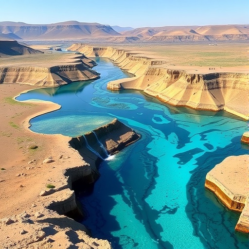
Deep beneath the arid plains straddling the Iran–Afghanistan border, a silent crisis is unfolding in the aquifers that sustain millions of people. A new study published in the journal Earth Science Informatics offers the most detailed quantitative picture yet of groundwater depletion in the Fariman–Torbat Jam basin, a critical sub-catchment of the transboundary Harirud basin, and its findings read as a warning for semi-arid regions worldwide: even when the rain returns, over-pumped aquifers may not recover, and rivers can become permanently severed from the groundwater systems that once fed them.
The research, conducted by Nima Moghaddam, Majid Kholghi and Afshin Ashrafzadeh of the University of Tehran’s Department of Irrigation and Reclamation Engineering, combines nearly two decades of hydro-climatic data with a suite of computational filtering techniques to disentangle the hidden flows of water between underground aquifers and surface streams. Drawing on a 19-year record spanning 2001 to 2019, the team set out to answer two deceptively simple questions: how much of the river’s flow actually comes from groundwater, and how close is the basin to the point of absolute water scarcity?
At the heart of the study lies a technical challenge that hydrologists have wrestled with for more than half a century: baseflow separation. In any stream, total flow is a mixture of quick storm runoff, water that rushes overland after rainfall, and baseflow, the slower, steadier contribution of groundwater seeping into the stream channel through the bed and banks. In semi-arid basins like Fariman–Torbat Jam, baseflow is disproportionately important, sustaining ecosystems and downstream communities through long dry seasons. But measuring it directly is nearly impossible, so scientists rely on analytical filters to partition streamflow records into their components.
The Iranian team evaluated four widely used recursive digital filters, the Eckhardt, Chapman, Furey–Gupta, and Boughton algorithms, each of which applies a mathematical recursion to the daily streamflow series to estimate the groundwater-derived fraction. Rather than accepting the filters’ output at face value, the researchers benchmarked all four against a Master Recession Curve, a physically grounded model that describes how a stream’s flow declines during rainless periods as aquifer storage drains. This recession-based approach, rooted in classical hydrogeology, provided an independent standard of comparison that few baseflow studies employ so rigorously.
The verdict was clear. The Eckhardt filter, a two-parameter recursive algorithm designed to respect both the nonlinear storage behavior of aquifers and a ceiling on how much of the flow can plausibly be groundwater, outperformed the alternatives in capturing the lateral groundwater discharge characteristic of the basin. Its two governing parameters were not assumed but derived through iterative calibration against the Master Recession Curve: a recession constant of 0.3166 and a maximum Baseflow Index of 0.380. The recession constant describes how quickly aquifer storage drains to the stream, while the maximum Baseflow Index caps the long-term proportion of streamflow that can originate from groundwater.
That ceiling of 0.380 is itself telling. In healthy, perennial river systems, the maximum Baseflow Index can be considerably higher, reflecting a strong, continuous connection between aquifer and channel. The authors deliberately set a relatively low value for Fariman–Torbat Jam to reflect what the data revealed: a heavily pumped, degraded system in which the river has become ephemeral, flowing only episodically rather than year-round. The parameter choice, in other words, encodes the physical reality of an aquifer–river system already in decline.
And decline it has. Across the 19-year record, the analysis revealed a statistically significant downward trend in baseflow, a signal the researchers interpret as evidence of a physical decoupling of the river from its aquifer. When groundwater tables fall below the elevation of the stream bed, whether through chronic pumping or prolonged drought, the hydraulic gradient reverses: instead of groundwater feeding the river, the river begins to lose water to the subsurface. Once that connection is severed, restoring it requires far more than a few wet years. The finding places Fariman–Torbat Jam in the company of other stressed basins around the world where irrigation pumping has been shown to strip dry-season flows from streams, with consequences that cascade through ecosystems and across borders.
Perhaps the study’s most striking result, and the one most likely to resonate far beyond hydrology, concerns what happened in 2019. In that year, the region experienced a dramatic precipitation surge, with the Standardized Precipitation Index exceeding 2.0, a value conventionally associated with severely wet conditions. Under conventional water-balance thinking, such a deluge should have recharged the aquifer and eased pressure on groundwater resources. Instead, the dimensionless Groundwater Footprint ratio, a measure of the area of aquifer required to sustain current extraction relative to the actual recharge area, spiked to 2.26.
The researchers describe this phenomenon as an “apparent recharge-extraction decoupling,” a nonlinear hydrogeological response in which anthropogenic pumping overwhelmed natural recharge pulses. Several mechanisms conspire to produce it. Percolation of infiltrated rainfall through thick unsaturated zones can take years or even decades to reach the water table, so a wet year’s recharge may simply not arrive in time to offset extraction. Spatial heterogeneity in the aquifer means that rainfall concentrated in some parts of the basin may never reach the heavily pumped zones at all. And in a basin where irrigation infrastructure is geared to exploit every available drop, abundant rainfall can even spur expanded cultivation and thus expanded pumping, canceling out the hydrological gift from the sky.
The Groundwater Footprint concept, adapted from a framework first introduced to quantify aquifer stress at the global scale, expresses sustainability in a single number. When the ratio of footprint area to aquifer area exceeds 1.0, extraction is outpacing recharge; the aquifer is being mined, not managed. The Fariman–Torbat Jam basin now sits well beyond that threshold, and the authors project that without intervention the basin faces imminent absolute scarcity, defined by a ratio exceeding 2.0 on a sustained basis. The consequences would not respect the national border: downstream transboundary ecosystems, and the delicate web of water-sharing arrangements between Iran and Afghanistan, would bear the brunt.
This is where the study makes its second, equally significant contribution. Beyond the equations and filters, the team conducted a multi-dimensional governance assessment of the basin, and the results expose a structural asymmetry that may matter as much as any recession constant. Policy dimensions tied to security, notably Border Security, scored highly in the assessment, reflecting the geopolitical salience of the Iran–Afghanistan frontier. Yet the essential management tools of sustainable groundwater governance, Stakeholder Participation and Water Pricing, were found to be critically absent. In plain terms, the basin is policed but not governed: the state apparatus monitors and controls the border, but the levers that actually regulate demand, such as meaningful prices on extracted water and inclusive decision-making involving the farmers and communities who use it, remain largely nonexistent.
The authors argue that this imbalance is not incidental but causal. A security-centric governance model, they suggest, is structurally incapable of addressing aquifer depletion, because depletion is driven not by hostile actors but by dispersed, individually rational pumping decisions made under weak economic signals. Shifting to what they call a resilience-centric model, one that treats the aquifer as shared infrastructure requiring adaptive management, stakeholder engagement and economic instruments, is framed not as an idealistic aspiration but as the necessary condition for avoiding collapse. Their conclusion is unambiguous: without such a shift, the basin faces imminent absolute water scarcity, carrying profound risks for downstream transboundary ecosystems and regional stability.
The broader implications extend well beyond this one basin. Transboundary aquifers account for a substantial share of the world’s freshwater, yet they remain among the least governed of shared resources, lacking the treaties, commissions and monitoring networks that many international rivers enjoy. When a river–aquifer system decouples, the surface water agreement may become meaningless, because the river no longer behaves as it did when the treaty was signed. The Fariman–Torbat Jam study illustrates how quantitative tools, from recursive digital filters to groundwater footprint accounting, can provide the early-warning metrics that such governance frameworks will need. A groundwater footprint ratio that spikes during a flood year is precisely the kind of counterintuitive signal that should trigger policy attention before the crisis becomes irreversible.
For the scientists, the methodological takeaway is the value of multi-method rigor. By forcing four competing filters to face a physically based recession benchmark, the study sidesteps a common pitfall in baseflow research, where the choice of filter is often arbitrary and results can vary widely depending on which algorithm is selected. The calibrated Eckhardt approach demonstrated here offers a transferable template for other data-scarce, semi-arid basins where irrigation stress is driving similar aquifer–stream disconnections.
For the people of the Harirud basin, and for policymakers in Tehran and Kabul alike, the message is starker. The rain that fell so abundantly in 2019 did not save the aquifer, and no future wet year will, as long as extraction continues to run ahead of recharge and governance continues to prioritize borders over basins. The groundwater beneath Fariman–Torbat Jam has been delivering a quiet, measurable warning for nearly two decades. The new research has finally translated that warning into numbers. Whether it translates into action is, as the authors make clear, no longer a hydrological question but a political one.
Cite Scienmag News
Violet Maxwell. (September 5, 2026). Scientists quantify groundwater footprint in basin on Iran-Afghanistan border. Scienmag. https://scienmag.com/scientists-quantify-groundwater-footprint-in-basin-on-iran-afghanistan-border/
Violet Maxwell. "Scientists quantify groundwater footprint in basin on Iran-Afghanistan border." Scienmag, 5 September 2026, https://scienmag.com/scientists-quantify-groundwater-footprint-in-basin-on-iran-afghanistan-border/. Accessed 5 September 2026.
Violet Maxwell. "Scientists quantify groundwater footprint in basin on Iran-Afghanistan border." Scienmag. September 5, 2026. https://scienmag.com/scientists-quantify-groundwater-footprint-in-basin-on-iran-afghanistan-border/


