


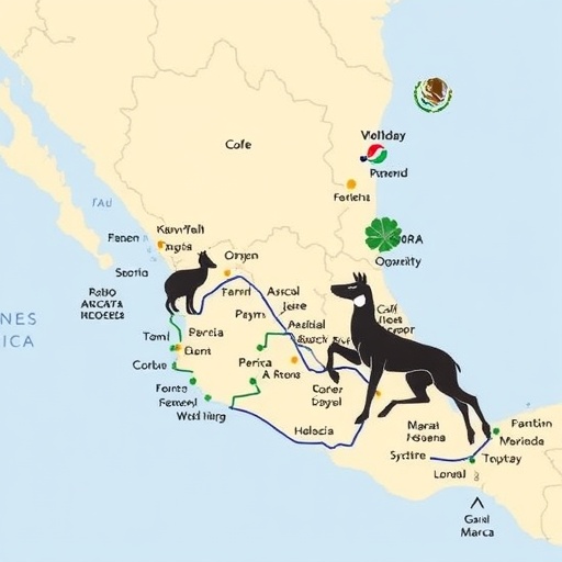
For decades, traffickers have been stripping Mexico’s forests of wild parrots and feeding them into an illegal market that stretches from remote rural communities to major urban centers. Now, researchers have developed a predictive mapping platform designed to help authorities intervene before a shipment reaches its destination. The system identifies the roads and regions most likely to carry illegally captured birds, transforming thousands of past confiscation records into a forward-looking tool for wildlife enforcement. Its creators say the approach could mark a major shift in conservation: instead of responding only after animals are seized, officials may be able to anticipate where trafficking networks will operate next.
The study, led by researchers at The Australian National University and co-authored by scientists at Arizona State University, examined more than 6,000 parrot confiscation records collected in Mexico between 1997 and 2024. The records provided information about where birds were intercepted, which species were involved and how trafficking patterns changed over time. The researchers compared these observations with parrot distributions, transportation infrastructure, policy changes and broader social disruptions, including the COVID-19 pandemic. Their analysis revealed that trafficking activity was not scattered randomly across the country. Instead, it concentrated along a relatively small number of recurring corridors, particularly in southeastern Mexico and across the Yucatán Peninsula.
Mexico is home to 20 native parrot species considered in the analysis, and half are directly threatened by trapping for the illegal wildlife trade. The conservation picture has continued to worsen despite international protections and national policy changes. Since 1993, no Mexican parrot species has improved its conservation status. The researchers report that Mexico’s parrots now face a substantially higher extinction risk than birds globally, with illegal trapping emerging as one of the most extensive and damaging pressures on their populations. In some cases, the threat from capture rivals or exceeds the impact of habitat loss caused by agriculture and logging, because removing breeding adults and nestlings can rapidly undermine already vulnerable populations.
The research also shows how criminal networks changed after Mexico introduced a 2008 ban on the capture and trade of native parrots. Rather than eliminating the market, the policy appears to have pushed trafficking into more concealed and adaptive forms. Earlier seizures were more often associated with opportunistic trapping near rural habitats, while later confiscations increasingly occurred far from the birds’ natural ranges. Many were recorded hundreds of kilometers away, often near Mexico City and other large urban markets. This geographic separation between capture sites and seizure locations suggests a sophisticated supply chain in which birds are collected in forest regions, moved through intermediate transport hubs and eventually delivered to customers in cities.
To reconstruct those hidden routes, the researchers adapted a modeling technique normally used in landscape ecology to study how animals move through fragmented environments. In ecological applications, the method estimates the most probable paths between habitat patches by assigning different levels of resistance to features such as roads, rivers, settlements or disturbed land. The team applied a similar logic to trafficking, but represented Mexico as an electrical network. Wild parrot populations were treated as sources of electrical current, while confiscation locations acted as endpoints. The country’s road system became the conductive framework, and mathematical calculations estimated where the greatest “current” of illegal movement would flow between capture areas and known seizure sites.
This approach, known as circuit-based connectivity modeling, is useful because trafficking rarely follows a single fixed route. Criminal networks can divert shipments, change vehicles or use alternative roads when enforcement pressure increases. A conventional route map might identify only the paths already observed, whereas a circuit model highlights a broader landscape of probable movement and reveals bottlenecks where multiple possible routes converge. Those bottlenecks may be especially valuable to law enforcement because monitoring a limited number of transport links could disrupt movement across a much larger network. The model therefore does not merely draw lines between places; it estimates the structure and resilience of the trafficking system.
The researchers found that traffickers consistently targeted large, charismatic species, including macaws and Amazon parrots, at levels considered unsustainable in the wild. These birds are highly visible in the illegal market and can command high prices, creating incentives to capture them even when populations are declining. Nestlings are particularly vulnerable because they can be removed from nests before they are able to fly, then transported and sold as pets. The featured image from the project shows a rescued Scarlet Macaw nestling, a reminder that the data represent living animals taken from ecosystems rather than abstract points on a map. Every seizure may prevent individual suffering, but the broader pattern indicates that removing birds at scale can damage reproduction and destabilize entire populations.
The resulting platform allows verified law enforcement officers to examine predicted trafficking hotspots by species and jurisdiction. Authorized users can zoom into their areas of responsibility, inspect high-risk transportation corridors and filter the model according to individual parrot species. That species-specific capability could help agencies prioritize patrols, inspections and intelligence operations according to the biological vulnerability of different birds. Greg Asner of Arizona State University said the tool could help authorities move from a reactive posture to proactive intervention by identifying transit bottlenecks before animals reach urban markets. George Olah of ANU, the study’s lead author, emphasized that trafficking networks respond to changing social and economic conditions but often do so in predictable ways that can be detected through long-term analysis.
The platform may ultimately have applications far beyond parrots. Organized crime groups can use the same roads and logistical systems to move timber, reptiles, marine wildlife and other forms of contraband. The researchers say their framework could be adapted to these commodities, creating a general method for analyzing illegal trade wherever ecological data can be combined with transportation networks and seizure records. Olah is also incorporating forensic DNA evidence into related work, which could help identify where confiscated animals originated and provide stronger evidence for prosecutions. By connecting landscape ecology, criminology, geospatial modeling and genetics, the study offers a new strategy for protecting wildlife. Its central message is both urgent and actionable: illegal trapping may be hidden from view, but the infrastructure that supports it leaves patterns that science can expose.
News Publication Date: 24-Aug-2026
Web References: Arizona State University Center for Global Discovery and Conservation: https://globalfutures.asu.edu/gdcs/ ; Greg Asner profile: https://search.asu.edu/profile/3398779 ; George Olah profile: https://researchportalplus.anu.edu.au/en/persons/george-olah/
References: Proceedings of the National Academy of Sciences. DOI: https://doi.org/10.1073/pnas.2609240123
Cite Scienmag News
Margaret Porter. (August 24, 2026). Scientists map Mexico’s hidden routes in the illegal wildlife trade. Scienmag. https://scienmag.com/scientists-map-mexicos-hidden-routes-in-the-illegal-wildlife-trade/
Margaret Porter. "Scientists map Mexico’s hidden routes in the illegal wildlife trade." Scienmag, 24 August 2026, https://scienmag.com/scientists-map-mexicos-hidden-routes-in-the-illegal-wildlife-trade/. Accessed 4 September 2026.
Margaret Porter. "Scientists map Mexico’s hidden routes in the illegal wildlife trade." Scienmag. August 24, 2026. https://scienmag.com/scientists-map-mexicos-hidden-routes-in-the-illegal-wildlife-trade/


