


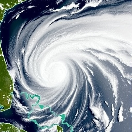
Massive hurricanes are no longer rare catastrophes separated by generations. As the climate warms, major storms are becoming more frequent, more powerful, and slower to move, allowing them to release destructive winds and rainfall over the same communities for longer periods. The 2005 Hurricane Katrina, which caused more than $100 billion in damage, was once viewed as an exceptional disaster. Today, events of comparable scale are increasingly treated as a recurring feature of a changing climate. A new study suggests that one of the most effective ways to limit the economic consequences of these storms may be hidden in a surprisingly simple signal visible from above: blue tarps covering damaged roofs.
Researchers from Kyoto University and Kobe University have developed a method that uses high-resolution drone and satellite images to identify wind-damaged homes across large areas. Their approach focuses on the temporary blue sheeting homeowners and contractors commonly place over broken roofs after a hurricane. Because these tarps are highly visible against surrounding buildings and vegetation, they can serve as a remotely detected indicator of roof damage. By analyzing their location, color, and size, the researchers were able to estimate not only which homes had been damaged, but also how severe the damage was likely to be.
The need for such a system is becoming increasingly urgent. Hurricanes harm residential properties through both flooding and wind, yet wind damage has historically been much more difficult to measure at scale. Flood risk can be modeled using elevation maps, rainfall data, drainage systems, and hydrological simulations that estimate where water will accumulate. Wind damage, by contrast, can vary dramatically from one house to the next, depending on roof construction, building age, connections between structural components, nearby trees, and the direction and intensity of gusts. Conventional assessments often require labor-intensive inspections, insurance records, or building permits, all of which can be incomplete or delayed.
Insurance data from Hurricane Ian in 2022 illustrates the importance of the distinction. Approximately 44 percent of insurance claims were associated with flooding, while 56 percent involved wind damage. Yet researchers and policymakers have had fewer tools for mapping wind losses consistently across entire regions. A damaged roof can be difficult to identify in ordinary aerial imagery, especially when shadows, vegetation, debris, and variations in roofing materials obscure the evidence. Blue tarps provide a useful solution because they create a distinctive visual signature. In the study, image-processing techniques divided aerial photographs into regions based on color and shape, then extracted the red, green, and blue, or RGB, characteristics of areas identified as tarps. The resulting information was used to estimate the full extent of roof damage.
The research team applied the method to Hurricane Irma, which struck Florida in September 2017. Irma produced powerful winds across southern Florida, creating an unusually large natural experiment for studying how construction standards influence storm outcomes. The researchers analyzed imagery collected after the hurricane and located homes covered by blue tarps. Tarp area was treated as a proxy for damage severity: a larger covered region generally indicated a more extensive roof failure. To strengthen the analysis, the researchers compared the remote-sensing results with building-permit records, which provided an independent source of information about repairs and structural damage.
The study examined more than one million homes across eight counties in southern Florida, making it one of the largest attempts to measure residential wind damage using remotely detected evidence. The researchers then investigated the effect of Florida’s 2001 Building Code, known as the 2001 FBC. The code required newly constructed and re-roofed homes to use stronger roof-to-wall connections and thicker roof decking. In some locations, it also required impact-resistant windows and doors. These features are designed to prevent a small breach from becoming a catastrophic structural failure. Once wind lifts part of a roof or breaks a window, internal air pressure can rise rapidly, increasing the forces acting on the building envelope and accelerating damage.
To estimate the building code’s effect, the researchers used a regression discontinuity design. This statistical method compares homes constructed just before and just after a policy threshold, under the assumption that nearby buildings are broadly similar except for their exposure to the new regulation. Because the 2001 FBC applied according to construction timing, the researchers could examine whether homes on opposite sides of the regulatory cutoff experienced different outcomes during Irma. The approach does not simply compare old and new houses across an entire region, where differences in location, income, design, or maintenance could distort the result. Instead, it focuses on properties close to the policy boundary and asks whether the code produced a measurable change in wind vulnerability.
The findings indicate that the code had a substantial protective effect. Homes built under the 2001 FBC were approximately 22 percent less likely to show evidence of wind damage after Hurricane Irma. When damage did occur, its estimated severity was about 27 percent lower. The results suggest that construction standards can reduce both the probability of failure and the scale of losses once a building is affected. That distinction matters for homeowners and communities: a roof that sustains limited damage may be repaired quickly, while a severely compromised structure can remain exposed to rain, mold, theft, and further collapse.
The economic consequences extended beyond repair bills. The researchers found that damaged homes sold before repairs were more difficult to sell and, when they did change hands, fetched approximately 13.3 percent less than comparable undamaged homes. That reduction amounted to about $29,400 on average. The result shows that the cost of a hurricane is not limited to insurance payouts or construction work. Damage can reduce a property’s marketability, interrupt household finances, and impose losses on owners who must sell before restoration is complete. When multiplied across thousands of homes, these individual effects can become a major regional economic shock.
The researchers estimate that homeowners covered by the stronger standards spent thousands of dollars on reinforced roofs and impact-resistant features, with an average preventative cost of about $4,930. Their findings suggest that these investments delivered benefits not only by reducing physical damage but also by preserving property value after a storm. “This study provides large-scale evidence that stronger building codes are effective for reducing wind risk and adapting to climate change,” said co-author Kenji Takeuchi. By combining remote sensing, image segmentation, administrative records, and economic analysis, the study offers a practical framework for evaluating resilience policies in places where hurricanes are becoming more destructive. The same method could potentially be adapted to future storms, allowing authorities to map damage faster, target inspections, and measure whether new building requirements are working before the next disaster arrives.
Web References: https://doi.org/10.1257/pol.20240544
References: American Economic Journal: Economic Policy, “Are Building Codes an Effective Adaptation to Wind Risk? Evidence from Remotely Detected Blue Tarps,” DOI: 10.1257/pol.20240544
Cite Scienmag News
Russell Cooper. (August 18, 2026). Satellites Improve Assessment of Hurricane Wind Damage. Scienmag. https://scienmag.com/satellites-improve-assessment-of-hurricane-wind-damage/
Russell Cooper. "Satellites Improve Assessment of Hurricane Wind Damage." Scienmag, 18 August 2026, https://scienmag.com/satellites-improve-assessment-of-hurricane-wind-damage/. Accessed 4 September 2026.
Russell Cooper. "Satellites Improve Assessment of Hurricane Wind Damage." Scienmag. August 18, 2026. https://scienmag.com/satellites-improve-assessment-of-hurricane-wind-damage/


