
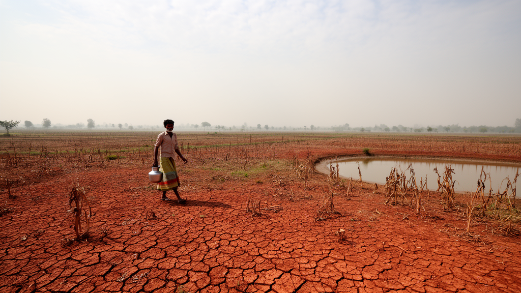
Annual rainfall across the Barind Tract of northwestern Bangladesh has been trending downward at most of the stations that measure it, according to a new 25-year analysis of records from 18 gauges operated by the Bangladesh Water Development Board. The study, published in Discover Atmosphere, examined continuous annual rainfall data from 2000 to 2024 and found statistically significant declines concentrated in the western and southwestern parts of the region, while a handful of eastern stations showed smaller, statistically insignificant increases. The result is a picture of pronounced spatial heterogeneity rather than a uniform regional shift, in one of the country’s most water-stressed landscapes.
The Barind Tract is a drought-prone physiographic unit covering roughly 7,700 square kilometers between approximately 24°20′–25°35′ N latitude and 88°15′–89°30′ E longitude, spanning the districts of Chapai Nawabganj, Naogaon, and Rajshahi. The region sits on a Pleistocene terrace of reddish-brown clay and silty loam soils with low infiltration capacity, which restricts groundwater recharge. It is bounded by the Ganges River to the south and west, limiting lateral aquifer recharge, and by the Atrai River floodplain to the east. Elevation ranges from 15 to 45 meters above sea level across gently undulating terrain.
The climate is tropical monsoonal, with a distinct wet season from June to October and a prolonged dry season. Annual rainfall varies between 1,250 and 2,000 millimeters, with more than 80 percent concentrated in the monsoon months of June through September. Inter-annual and intra-seasonal variability is pronounced, often producing recurrent drought conditions. Temperatures range from average winter minima of about 10 degrees Celsius to pre-monsoon maxima exceeding 40 degrees Celsius, which exacerbates evapotranspiration losses. Agriculture in the region, particularly boro rice cultivation, depends almost exclusively on groundwater irrigation, and over-extraction has been associated with water table declines of 2 to 5 meters in recent decades, particularly in Chapai Nawabganj and Naogaon.
The researchers obtained rainfall data from the Bangladesh Water Development Board, whose website lists 19 rainfall stations across the Barind Tract. Only 18 of these provide continuous 25-year records, so one station was excluded due to insufficient data availability. Missing monthly rainfall values were replaced with the mean of that month computed from available data across all stations, a practice the authors describe as standard in the literature. Descriptive statistics, including the mean, standard deviation, minimum, maximum, and coefficient of variation, were calculated before trend analysis, and skewness and kurtosis were used to examine distributional characteristics.
To detect and quantify trends, the study applied the non-parametric Mann-Kendall test together with Sen’s slope estimator, which reports the median rate of change in millimeters per year. These methods were chosen because they are robust to non-normal distributions and missing data. The Shapiro-Wilk test at the 5 percent significance level indicated that 15 of the 18 rainfall series followed a normal distribution, while three stations showed non-normality; because the Mann-Kendall test does not require normality, it was applied uniformly without data transformation. Rainfall anomalies were additionally examined using the Standardized Anomaly Index, which expresses each year’s rainfall as a deviation from the long-term mean scaled by the standard deviation, allowing inter-annual wet and dry fluctuations to be compared across stations.
The descriptive results revealed a clear southwest-to-northeast gradient in both mean rainfall and variability. Western stations including Badalgachi, Nachole, and Chapai Nawabganj recorded the lowest long-term means, between 1,188 and 1,310 millimeters, with standard deviations of roughly 263 to 358 millimeters. Eastern and peripheral stations such as Ahsanganj, Sapahar, and Bholahat showed higher mean totals of 1,452 to 1,503 millimeters and greater variability, with standard deviations of 408 to 498 millimeters, a pattern the authors attribute in part to localized orographic and convective contributions. Inter-annual variability, measured by the coefficient of variation, ranged from 16.34 percent at Mohadebpur to 33.14 percent at Ahsanganj. Skewness coefficients ranged from −0.49 at Puthia to +3.02 at Bholahat, and kurtosis values spanned 1.71 at Manda to 13.19 at Bholahat, with 14 of 18 stations exceeding the mesokurtic benchmark of 3, indicating heavy-tailed distributions prone to extreme wet or dry years.
The Mann-Kendall analysis identified seven stations with statistically significant drying trends, clustered in the northwest and southwest. Badalgachi recorded the steepest reduction, with a Sen’s slope of −34.99 millimeters per year and a Mann-Kendall tau of −0.47 at p = 0.00, followed by Nachole at −23.54 millimeters per year (tau = −0.45, p = 0.00), Chapai Nawabganj at −20.29 millimeters per year (tau = −0.41, p = 0.00), Tanore at −24.19 millimeters per year (tau = −0.33, p = 0.02), Rohanpur at −14.79 millimeters per year (tau = −0.36, p = 0.01), Manda at −15.23 millimeters per year (tau = −0.29, p = 0.05), and Sardah at −13.10 millimeters per year (tau = −0.27, p = 0.07). By contrast, central and northeastern stations showed weak negative trends or insignificant positive slopes: Rajshahi at +5.05 millimeters per year (p = 0.56), Nazipur at +4.11 millimeters per year (p = 0.44), and Ahsanganj at +23.44 millimeters per year (p = 0.10). The authors suggest these localized gains may reflect orographic convection and proximity to residual floodplain storage, though they remain statistically insignificant.
Analysis of the record in five-year intervals revealed evolving dynamics that mostly did not reach formal statistical significance. The 2000–2004 window showed predominantly positive Mann-Kendall tau values and Sen’s slopes at stations such as Badalgachi (tau = +0.8, slope = +76.9 millimeters per year) and Sapahar (tau = +0.8, slope = +100.8), suggesting a transient wetting phase. The 2005–2009 interval showed negative tau values at over two-thirds of stations, consistent with a regional drying tendency, while 2010–2014 indicated modest recovery at a few stations. The 2015–2019 and 2020–2024 periods again showed predominantly negative tau values and declining slopes, including Chapai Nawabganj (tau = −0.6, slope = −118.4) and Ahsanganj (tau = −0.6, slope = −291.8). The authors emphasize that none of these five-year segments reach classical significance thresholds, but the persistent predominance of negative slopes at western and southwestern stations points to a drying tendency that warrants further monitoring.
The Standardized Anomaly Index identified multi-year drought clusters during 2005–2009 and 2020–2024, which coincide with known groundwater stress hotspots in Chapai Nawabganj and Naogaon. These periods also coincide with moderate to strong El Niño events, which the authors note may have influenced monsoonal rainfall deficits in northern Bangladesh, while explicitly stating that causality cannot be formally inferred at the station level. The overall SAI trend line indicates a gradual decline in rainfall anomalies over the study period. Spatially, stations closer to river channels or low-lying floodplains show comparatively smaller negative slopes, which the authors interpret as a possible moderating influence of local hydrology, whereas interior plateau stations exhibit more pronounced declining trends. Physical factors such as proximity to the Ganges and Atrai rivers, orographic influences, and land-use changes including agricultural expansion and urbanization may modulate the observed gradients.
The authors acknowledge several limitations. Serial correlation was not formally tested before the Mann-Kendall analysis, and the use of annual data limits exploration of seasonal and intra-annual fluctuations. They recommend that future research extend beyond annual aggregates to examine monsoon versus pre-monsoon shifts, which may diverge, and incorporate complementary datasets such as high-resolution satellite precipitation, reanalysis products, and evapotranspiration analyses via the Standardized Precipitation Evapotranspiration Index, alongside socioeconomic vulnerability mapping. Within those constraints, the study establishes a baseline of observed rainfall change for drought monitoring, water-resource allocation, and the design of targeted climate-resilience interventions, highlighting the western and southwestern Barind, where significant declines align with acute groundwater depletion, as priority areas for measures such as managed aquifer recharge.
Subject of Research: Long-term annual rainfall trends and variability in the drought-prone Barind Tract of northwestern Bangladesh
Article Title: Spatial-temporal analysis of annual rainfall trends and variability in the Barind Tract
Article References: Esha, M. Z., Khan, M. S. A., & Tabassum, S. (2026). Spatial-temporal analysis of annual rainfall trends and variability in the Barind Tract. Discover Atmosphere, 4(1), Article 14. https://doi.org/10.1007/s44292-026-00082-w
Image Credits: AI Generated
DOI: 10.1007/s44292-026-00082-w
Keywords: Barind Tract, Bangladesh, rainfall trends, Mann-Kendall test, Sen's slope, Standardized Anomaly Index, drought, groundwater depletion, hydro-climatic variability, water resources, monsoon, climate variability
Cite Scienmag News
Russell Cooper. (October 30, 2026). Rainfall Is Declining Across Bangladesh’s Drought-Prone Barind Tract, 25-Year Study Finds. Scienmag. https://scienmag.com/rainfall-is-declining-across-bangladeshs-drought-prone-barind-tract-25-year-study-finds/
Russell Cooper. "Rainfall Is Declining Across Bangladesh’s Drought-Prone Barind Tract, 25-Year Study Finds." Scienmag, 30 October 2026, https://scienmag.com/rainfall-is-declining-across-bangladeshs-drought-prone-barind-tract-25-year-study-finds/. Accessed 4 November 2026.
Russell Cooper. "Rainfall Is Declining Across Bangladesh’s Drought-Prone Barind Tract, 25-Year Study Finds." Scienmag. October 30, 2026. https://scienmag.com/rainfall-is-declining-across-bangladeshs-drought-prone-barind-tract-25-year-study-finds/