


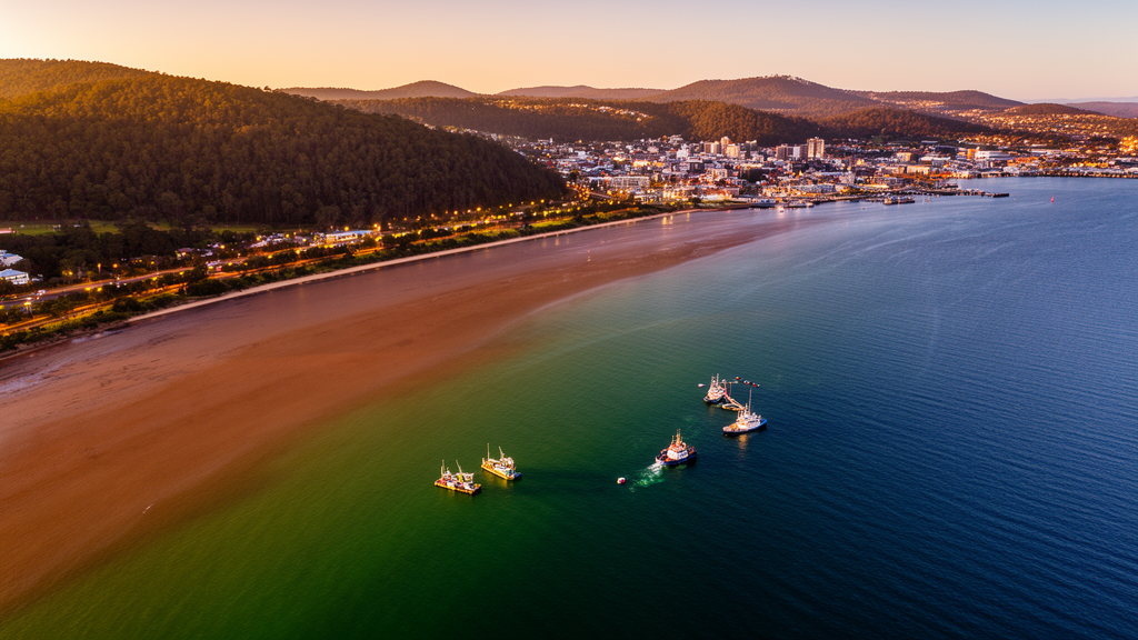
A pilot study led by the Derwent Estuary Program applied the UN System of Environmental-Economic Accounting for Ecosystem Accounting (SEEA-EA) to Tasmania’s Derwent Estuary, linking seagrass monitoring data to estimated physical and monetary ecosystem-service accounts. Between 2016 and 2019, the accounting exercise estimated that improved seagrass condition was associated with greater carbon storage, annual sequestration and fish-biomass enhancement. The study also found that fragmented, outdated and spatially limited data prevented a complete assessment of the estuary’s ecosystems.
The Derwent Estuary Program is a conservation not-for-profit organisation established in 1999 as a partnership among state and local governments, industries, scientists and the community. It coordinates ecological monitoring, engages with stakeholders and reports on the health of the 198-square-kilometre estuary. The pilot study examined how a conservation organisation could use SEEA-EA to connect existing monitoring with decisions about natural-resource management, reporting and stakeholder communication.
Researchers compiled environmental and socioeconomic information from the organisation, government reports and scientific literature. The framework includes accounts for ecosystem extent, condition, physical service flows, monetary service flows and monetary ecosystem assets. For the Derwent Estuary, the extent account drew on the Derwent Estuary Habitat Atlas and its primarily 2007 habitat observations. Sand and silt covered approximately 17,060 hectares, followed by sand flat and beach at 1,140 hectares, seagrass at 680 hectares, rocky reef at 300 hectares and saltmarsh at 220 hectares.
Seagrass condition was calculated from average photo-quadrat measurements at four sites in the upper and middle estuary: Murphys Flat, Dromedary Marsh, Granton Banks and Jordan River. In 2016, seagrass cover was 0.1, bare sediment cover 0.35 and algae cover 0.53. By 2019, seagrass cover had risen to 0.67 and algae cover had fallen to 0.1. The study described the 2016 condition as very poor and reported that high nutrient loading and low river discharge were likely contributors, while also noting substantial year-to-year variability in the estuary’s seagrass condition.
Because no time series of mapped seagrass extent was available, the researchers used bare sediment cover as a proxy for reduced seagrass coverage. On that basis, they estimated effective seagrass extent at 442 hectares in 2016 and 544 hectares in 2019. Rocky reef condition was assessed separately from a 2010 baseline survey covering 27 sites. Normalised diversity and abundance indicators generally indicated better reef condition in the lower estuary than in the middle estuary, although fish abundance was highest in the middle zone. The authors did not incorporate the rocky reef metrics into service accounts because appropriate physical and monetary valuation methods were unavailable.
The service accounts covered climate regulation and fish nursery services supplied by seagrass, plus recreational fishing associated with the estuary as a whole. Where local estimates were unavailable, the study used benefit transfer. Australian unit estimates indicated that one hectare of seagrass supports 55,589 additional fish, equivalent to 4,064 kilograms of biomass enhancement, valued at A$21,276 per hectare annually. Climate-regulation calculations combined temperate Australian seagrass carbon rates with an Australian Carbon Credit Unit price of A$33.75 per tonne of carbon dioxide observed in December 2023.
These calculations produced account estimates rather than direct measurements of complete ecosystem benefits. The model estimated that seagrass stored approximately 183,740 tonnes of carbon dioxide in soil and biomass in 2016, valued at A$6.20 million, and 226,141 tonnes in 2019, valued at A$7.63 million. Estimated annual sequestration increased from 811 tonnes of carbon dioxide, valued at A$27,374, to 998 tonnes, valued at A$33,691. Estimated fish-biomass enhancement rose from 1,796 tonnes, valued at A$9.40 million, to 2,211 tonnes, valued at A$11.57 million.
Recreational fishing was valued from two Tasmanian surveys covering annual expenditure in 2013 and 2018. The accounts estimated total annual consumer expenditure of A$9.63 million among 9,557 recreational fishers in 2013 and A$12.44 million among 6,961 fishers in 2018. These expenditure-based estimates represent the monetary account for the cultural service and were not equivalent to a comprehensive valuation of all benefits from the estuary. A separate Tasmanian survey reported that 94% of fishing trips were satisfying regardless of whether fish were caught, underscoring the importance of non-catch benefits.
The pilot was constrained by a single 2007 habitat-extent observation, condition data with inconsistent geographical and temporal coverage, and the exclusion of saltmarsh data that were too variable for suitable condition metrics. Uncertainty compounded as estimates of habitat extent affected physical service quantities and then their monetary values; benefit-transfer estimates added further uncertainty. The researchers recommended more locally relevant ecological data, regular habitat mapping using remote-sensing advances, standardised condition indicators linked to specific services, and closer collaboration among ecologists, economists, accountants and data providers. They cautioned that repeated accounts could improve data quality and stakeholder trust, but widespread reliance on transferred estimates could weaken incentives to collect local data.
Subject of Research: Pilot application of SEEA-EA ecosystem accounts to a conservation-managed estuary in Tasmania
Article Title: Applying Marine and Coastal Ecosystem Accounting in an estuary managed by a Not-for-Profit Organisation: Evidence from Australia
Article References: Ha, D., Pelletier, M.-C., Weller-Wong, A., Alshamari, A., Horner, C., & Finau, G. (2025). Applying Marine and Coastal Ecosystem Accounting in an estuary managed by a Not-for-Profit Organisation: Evidence from Australia. One Ecosystem, 10, Article e153237. https://doi.org/10.3897/oneeco.10.e153237
Image Credits: AI Generated
DOI: 10.3897/oneeco.10.e153237
Keywords: SEEA-EA, ecosystem accounting, Derwent Estuary, seagrass condition, ecosystem services, marine conservation, benefit transfer, Tasmania, Derwent Estuary Program, not-for-profit management, Applying, Marine
Cite Scienmag News
Gavin Prescott. (October 20, 2026). Pilot ecosystem accounts link Derwent Estuary seagrass condition to estimated services. Scienmag. https://scienmag.com/pilot-ecosystem-accounts-link-derwent-estuary-seagrass-condition-to-estimated-services/
Gavin Prescott. "Pilot ecosystem accounts link Derwent Estuary seagrass condition to estimated services." Scienmag, 20 October 2026, https://scienmag.com/pilot-ecosystem-accounts-link-derwent-estuary-seagrass-condition-to-estimated-services/. Accessed 20 October 2026.
Gavin Prescott. "Pilot ecosystem accounts link Derwent Estuary seagrass condition to estimated services." Scienmag. October 20, 2026. https://scienmag.com/pilot-ecosystem-accounts-link-derwent-estuary-seagrass-condition-to-estimated-services/


