


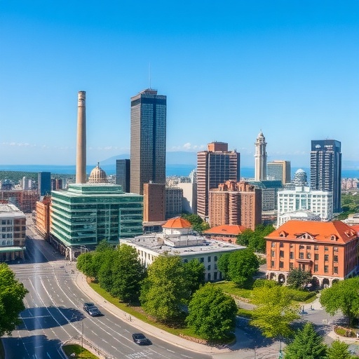
Urban landscapes around the world are grappling with the dual threats of escalating heat and deteriorating air quality, challenges that are particularly acute in humid subtropical climates. Recent groundbreaking research led by Zhu, L., Wang, F., Nielsen, C.P., et al., published in Nature Communications (2026), unveils a compelling approach that addresses these intertwined urban stressors through optimized spatial planning. This innovative study provides a roadmap for cities seeking sustainable solutions to mitigate urban heat islands and curb air pollution simultaneously, an achievement with profound implications on public health and urban livability.
At the heart of this research lies the concept of spatial optimization—a strategic methodology for urban planning that thoughtfully integrates land use, vegetation, and pollution control measures to maximize environmental benefits. Humid subtropical regions, characterized by high temperatures, moisture levels, and rapid urban growth, face intensified urban heat island effects and air stagnation that exacerbate pollutant concentrations. The study’s authors developed sophisticated computational models simulating various urban configurations, demonstrating how targeted spatial planning can disrupt the feedback loop between heat accumulation and pollutant entrapment.
One of the key technical innovations in this research is the coupling of microclimate modeling with atmospheric chemistry simulations. This dual-model framework accounts for heat transfer dynamics, solar radiation absorption, and the dispersion and chemical transformation of pollutants such as ozone and particulate matter. By leveraging high-resolution data, the team elucidated how green infrastructure placements, building orientation, and open space design interact to create microenvironments that cool urban areas and facilitate pollutant dispersion, thereby improving air quality.
The results reveal that conventional urban planning often overlooks the synergistic effects between heat and air pollution. For instance, densely built areas with limited ventilation exacerbate both thermal stress and pollutant concentration due to restricted airflow and surface heat retention. In contrast, optimized spatial layouts that introduce corridors of vegetation and strategically spaced high-albedo surfaces significantly enhance convective cooling and ventilation, alleviating these compounding issues.
Furthermore, the researchers emphasize the importance of vegetation not only for shading and evapotranspiration but also as active pollutant sinks. Strategic placement of tree canopies and green belts can reduce surface temperatures by several degrees Celsius while simultaneously capturing airborne particulates and facilitating the chemical breakdown of urban pollutants. This multipronged role challenges prior assumptions that treated heat mitigation and air quality management as separate endeavors.
Another critical insight concerns the temporal dynamics of heat and air pollution interaction. The study’s simulation shows that afternoon peaks in urban temperature lead to increased formation of secondary pollutants like ozone, intensifying health risks. The optimized spatial patterns mitigate these peaks by enhancing natural ventilation during critical hours, disrupting the photochemical reactions that generate ozone in the urban canopy layer.
Crucially, the approach presented is scalable and adaptable. Through customizable parameters reflecting local climate, topography, and emission sources, city planners can generate bespoke optimization plans tailored to their unique challenges. This adaptability is vital for humid subtropical cities, which are projected to endure heightened heat stress due to climate change, making preemptive design interventions essential for resilience.
Beyond environmental improvements, the study highlights ancillary social and economic benefits. Cooler urban environments reduce energy demand for air conditioning, thereby lowering greenhouse gas emissions and utility costs. Enhanced air quality directly correlates with reduced respiratory and cardiovascular morbidity, decreasing healthcare burdens and improving life quality for vulnerable populations disproportionately impacted by urban pollution and heat.
This research also contributes to the evolving discourse on sustainable urban development by bridging the gap between ecological science and urban design. It advocates for a paradigm shift where spatial planning incorporates multidisciplinary environmental modeling, transcending traditional zoning and land-use decisions to an integrated system approach that considers atmospheric physics and chemistry.
The integration of advanced geospatial analytics and machine learning techniques in model development marks a significant technical advancement. These tools enable the processing of complex datasets at unprecedented resolutions, capturing fine-scale environmental heterogeneities critical for precise optimization outcomes. Moreover, the open-access nature of the study’s framework encourages replication and customization across diverse urban contexts worldwide.
Critically, the authors identify implementation barriers, including institutional inertia, regulatory challenges, and stakeholder engagement complexities. However, they argue that the mounting costs of inadequate urban heat and pollution management underscore the urgency to adopt such scientifically grounded planning tools. Pilot projects in select humid subtropical cities are already underway, showcasing promising preliminary results and community acceptance.
In summary, Zhu, Wang, Nielsen, and colleagues’ study presents a holistic and technically robust solution to some of the most pressing urban environmental problems. By harnessing optimized spatial planning, cities in humid subtropical climates can effectively combat the compounded impacts of urban heat and air pollution. This approach not only improves environmental conditions but also advances urban sustainability and public health, signaling a transformative way forward in climate-adaptive city planning.
As global urbanization continues unabated, and climate risks escalate, such innovative research exemplifies the critical nexus of science and policy needed to build healthier, more resilient cities. The dual benefits attained through spatial optimization strategies offer a beacon of hope for millions living under the growing pressures of heat stress and air pollution, embodying a visionary pathway toward urban futures that are both livable and sustainable.
Cite Scienmag News
Russell Cooper. (May 30, 2026). Optimized Planning Cools Cities, Cuts Pollution. Scienmag. https://scienmag.com/optimized-planning-cools-cities-cuts-pollution/
Russell Cooper. "Optimized Planning Cools Cities, Cuts Pollution." Scienmag, 30 May 2026, https://scienmag.com/optimized-planning-cools-cities-cuts-pollution/. Accessed 3 September 2026.
Russell Cooper. "Optimized Planning Cools Cities, Cuts Pollution." Scienmag. May 30, 2026. https://scienmag.com/optimized-planning-cools-cities-cuts-pollution/


