


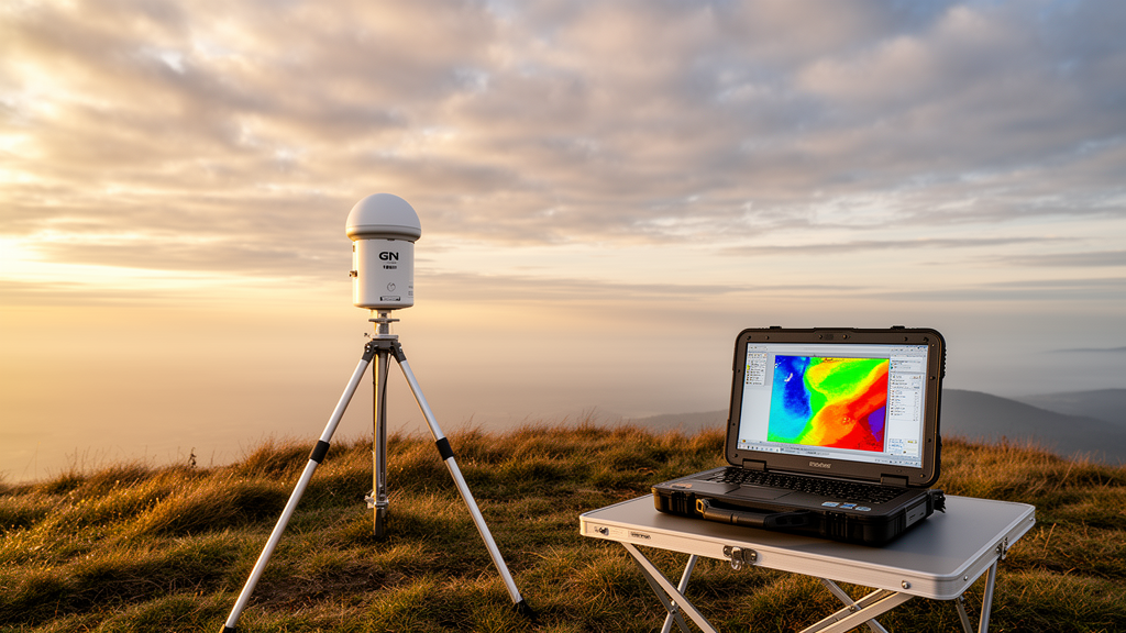
Water vapor is the atmosphere’s great mover. It carries latent heat, feeds storms, warms the planet as a greenhouse gas and shapes rainfall patterns across every continent. Yet despite its importance, measuring exactly how much moisture sits at each altitude above a given point on Earth remains one of the trickiest jobs in meteorology. A research team in China has now shown that a single ground-based GNSS meteorological station — the kind of receiver already installed at thousands of sites worldwide for navigation and surveying — can be paired with an artificial neural network to reconstruct the vertical distribution of absolute humidity from the surface up to 10 kilometers, in near real time, without waiting for weather balloons.
The new system, called the GNSS-based Profiling Tropospheric Humidity Network, or GPTHNet, was developed by Zhou Shoudong, Wang Degao, Zheng Qingqing and Jiang Peng and published in Frontiers in Astronomy and Space Sciences. The core idea is deceptively simple: GNSS signals traveling from satellites to a ground receiver are delayed and bent as they pass through the neutral atmosphere, and the size of that delay reveals how much water vapor lies in the column of air above the station. Meteorologists have exploited this effect for decades to calculate precipitable water vapor, a single number representing the total moisture in the column. The problem is that this column total says nothing about how the moisture is layered — whether the vapor is concentrated near the ground, pooled beneath a temperature inversion, or distributed through the middle troposphere where storms draw their fuel.
Traditionally, that vertical detail has come from radiosondes, the instrumented balloons launched twice daily from stations that may be hundreds of kilometers apart. Radiosondes are accurate, but the atmosphere between two launches, twelve hours apart, can transform entirely — a fact that matters enormously for forecasting flash floods, severe convection and monsoon rainfall. Alternatives such as microwave radiometers and Raman lidars can profile moisture continuously, but they are expensive, and their performance degrades in heavy precipitation precisely when humidity data are most valuable. GNSS tomography, which divides the troposphere into three-dimensional voxels sampled by many slant signal paths, offers a continuous alternative but demands a dense network of receivers covering the region of interest, along with carefully tuned mathematical constraints.
The Chinese team’s approach sidesteps that infrastructure requirement entirely. Instead of physically inverting signal paths, their multilayer perceptron learns the statistical relationship between what a single station can measure and what the humidity profile looks like. The network’s inputs fall into two categories. The first part describes the current atmospheric state at the profiling moment: surface air pressure, temperature and absolute humidity measured at two meters, the GNSS-derived precipitable water vapor, and the decimal day of year, which encodes seasonality. The second part provides an initialization snapshot from the most recent radiosonde launch before the profiling epoch: ground-level meteorology, the radiosonde-derived column water vapor, the full measured humidity profile, and the eastward and northward wind components resampled onto standard heights. From these inputs, the network outputs absolute humidity at 40 height levels from 250 meters to 10,000 meters, at 250-meter intervals.
Training data came from the Atmospheric Radiation Measurement User Facility’s Tropical Western Pacific site in Darwin, Australia, a location chosen for its extreme humidity variability and its monsoon cycle. The researchers assembled 5,872 input samples from radiosonde and surface measurements spanning 2002 to 2011, correcting known dry-bias and time-lag artifacts in the Vaisala RS-80 and RS-92 sondes using the ARM Sonde Adjust value-added product. The dataset was split 60:20:20 into training, validation and test sets. Rather than guessing at an architecture, the team grew their networks neuron by neuron, training each configuration a thousand times, adding hidden layers until the validation loss converged. The final initialization model stacks an input layer of 130 neurons, two hidden layers of 91 and 81 ReLU units, and a linear output layer of 40 neurons, trained with a quadratic cost function and the Adam optimizer at a learning rate of 0.01, with early stopping guarding against overfitting.
A second model, ANN_NoInit, was built for situations where no radiosonde sounding is available to seed the retrieval. It relies only on the surface and GNSS inputs, using six input neurons and three hidden layers of 100, 82 and 56 units. The trade-off is clear in the results: both models track radiosonde profiles well, but the initialized version captures fine structure — including humidity inversion layers in the middle and upper atmosphere — that the uninitialized model smooths away. On the withheld test data, the initialized model’s bias stayed within ±0.14 grams per cubic meter at all standard levels, with a root mean square error peaking at 1.72 grams per cubic meter at 500 meters and falling to just 0.07 grams per cubic meter at the top level.
The crucial test came with data the networks had never seen in any form. The researchers constructed GNSS–radiosonde-combined inputs, in which the real-time part of the input was drawn from the DARW station of the International GNSS Service rather than from balloons, converting the station’s zenith total delay into precipitable water vapor using a hydrostatic delay model and their own time-varying global temperature model for the wet-delay conversion. After a 45-meter height adjustment between the GNSS and radiosonde sites, the GNSS-derived water vapor agreed with the balloon values with a correlation of 0.98. Feeding 419 such samples from 2012 into the trained networks, the initialized model achieved a maximum root mean square error of 1.90 grams per cubic meter at 500 meters, degrading gracefully to below 0.1 grams per cubic meter at the highest levels — accuracy the authors report as comparable to full GNSS tomography, but achievable with a single receiver.
Independent validation against Raman lidar, which profiles moisture every 10 minutes at 75-meter vertical resolution, exposed both the method’s potential and its limits. During two weeks of the monsoon season, the initialized model’s relative error grew from roughly 12 percent at the lowest level to about 75 percent aloft, while in the dry season the error peaked near 2,250 meters, where absolute humidity drops sharply. The uninitialized model fared notably worse in dry conditions, because when surface moisture is decoupled from the upper column, the network without an initialization profile can only fall back on the climatological average it learned during training. Part of the systematic underestimation against the lidar likely reflects instrument differences rather than retrieval failure: the lidar operates on an entirely different measurement principle and is known to suffer calibration uncertainties in the lower troposphere, and the neural network’s quadratic loss function naturally regresses predictions toward the mean, smoothing sharp humidity peaks.
One practical concern was the initialization lag. Because balloons launch every twelve hours, the training samples always paired a current snapshot with a twelve-hour-old profile. Testing 435 samples with shorter lags showed a reassuring result: the initialization profile itself degrades rapidly as it ages, with some errors exceeding 3.5 grams per cubic meter, while the network’s output barely changes — the fitted slope of its error against lag time was a negligible −0.0087 grams per cubic meter per hour. The network has effectively learned to correct stale soundings, which is exactly what an operational system needs.
The authors are candid about the approach’s weaknesses. Neural networks hide their physics inside opaque weights, making errors hard to diagnose, and assimilating any new input variable would require designing and retraining an entirely new architecture. But they also point to a practical path forward: because the input and output design is site-independent, the trained networks can be adapted to new locations through transfer learning, fine-tuning with just one to two years of local radiosonde profiles rather than a decade of training data. Given that thousands of GNSS meteorological stations already stream data continuously around the globe, a technique that turns any one of them into a standalone humidity profiler — feeding severe-weather warnings, nowcasting systems and numerical weather models at refresh rates balloons can never match — could reshape how the lowest layer of the atmosphere is monitored, one receiver at a time.
Subject of Research: Retrieval of tropospheric absolute humidity profiles from a single ground-based GNSS meteorological station using artificial neural networks
Article Title: Remotely profiling the tropospheric absolute humidity using a single ground-based GNSS meteorological station based on an artificial neural network
Article References: Shoudong, Z., Degao, W., Qingqing, Z., & Peng, J. (2026). Remotely profiling the tropospheric absolute humidity using a single ground-based GNSS meteorological station based on an artificial neural network. Frontiers in Astronomy and Space Sciences, 13, Article 1984982. https://doi.org/10.3389/fspas.2026.1984982
Image Credits: AI Generated
DOI: 10.3389/fspas.2026.1984982
Keywords: GNSS meteorology, water vapor profiling, artificial neural network, precipitable water vapor, radiosonde, Raman lidar, troposphere, multilayer perceptron, weather forecasting, machine learning, absolute humidity, atmospheric remote sensing
Cite Scienmag News
Blake Davidson. (October 15, 2026). One GPS Station and an AI Now Maps Water Vapor Through the Sky. Scienmag. https://scienmag.com/one-gps-station-and-an-ai-now-maps-water-vapor-through-the-sky/
Blake Davidson. "One GPS Station and an AI Now Maps Water Vapor Through the Sky." Scienmag, 15 October 2026, https://scienmag.com/one-gps-station-and-an-ai-now-maps-water-vapor-through-the-sky/. Accessed 15 October 2026.
Blake Davidson. "One GPS Station and an AI Now Maps Water Vapor Through the Sky." Scienmag. October 15, 2026. https://scienmag.com/one-gps-station-and-an-ai-now-maps-water-vapor-through-the-sky/


