For decades, scientific models have relentlessly sought to predict the behavior of sand and dust storms (SDS) around the globe, aiming to mitigate their far-reaching impacts on both climate and human health. Yet, despite decades of development leveraging satellite data, ground measurements, and climate observations, existing models consistently over-predict the timing and scope of sediment transport on Earth’s surface. A pioneering study spearheaded by Cardiff University has now unveiled a groundbreaking satellite-driven model, termed dEARTH, that dynamically captures the shifting nature of soil surfaces—thereby revolutionizing the fidelity of sand and dust storm emission predictions.
Traditional sediment transport models hinge on two critical yet flawed assumptions: they consider soil surfaces static over time and presume a constant threshold wind velocity required to initiate sediment motion. This simplification effectively ignores the dynamic interactions between wind forces, soil crusting, vegetation cover, and sediment availability — factors that continuously evolve in response to environmental conditions. The Cardiff-led team has demonstrated that these oversimplifications ultimately lead to substantial inaccuracies in forecasting sediment fluxes, artificially inflating the extent and frequency of dust mobilization by wind.
Published in Nature Communications Earth and Environment, the dEARTH model introduces an innovative methodology that harnesses real-time satellite imagery to capture critical changes in surface roughness, crust formation, vegetation shielding, and sediment supply. By leveraging optical remote sensing data, the model dynamically adjusts the thresholds for sediment entrainment based on the current physical state of land surfaces. This approach enables the temporal and spatial variability of sediment availability and transport risk to be realistically accounted for, providing a substantial leap forward from static parameterizations used in prior models.
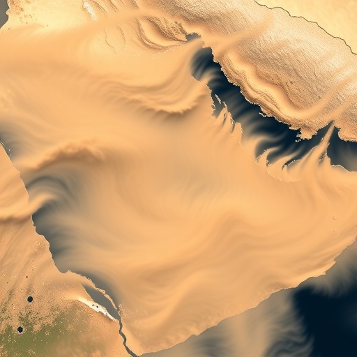
At the core of dEARTH’s innovation is its capacity to interpret subtle pixel-level variations from satellite reflectance imagery. These variations reflect soil surface conditions in greyscale, fluctuating from white to black, with additional consideration for snow cover changes. Overlaying these greyscale indicators are dynamic colour-coded signals—ranging from yellow to red—that denote sites and extents of sediment transport, classified by size and intensity. These data layers collectively enable the model to detect rapid feedback mechanisms whereby small sediment transport events can swiftly escalate into larger fluxes, a phenomenon deeply rooted in the soil properties and wind interactions.
Testing the model against the environmental conditions of 2024 revealed profoundly different insights compared to classical sediment transport predictions. dEARTH estimated that sediment transport impacts cover 69% less of the global terrestrial surface than previously thought, while total global sediment flux was recalculated to be 45% lower. These revisions collectively emphasize that sediment transport is considerably sparser and more episodic, challenging long-held perceptions about the pervasiveness of dust storm phenomena.
The implications of these findings extend far beyond theoretical modeling improvements. Sand and dust storms serve as critical modulators of atmospheric composition, influence radiative forcing, and act as vectors of nutrients and pollutants. Overestimations in sediment transport forecasts have cascading consequences, skewing climate models, air quality assessments, and land degradation evaluations. By refining the understanding of where and when sediment mobilization occurs, dEARTH enhances the accuracy of early warning systems, which policymakers and communities rely upon to prepare for hazardous SDS events.
Researchers underscore that dEARTH does not diminish the seriousness of health and environmental risks posed by dust storms. Instead, it provides a foundation for more realistic and operationally reliable predictions. By factoring in the state-dependent nature of surface thresholds and sediment supply, the model captures the intricate dance between atmospheric forces and Earth’s heterogeneous terrains. This dynamic representation is particularly timely, coinciding with global initiatives such as the UN Decade to Combat Sand and Dust Storms (2025–2034), where accurate monitoring and mitigation strategies will be paramount.
Lead author Dr. Zhuoli Zhou highlights the novelty of departing from a decades-old paradigm. “Existing models have long treated the wind strength required for sediment movement as unchanging, coupled with a persistent assumption that loose sediment is always available. Our research corrects this by modeling how soil surface features, like crusting and vegetation, evolve and influence sediment flux thresholds dynamically,” Dr. Zhou explains. These insights represent an essential recalibration in Earth system science, reiterating that the Earth’s surface is a continuously adapting interface, not a fixed boundary.
Operational integration of dEARTH’s dynamic threshold framework is envisaged as a future milestone. The research team envisions embedding the model within current dust emission and early warning infrastructures, facilitating a satellite-enabled, globally consistent monitoring platform for wind erosion and dust mobilization. Such a system promises to revolutionize land management practices, offering precise data-driven guidance to mitigate environmental degradation while improving climate adaptation capacities.
Professor Adrian Chappell, co-author and expert in Earth surface processes, stresses the technological breakthrough achieved: “By moving beyond numerical simulations with static parameters and exploiting optical satellite remote sensing, we now possess the tools to quantify the highly variable nature of sediment transport processes across space and time. This step change enhances not just model reliability but also the practical utility of predictions that inform public health and environmental policies worldwide.”
As the scientific community grapples with the complexities introduced by changing climates and land use patterns, models like dEARTH represent an essential evolution in predictive capability. They underscore the necessity of integrating multi-scale observational data into simulations and challenge researchers to rethink assumptions that no longer hold in an era marked by rapid global change. Beyond academic circles, this advancement holds the promise of tangibly improving the resilience of vulnerable populations against the scourges of dust storms, air pollution, and related ecological crises.
In summary, dEARTH offers a transformative approach to understanding and forecasting sediment flux that harmonizes satellite remote sensing data with sophisticated soil surface dynamics. By reflecting the true temporal variability of the Earth’s surface and sediment availability, the model paves the way for more accurate environmental monitoring and tailored mitigation strategies. This marks a pivotal step forward in environmental science, opening new horizons for combating the persistent and far-reaching threat of sand and dust storms in the coming decades.
Subject of Research: Not applicable
Article Title: Satellite retrieved soil surface dynamics reduce the extent and frequency of sediment flux with implications for early warning systems
News Publication Date: 23-Mar-2026
Web References: http://dx.doi.org/10.1038/s43247-026-03368-4
References: Communications Earth & Environment, DOI: 10.1038/s43247-026-03368-4
Image Credits: Cardiff University
Keywords: Sand and dust storms, sediment transport, soil surface dynamics, satellite remote sensing, Earth system modeling, sediment flux, wind erosion, dust emission, environmental monitoring, early warning systems, land degradation, computational modeling
