


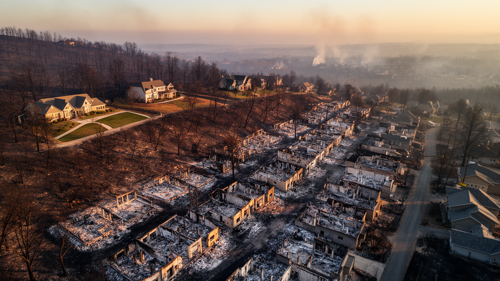
When the Palisades Fire ignited on 7 January 2025 above Pacific Palisades, it did more than burn chaparral in the Santa Monica Mountains. Driven by strong Santa Ana winds after one of the driest autumns in the region’s 45-year record, the fire pushed into dense residential fabric and destroyed 5,566 of 9,883 inspected residential structures. A new spatially validated geospatial artificial intelligence (GeoAI) study of that event now offers one of the most technically rigorous accounts yet of why some homes burned while neighboring ones survived, and its central finding is striking: the strongest pre-fire predictor of destruction was not vegetation greenness, terrain, or fuel type, but simply how many buildings stood within 100 meters of a structure.
The research, published in Frontiers in Sustainability by Parastoo Farajpoor and Mohammadreza Narimani of the University of California, Davis, links 12,081 CAL FIRE damage inspection records to an entirely open stack of satellite and map data: Sentinel-2 vegetation indices, Landsat surface temperature, LANDFIRE fuel models, 10-meter terrain data, and a dated OpenStreetMap snapshot of buildings and roads captured six days before ignition. The workflow was designed as a data-to-decision system in the spirit of urban informatics, with strict temporal separation so that no post-fire information could leak into the pre-fire predictors. Structures outside the inspected set were treated as unknown rather than undamaged, and building-envelope characteristics observed only after the fire were deliberately excluded because their observability depended on the outcome itself, a subtle form of data leakage that could let a model infer destruction from the absence of inspectable material.
The most consequential technical result concerns validation. Under conventional random cross-validation, the integrated gradient-boosting model appeared excellent, achieving a receiver operating characteristic area under the curve (ROC-AUC) of 0.92. But when the researchers evaluated the same model on spatially held-out 1-kilometer blocks of the fire footprint, performance fell to 0.75. That 0.17 AUC gap is not a statistical footnote; it is the difference between an apparently superb forecasting tool and a moderately informative neighborhood screening tool. Nearby structures share landscape, exposure history, and fire progression, so random splits allow a model to memorize local signatures rather than learn transferable relationships. The interpretable logistic model, notably, matched the more flexible gradient-boosting model under spatial blocking and showed a calibration slope closer to the ideal value of one, meaning its stated probabilities were less overconfident when applied to unfamiliar parts of the city.
Within the inspected residential population, a one-standard-deviation increase in building count within a 100-meter-radius disk was associated with a 3.74-fold increase in the conditional odds of destruction, the largest association in the model. The gradient-boosting model’s SHAP attributions told the same story, and the response was markedly non-linear: destruction odds rose sharply once roughly 50 to 60 buildings fell within the 100-meter disk. This inflection is compatible with a change in propagation opportunity as repeated ember exchange and radiant-heat exposure accumulate across dense urban fabric, echoing prior California findings that housing arrangement and structure density rival or exceed vegetation cover as correlates of loss. The researchers are careful to note that the threshold is a model-derived value within Palisades data, not a universal zoning cutoff, and that building concentration may also encode where the fire traveled and when structures were exposed.
The vegetation results complicate any simple narrative about green space being protective or hazardous. Higher neighborhood values of the Normalized Difference Moisture Index (NDMI), a shortwave-infrared measure of canopy moisture, were consistently associated with lower destruction odds across both joint and single-index model specifications, with the strongest effect at the 100 to 300 meter neighborhood scale. The Normalized Difference Vegetation Index (NDVI), a greenness measure, told a specification-dependent story: its positive coefficient in the joint model reversed when entered separately, so the data do not support an independent harmful effect of greenness. The actionable distinction, the authors argue, is among vegetation amount, moisture condition, arrangement, and continuity, and NDVI alone cannot make it. A greenness-only risk map risks conflating actively transpiring vegetation with desiccated fuel.
Smaller but coherent effects emerged for terrain, access, and construction era. Destruction odds increased at higher local topographic positions and on east-facing aspects, and decreased with elevation, distance from wildland fuels, and distance from dead-end road nodes. Newer construction year and greater assessed value were protective conditional on other predictors, a pattern compatible with progressive improvements in building practice, though year built also encodes neighborhood age and redevelopment history. Discrimination also tended to increase with spatial scale, from 0.72 for immediate 0 to 30 meter surroundings to 0.75 for the 100 to 300 meter neighborhood, suggesting that open urban data are most useful at the scale where community morphology operates.
A separate impact track, analytically isolated from the pre-fire models, characterized spectral change and post-fire recovery without contaminating the susceptibility analysis. Mean differenced Normalized Burn Ratio (dNBR) in the 30 to 100 meter ring was 159 for undamaged structures, 218 for affected structures, and 236 for destroyed structures, with broad class overlap underscoring that neighborhood spectral change differs from an individual structure’s fire exposure. Monthly tracking of relative greenness through July 2026 showed strongly seasonal recovery ordered by spectral-impact class, with NDVI reaching 64 to 77 percent of the month-matched three-year baseline by mid-2026. Because these summaries combine developed and wildland surfaces, they reflect demolition, debris clearance, and landscaping as much as ecological recovery.
The community-context analysis revealed its own boundary: the 12 census tracts containing inspected structures occupied a narrow, low range of the national Social Vulnerability Index distribution, near the least-vulnerable quarter, with tract destruction fractions ranging from 0 to 0.90 but no reliable statistical gradient. The authors stress that this restricted-range comparison shows only that a single affluent study area contains too little social variation to estimate the vulnerability relationship, not that social factors are unimportant to wildfire resilience.
The practical translation is a neighborhood-scale screening framework rather than a parcel-level prediction system. The proposed pathway runs from computational screening to professional assessment, field verification, and planning action, with every indicator coupled to its valid scale and uncertainty. Dense-fabric areas flagged by the model would trigger coordinated assessment of the adjacent-building interface, including ember-resistant vents and roofs, ignition-resistant fencing, and reduced combustible continuity, while vegetation programs would replace greenness-only screening with moisture-aware assessments that preserve urban canopy’s cooling value. Because the entire pipeline is scripted and archived with public replication code, it can be rerun as inspection data are released for future fires, building toward a multi-event benchmark. Until coefficients and density thresholds are tested across additional fires and urban forms, the authors conclude, they should not be treated as operationally transferable, but as an auditable single-event baseline for comparative urban wildfire resilience science.
Subject of Research: Urban wildfire resilience and explainable GeoAI modeling of structure loss in the 2025 Palisades Fire
Article Title: Explainable GeoAI for urban wildfire structure loss: vegetation and built environment in the 2025 palisades fire
Article References: Explainable GeoAI for urban wildfire structure loss: vegetation and built environment in the 2025 palisades fire. (n.d.). https://doi.org/10.3389/frsus.2026.1975724
Image Credits: AI Generated
DOI: 10.3389/frsus.2026.1975724
Keywords: Palisades Fire, GeoAI, urban wildfire, spatial cross-validation, building density, vegetation moisture, NDMI, NDVI, wildland-urban interface, urban informatics, CAL FIRE, Sentinel-2
Cite Scienmag News
Blake Davidson. (October 16, 2026). Neighborhood building density emerges as strongest predictor of home destruction in 2025 Palisades Fire. Scienmag. https://scienmag.com/neighborhood-building-density-emerges-as-strongest-predictor-of-home-destruction-in-2025-palisades-fire/
Blake Davidson. "Neighborhood building density emerges as strongest predictor of home destruction in 2025 Palisades Fire." Scienmag, 16 October 2026, https://scienmag.com/neighborhood-building-density-emerges-as-strongest-predictor-of-home-destruction-in-2025-palisades-fire/. Accessed 16 October 2026.
Blake Davidson. "Neighborhood building density emerges as strongest predictor of home destruction in 2025 Palisades Fire." Scienmag. October 16, 2026. https://scienmag.com/neighborhood-building-density-emerges-as-strongest-predictor-of-home-destruction-in-2025-palisades-fire/


