


Multiscale Urban Modeling Reveals How City Environments Drive New York Hypertension Rates
A spatial modeling study across New York City census tracts demonstrates that social, built, and natural environments influence hypertension prevalence ...
A spatial modeling study across New York City census tracts demonstrates that social, built, and natural environments influence hypertension prevalence ...

Explainable artificial intelligence reveals key building density and traffic thresholds governing urban heat island intensity in a high-density northern Chinese ...
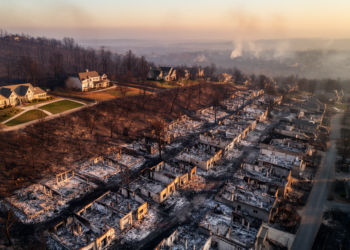
A spatially validated GeoAI analysis of 12,081 damage inspections from the 2025 Palisades Fire finds neighborhood building density was the ...


Embark on a thrilling journey of discovery with Scienmag.com—your ultimate source for cutting-edge breakthroughs. Immerse yourself in a world where curiosity knows no limits and tomorrow’s possibilities become today’s reality!