


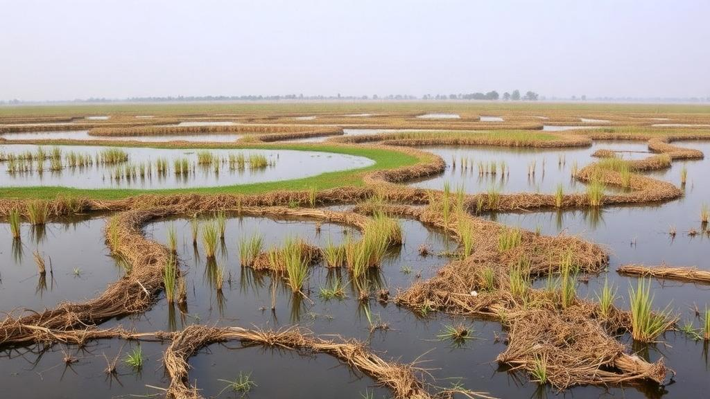
Deep in the Indian state of Punjab, where the Beas and Sutlej rivers meet, lies one of South Asia’s most ecologically significant artificial wetlands. Harike Wetland, a Ramsar site of international importance and an Important Bird Area, is facing a dilemma that conservationists and engineers around the world will recognize instantly. Six decades of sediment accumulation have slashed the reservoir’s water storage capacity by more than half from its 1957 level, according to a 2023 bathymetric survey by Punjab’s Department of Water Resources. The consequence is a cruel seasonal paradox: flooding during the monsoon and water shortages during the dry months, threatening drinking water and irrigation supplies for southern Punjab, Haryana, and Rajasthan. The obvious engineering answer, large-scale desilting, could devastate the very biodiversity that earned the wetland its protected status. A new study published in Environmental and Sustainability Indicators offers a way through this impasse, presenting a spatial prioritization framework that maps exactly where machinery should never go and where intervention might proceed with minimal ecological damage.
The research team, led by Vivek Ranjan with colleagues Sipu Kumar, Stanzin Zangmo, and Gopi Govindan Veeraswami, spent months conducting one of the most comprehensive biodiversity baselines ever assembled for Harike Wildlife Sanctuary, an 86-square-kilometer protected area at the river confluence. Their fieldwork, carried out between March and May 2024 and again after the monsoon from October to December, spanned every major taxonomic group. Using point counts, camera traps, double-observer boat surveys, visual encounter surveys, nested quadrats, and rake sampling, they documented 187 bird species, 14 mammal species, 18 species of herpetofauna, 25 fish species, and dozens of plant species across the sanctuary’s terrestrial, lotic, and lentic ecosystems. The inventory included some of the subcontinent’s most imperiled animals: the critically endangered gharial, the endangered Indus River Dolphin, of which Harike represents the only Indian home, the vulnerable smooth-coated otter, and an isolated breeding population of the endangered Hog deer.
The technical heart of the study lies in its spatial analysis. The researchers divided the sanctuary into one-square-kilometer sampling grids and then used two complementary geospatial techniques to identify biodiversity hotspots. The Getis-Ord Gi* statistic, a classic test for statistically significant spatial clustering, was applied to overall bird species richness and to independent camera-trap detections of Hog deer. Both variables showed strongly clustered distributions, with Moran’s I tests yielding highly significant results: a z-score of 3.10 for bird richness and 3.06 for Hog deer detections. Kernel Density Estimation, meanwhile, generated smooth heat maps of threatened and near-threatened bird richness and Hog deer distribution, classified into low, moderate, and high classes using the natural breaks method. The results revealed that the highest concentrations of threatened birds cluster near the terrestrial-lentic ecotone and around the Beas-Sutlej confluence, while Hog deer concentrate on river islands and connected mainland areas dominated by tall grasses and reeds.
What elevates the study beyond a conventional hotspot map is its application of multi-criteria decision analysis, or MCDA, a GIS-based weighted overlay technique that integrates multiple reclassified raster layers into a single composite suitability surface. The researchers assigned the greatest weight, 70 percent, to the threatened and near-threatened bird richness hotspot layer, followed by 20 percent for Hog deer distribution, 9 percent for overall bird richness, and 1 percent for water depth, with shallower areas rated as more suitable because they support submerged vegetation, macroinvertebrates, and fish breeding. Cropland at the human-wildlife interface was treated as a restrictive factor rather than a weighted layer, and the five mapped heronry sites, colonial waterbird nesting colonies of Oriental Darters, cormorants, Glossy Ibis, egrets, and night herons, were folded in because they overlapped with high bird richness zones. A one-at-a-time sensitivity analysis tested the robustness of the weighting scheme across multiple runs.
The output of this weighted overlay was a delineation of No-Desilt Zones, areas covering roughly 16 square kilometers where any desilting or developmental activity should be categorically excluded. These zones fall into two broad ecological categories. In the LMB and Riyasat reservoirs, the priority areas are characterized by extensive floating vegetation and open water, the lentic habitats that the surveys showed harbor the highest bird diversity, with a mean species richness of 26.68 and a Shannon Diversity Index of 3.01. Near the Beas-Sutlej confluence, the priority zones are dominated by reed banks along flowing channels, underscoring the ecological value of lotic habitats within the wetland mosaic. Crucially, when the researchers compared their priority map against an independent post-monsoon hotspot map built from winter migratory bird data, a season with entirely different species assemblages, they found substantial overlap. This validation suggests the MCDA approach captures something fundamental about habitat quality rather than merely the distribution of a single season’s species.
The study also developed an indicator-species monitoring system designed to make long-term impact tracking practical and inexpensive. Using the IndVal method of Dufrêne and Legendre, which scores each species on its fidelity and specificity to a habitat type, the team identified 45 significant indicator bird species in the pre-monsoon period and 48 in the post-monsoon period. Strong indicators, those with IndVal values of at least 0.7, included the common myna and jungle babbler in terrestrial habitats, with indicator values of 0.95 and 0.90 respectively, and the intermediate egret, little cormorant, and little egret in aquatic systems, scoring 0.94, 0.93, and 0.87. Several species, notably the little cormorant, intermediate egret, and little egret, remained strong aquatic indicators across both seasons, making them reliable sentinels for long-term monitoring. Winter visitors such as the Eurasian coot, northern shoveler, and gadwall emerged as strong lentic indicators only in the cold months, reflecting the seasonal importance of slow-moving open water for migratory waterbirds traveling the Central Asian flyway.
Perhaps the most consequential contribution is the conceptual decision-making framework that wraps around these technical tools. The framework places biodiversity at the center of project planning and insists that impact assessment and mitigation planning occur during the project planning phase, before any Detailed Project Report is drafted. It follows the internationally accepted mitigation hierarchy, avoidance first, then minimization, restoration, offset as a last resort, and enhancement to create net benefits. But the framework goes further than most by explicitly addressing the question that earlier spatial prioritization studies left unanswered: under what conditions should a project be abandoned altogether? The authors are unambiguous. If biodiversity hotspots cannot be safeguarded within the techno-economic constraints of a project, or if projected impacts on priority critical wildlife areas would be highly detrimental, the project should not proceed. Techno-economic feasibility, in their formulation, is a necessary but never overriding consideration.
This stance matters because Harike sits at the intersection of two statutory mandates that pull in opposite directions. The water resources department must manage sediment to preserve storage capacity for millions of people downstream, while the forest department must protect the sanctuary’s flora and fauna. In India, developmental projects in protected areas face review by three different statutory bodies, each of which can demand scientifically rigorous wildlife mitigation plans as a clearance condition. What has been missing, the authors argue, is a unified, evidence-based process for producing those plans. Their framework fills this gap by integrating baseline biodiversity assessment, spatial prioritization, indicator-based monitoring, and mitigation planning into feedback loops that guide decisions on where, whether, and how interventions should proceed. It is designed to be adaptable to other protected wetlands and floodplain ecosystems, provided reliable baseline data and long-term monitoring exist to keep it calibrated.
The study is candid about its limitations. The baseline rests on two seasons within a single annual cycle, and the authors note that multi-year data would sharpen the spatial prioritization further. Hydrological, sediment, and water-quality data for the sanctuary were not incorporated, and MCDA outcomes can shift with different variable selections, larger datasets, and alternative weightings. Long-term monitoring will be needed to validate the indicator species through observed changes in abundance, occupancy, breeding success, and habitat use. None of these caveats, however, undermines the central demonstration: that a framework-based, ecocentric approach can convert a seemingly irreconcilable conflict between public welfare and biodiversity conservation into a tractable planning problem with clearly delineated red lines.
The broader lesson radiating from Harike is one that wetland managers worldwide should heed. Development and conservation are routinely framed as antagonists, yet the authors show that holistic impact assessment and mitigation planning can transform a conservation challenge into a conservation opportunity. Wetlands are among the planet’s most productive ecosystems, delivering water storage, flood regulation, fisheries, and habitat within a single socio-ecological system, and human communities are integral to their functioning. By using biodiversity attributes as surrogates for spatial prioritization, by validating priority zones against independent seasonal data, and by anchoring monitoring in statistically robust indicator species, the Harike framework offers a template for the kind of evidence-driven compromise that the mitigation hierarchy was always meant to enable but rarely achieves in practice. As sedimentation, encroachment, and land-use change intensify pressures on protected wetlands across the developing world, the question is no longer whether such interventions will be needed, but whether the science guiding them will be rigorous enough to leave the biodiversity refuges intact.
Subject of Research: Spatial prioritization and mitigation planning for protected wetland desilting using multi-criteria decision analysis
Article Title: Spatial prioritization of habitats and conceptual framework for impact assessment and mitigation planning for protected wetlands
Article References: Ranjan, V., Kumar, S., Zangmo, S., & Govindan Veeraswami, G. (2026). Spatial prioritization of habitats and conceptual framework for impact assessment and mitigation planning for protected wetlands. Environmental and Sustainability Indicators, 32, Article 101563. https://doi.org/10.1016/j.indic.2026.101563
Image Credits: AI Generated
DOI: 10.1016/j.indic.2026.101563
Keywords: Harike Wetland, Ramsar site, spatial prioritization, mitigation hierarchy, multi-criteria decision analysis, biodiversity hotspots, indicator species, desilting, wetland conservation, Getis-Ord Gi*, kernel density estimation, Indus River Dolphin
Cite Scienmag News
Margaret Porter. (October 11, 2026). Mapping Safe Havens: New Framework Guides Desilting of India’s Protected Harike Wetland. Scienmag. https://scienmag.com/mapping-safe-havens-new-framework-guides-desilting-of-indias-protected-harike-wetland/
Margaret Porter. "Mapping Safe Havens: New Framework Guides Desilting of India’s Protected Harike Wetland." Scienmag, 11 October 2026, https://scienmag.com/mapping-safe-havens-new-framework-guides-desilting-of-indias-protected-harike-wetland/. Accessed 11 October 2026.
Margaret Porter. "Mapping Safe Havens: New Framework Guides Desilting of India’s Protected Harike Wetland." Scienmag. October 11, 2026. https://scienmag.com/mapping-safe-havens-new-framework-guides-desilting-of-indias-protected-harike-wetland/


