


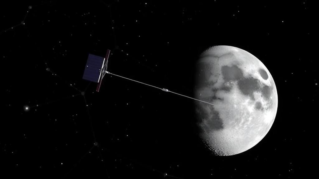
Every satellite navigation network on Earth shares a quiet, hidden weakness: left to its own devices, it slowly loses its sense of direction. The satellites in a global navigation satellite system can measure distances to one another with extraordinary precision, but relative ranging alone cannot tell the network where it sits in the wider universe. The entire constellation can rotate, almost imperceptibly, and the ranging data will look perfectly consistent. Over weeks and months, that rotational drift accumulates until the orbits the satellites compute for themselves no longer match reality, and the positioning signals they broadcast begin to mislead the very users they are meant to guide. A new study published in the journal Satellite Navigation proposes a strikingly elegant remedy: anchor the Earth-orbiting constellation to the moon itself.
The research, led by Xia Lin and Baojun Lin of the Aerospace Information Research Institute at the Chinese Academy of Sciences, demonstrates that adding just four satellites in elliptical lunar frozen orbits, known as ELFO, to China’s BeiDou-3 navigation constellation can eliminate the rotational drift that has plagued autonomous navigation concepts since their inception. The team combined twenty-four real BeiDou-3 Medium Earth Orbit, or MEO, satellites with four simulated lunar satellites in a centralized extended Kalman filter, processing sixty days of genuine onboard inter-satellite link ranging measurements alongside simulated Earth-moon links. The result was remarkable: the constellation’s orientation remained stable for the full two-month span, the mean user range error held at just 0.35 meters, and the lunar satellites themselves were located to within 2.3 meters in three dimensions.
To appreciate why this matters, it helps to understand how autonomous orbit determination works and why it fails. Modern navigation satellites are not solely dependent on ground stations; they carry inter-satellite links that let them range against one another and compute their own orbits onboard. This autonomy is a strategic asset, because ground stations can fail, be disrupted, or fall out of contact during crises. But inter-satellite ranging has a fundamental blind spot. The measurements capture only relative geometry, the distances between satellites, and relative distances are completely insensitive to a rigid rotation of the whole network. Mathematically, the rotation of the constellation is unobservable: no matter how the network turns as a whole, the ranging data remains unchanged. The system is rank-deficient, and the missing information must come from somewhere else.
Operators have long compensated for this with prediction-based corrections, using forecast orbits generated on the ground to nudge the constellation back toward its expected orientation. This slows the drift but never stops it, because the forecasts themselves carry errors that grow over time. The problem becomes especially acute during eclipse seasons, when satellites pass through Earth’s shadow and solar radiation pressure models become less reliable, accelerating the degradation of predicted orbits. The error accumulates relentlessly, and without periodic ground intervention the constellation’s absolute orientation eventually becomes unusable. What the field has needed is an external, dynamics-based reference, something in the measurement data itself that makes rotation visible without requiring constant contact with Earth.
The insight behind the new study is that the moon provides exactly that reference, through the physics of gravity rather than through any additional measurement. Satellites in elliptical lunar frozen orbits are governed overwhelmingly by lunar gravity, while BeiDou-3 MEO satellites are governed overwhelmingly by Earth’s gravity. Because these two gravitational environments are so different, the two sets of satellites respond differently to any rotation of the combined network. When the whole system rotates, the lunar satellites’ dynamics pull their computed positions in a way that is inconsistent with the ranging data, and that inconsistency makes the rotation detectable. In effect, the lunar satellites act as a dynamical anchor: their motion is so strongly constrained by the moon’s gravity that they pin down the absolute orientation of the entire constellation.
The numbers from the observability analysis make the transformation vivid. With MEO satellites alone, the condition number of the position information matrix, a measure of how ill-conditioned the estimation problem is, sat between roughly ten to the fifteenth and ten to the eighteenth, effectively a singular case in which the rotation simply cannot be resolved. Once four ELFO satellites were added, the condition number fell to about ten squared, a well-behaved problem that a filter can solve robustly. In the joint Earth-moon solution, the three-axis rotational biases over sixty days stayed within 13.59, 10.27, and 4.04 milliarcseconds, compared with more than 300 milliarcseconds when no correction was applied and about 18 milliarcseconds with traditional prediction-based correction. The BeiDou-3 user range error, the quantity that ultimately determines how accurately a user on the ground can be positioned, remained at 0.35 meters, against 7.85 meters without correction and 0.60 meters with prediction-based correction.
The lunar satellites did not merely serve as passive anchors; they achieved impressive accuracy in their own right. Their maximum radial errors stayed below 0.16 meters, while along-track and cross-track errors remained under 1.7 meters and 1.8 meters respectively. This dual benefit is significant for the future of cislunar space operations, because it means the same infrastructure that stabilizes Earth’s navigation constellation also delivers precise positioning for spacecraft operating near the moon. The ELFO itself is a particularly favorable orbit for this purpose, offering good coverage of the lunar polar regions while demanding only modest station-keeping budgets, a combination that has already attracted the attention of major space agencies.
Indeed, the orbital choice aligns closely with international plans for lunar infrastructure. Both the European Space Agency’s Moonlight program and NASA’s LunaNet initiative have selected elliptical lunar frozen orbits as the reference orbit for their planned lunar navigation and communication constellations, specifically to provide continuous coverage of the lunar south pole, where water ice deposits have made the region a prime target for future crewed and robotic missions. The Chinese study suggests that these lunar constellations could do double duty, serving lunar explorers while simultaneously anchoring Earth-orbiting navigation networks. A single architecture, spanning the Earth-moon system, could deliver resilient positioning, navigation, and timing services to users on both worlds.
A crucial strength of the work is its grounding in real operational data. Rather than relying entirely on simulations, the researchers used sixty days of genuine onboard inter-satellite link measurements from BeiDou-3 MEO satellites, pairing them with simulated Earth-moon links. This hybrid approach gives a far more realistic picture of what today’s operational systems can actually achieve, since real ranging data carries the noise, biases, and scheduling constraints that idealized simulations tend to smooth away. The authors note that the lunar satellites essentially act as an anchor for the entire network, and that the joint solution addresses a limitation that has persisted since the earliest autonomous navigation concepts were proposed decades ago.
The implications extend well beyond the Earth-moon system. Long-duration autonomous navigation for Earth-orbiting constellations would reduce reliance on vulnerable ground infrastructure and improve resilience against disruption, a concern of growing importance as navigation services underpin everything from aviation and shipping to financial transaction timestamps and power grid synchronization. The authors caution that this is still a preliminary analysis: future work will replace the simulated lunar links with real onboard observations once lunar satellite missions become operational, and will develop link scheduling strategies that simultaneously support the orbit determination solution and provide continuous positioning, navigation, and timing services to lunar users. But the core result stands as a proof of concept that the moon, the celestial body humanity has watched and navigated by for millennia, may soon serve as the fixed reference point that keeps Earth’s satellite navigation networks true.
Subject of Research: Joint autonomous orbit determination of BeiDou-3 MEO satellites and lunar ELFO satellites using inter-satellite links
Article Title: Lunar satellites could anchor Earth's GPS: study finds a fix for drifting navigation constellations
Article References: Lunar satellites could anchor Earth's GPS: study finds a fix for drifting navigation constellations. (n.d.). Original publication
Image Credits: AI Generated
DOI: Not provided
Keywords: BeiDou-3, autonomous orbit determination, elliptical lunar frozen orbit, inter-satellite links, extended Kalman filter, GNSS, lunar navigation, user range error, observability, Moonlight, LunaNet, Satellite Navigation journal
Cite Scienmag News
Grant Pearson. (October 2, 2026). Lunar Satellites Could Anchor Earth’s GPS by Halting Navigation Constellation Drift. Scienmag. https://scienmag.com/lunar-satellites-could-anchor-earths-gps-by-halting-navigation-constellation-drift/
Grant Pearson. "Lunar Satellites Could Anchor Earth’s GPS by Halting Navigation Constellation Drift." Scienmag, 2 October 2026, https://scienmag.com/lunar-satellites-could-anchor-earths-gps-by-halting-navigation-constellation-drift/. Accessed 4 October 2026.
Grant Pearson. "Lunar Satellites Could Anchor Earth’s GPS by Halting Navigation Constellation Drift." Scienmag. October 2, 2026. https://scienmag.com/lunar-satellites-could-anchor-earths-gps-by-halting-navigation-constellation-drift/


