


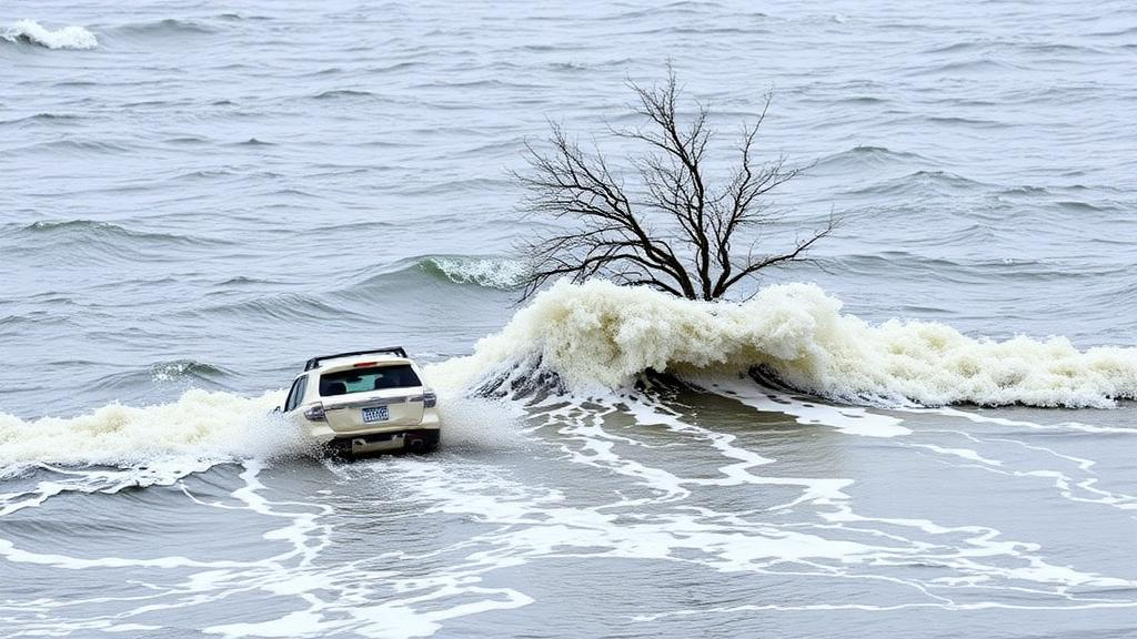
When a powerful storm approaches a low-lying coastline, the difference between a manageable event and a disaster often comes down to minutes of warning. Yet for most of the world’s vulnerable shores, the tools needed to predict exactly where and how badly waves will overtop defenses are either too computationally expensive to run in real time or require detailed local data that simply do not exist. A new study published in the journal Natural Hazards by Juan L. Garzon and Paul Husemann of the University of Algarve and Jarbas Bonetti of the Federal University of Santa Catarina tackles both problems at once, presenting a hybrid framework that pairs a physics-based numerical model with a probabilistic machine learning technique to deliver rapid, uncertainty-aware flood impact predictions in places where measurements are scarce.
The core of the challenge lies in a trade-off that has long frustrated coastal forecasters. Process-based models such as XBeach, an open-source model developed to simulate the hydrodynamic and morphodynamic response of beaches to storms, can capture the intricate physics of wave runup, overtopping and flooding with impressive fidelity. But a single high-resolution simulation of a storm striking a beach can take hours of computation on a cluster, far too slow for an operational early warning system that must issue alerts while the storm is still offshore. Simpler empirical formulas run instantly but gloss over the site-specific geometry of a beach, the very factor that often determines whether a seawall is overtopped or left untouched.
The researchers’ solution is to let the two approaches do what each does best. They ran XBeach thousands of times, generating a vast library of simulated storm scenarios spanning the range of offshore oceanic conditions that could plausibly strike the study area. Each simulation produced a detailed picture of the resulting hazards and impacts, from wave overtopping discharges to damage levels. These thousands of physically consistent scenario-impact pairs then became the training data for a Bayesian Network, a probabilistic graphical model that learns the statistical relationships between offshore forcing conditions and onshore impacts. Once trained, the Bayesian Network acts as a computationally cheap surrogate of the numerically intensive model, producing probabilistic estimates of storm-induced impacts in a fraction of the time a direct XBeach run would demand.
Bayesian Networks are particularly well suited to this role because they do not merely spit out a single deterministic answer. Instead, they quantify uncertainty explicitly, returning probability distributions over possible outcomes given the observed offshore conditions. For an early warning system, this matters enormously: emergency managers need to know not just the most likely impact but the chance that impacts will cross critical thresholds for pedestrians, vehicles and property. The approach also remains interpretable, a quality emphasized in the machine learning literature on Bayesian networks, which allows coastal scientists to trace which combinations of wave height, water level and beach state drive the most severe predicted responses.
The framework was tested at two contrasting beach profiles along an embayed beach in Santa Catarina, southern Brazil: one strongly urbanized and one semi-natural. This deliberate pairing allowed the team to assess explicitly how storm response varies over short distances along a single embayment, a spatial variability that coarser regional forecasts routinely miss. Embayed beaches, hemmed in by headlands, are notorious for focusing wave energy unevenly, so the same offshore storm can produce dramatically different overtopping at opposite ends of the bay. The extensive training dataset generated for the study provides new insight into this variability and helps identify the critical storm conditions that trigger extreme responses at each profile.
Perhaps the most innovative aspect of the work is how the team confronted the data scarcity that plagues coastal regions worldwide. Accurate XBeach simulations of wave overtopping require quantitative information on the underwater bathymetry, the shape of the seafloor, and on overtopping discharges for calibration, neither of which was readily available at the Brazilian study site. Rather than abandon the effort, the researchers reconstructed beach profiles using an empirical equilibrium profile formulation, drawing on the classic Dean equilibrium profile concept that relates the shape of a sandy beach to its sediment characteristics and wave climate. This allowed physically plausible cross-shore geometry to be generated where survey data were absent.
The second data gap, the lack of measured overtopping discharges, was bridged in an equally pragmatic way: the team used non-professional imagery, photographs and videos typically taken by members of the public during storm events, to estimate observed damage levels and infer the overtopping discharges associated with them. This strategy taps into a growing body of research showing that social media and crowdsourced imagery can meaningfully improve coastal flood forecasts and hazard alerts, turning an everyday byproduct of the smartphone era into a calibration resource for communities that cannot afford dedicated field campaigns.
The significance of the work extends well beyond one beach in Brazil. The United Nations has championed global early warning initiatives as a cornerstone of climate adaptation, recognizing that every dollar spent on early warning saves many more in avoided losses. Yet the regions that stand to benefit most, low-income and rapidly urbanizing coastlines, are precisely those with the least monitoring infrastructure. By demonstrating that a transferable, computationally efficient methodology can explicitly address data limitations, the study offers a template that coastal managers in data-limited settings can adapt without waiting for expensive bathymetric surveys or instrumented seawalls. The authors argue that coupling physically based modeling with data-driven probabilistic inference is what makes the framework both robust and practical for operational deployment.
Technically, the hybrid design also sheds light on the broader debate over surrogate modeling in coastal hazard prediction. Previous studies have benchmarked numerical models for wave overtopping, weighing accuracy against speed, and have explored neural networks and other machine learning tools for overtopping prediction at coastal structures. The Bayesian Network approach distinguishes itself by combining probabilistic output with modest training requirements and by being trained not on sparse field observations but on thousands of physically consistent numerical simulations. This means the surrogate inherits the physics of XBeach while shedding its computational burden, and it can be retrained as new bathymetry, imagery or storm observations become available, progressively sharpening its predictions over time.
For the residents and businesses lining vulnerable shores from Santa Catarina to the Basque coast, the practical promise is straightforward: earlier, more localized and more honest warnings that state not only what a storm is likely to do but how confident the forecast is. As sea levels rise and extreme meteo-oceanographic events intensify, the exposure of low coastal areas to storm surges and energetic waves will only grow. Frameworks like the one developed by Garzon, Husemann and Bonetti suggest that the barrier to protecting these communities is no longer the physics of flooding, which models already capture well, but the clever engineering of prediction systems that can run fast, learn from whatever data exist, and quantify what remains unknown. In that sense, the study marks a meaningful step toward making sophisticated coastal flood early warning systems a realistic option for the places that need them most.
Subject of Research: Hybrid numerical and Bayesian network modeling for rapid coastal storm flooding prediction and early warning in data-scarce coastal environments
Article Title: A hybrid approach for rapid coastal flooding impact prediction in data-scarce environments: an early warning system perspective
Article References: Garzon, J. L., Husemann, P., & Bonetti, J. (2026). A hybrid approach for rapid coastal flooding impact prediction in data-scarce environments: an early warning system perspective. Natural Hazards, 122(20), Article 650. https://doi.org/10.1007/s11069-026-08366-5
Image Credits: AI Generated
DOI: 10.1007/s11069-026-08366-5
Keywords: coastal flooding, early warning systems, XBeach, Bayesian networks, wave overtopping, storm surge, Santa Catarina, data-scarce environments, bathymetry reconstruction, probabilistic modeling, coastal hazard prediction, machine learning
Cite Scienmag News
Violet Maxwell. (September 30, 2026). Hybrid AI-physics model brings fast coastal flood warnings to data-poor shores. Scienmag. https://scienmag.com/hybrid-ai-physics-model-brings-fast-coastal-flood-warnings-to-data-poor-shores/
Violet Maxwell. "Hybrid AI-physics model brings fast coastal flood warnings to data-poor shores." Scienmag, 30 September 2026, https://scienmag.com/hybrid-ai-physics-model-brings-fast-coastal-flood-warnings-to-data-poor-shores/. Accessed 4 October 2026.
Violet Maxwell. "Hybrid AI-physics model brings fast coastal flood warnings to data-poor shores." Scienmag. September 30, 2026. https://scienmag.com/hybrid-ai-physics-model-brings-fast-coastal-flood-warnings-to-data-poor-shores/


