


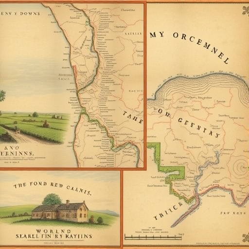
A groundbreaking study conducted by researchers at the University of Portsmouth has revealed a striking transformation of the rural landscape in Southern England, specifically within the lower Rother catchment area of the South Downs, West Sussex. Utilizing a meticulous comparison between digitized Victorian tithe maps from the mid-19th century and contemporary land cover data from 2021, the research exposes an alarming collapse of traditional meadowlands, documenting declines reaching as much as 99.9 percent since the 1840s. This extensive loss underscores a profound shift in land use driven by evolving agricultural practices, land tenure changes, and environmental policies over nearly two centuries.
The Victorian tithe maps, originally created as records of land ownership and usage for taxation purposes, provide a uniquely detailed baseline for assessing historic land cover. By overlaying this historical cartographic data with high-resolution modern satellite and land survey data, the research team was able to quantify and spatially map landscape transformations with unprecedented precision. This approach highlights the power of integrating archival geographic information systems with contemporary environmental data to decipher long-term ecological trends and landscape dynamics.
One of the most dramatic revelations from the study is the near-total disappearance of traditional meadows—once vital components of the pastoral ecosystem, supporting diverse flora and fauna. These meadows served essential functions, including hay production for livestock feed and grazing grounds, maintaining a biodiversity-rich habitat that fostered ecological resilience. The collapse of meadowland, which ranges between 75.6 and 99.9 percent loss, marks the most significant decline among all examined land cover categories, signaling a profound alteration of habitat structure and ecosystem services.
Complementing the meadow decline, the research reports a drastic reduction of unimproved grassland by 86.5 percent. Unimproved grasslands are areas that have not been subjected to intensive fertilization or reseeding, often harboring complex biological communities. Their reduction reflects intensified agricultural land management and conversion practices that favor monoculture and enhanced productivity, often at the expense of ecological integrity and species richness.
Interestingly, arable land—previously thought to be on the rise in many regions—has also decreased by 45.5 percent in the study area. This juxtaposition suggests a multifaceted shift in land use priorities, where traditional crop farming diminishes while alternative land management types expand. In contrast, improved grassland, often characterized by fertilized and reseeded fields intended for pasture, has surged by 135.8 percent. This increase illustrates the agricultural sector’s adaptation towards intensively managed grazing systems designed to maximize yield and economic return.
Woodland cover within the catchment has also expanded by 56.3 percent over the studied period. This afforestation trend may be attributed to several factors, including natural succession following agricultural abandonment, targeted reforestation efforts, and changing landowner priorities influenced by environmental subsidy schemes. While increased woodland can contribute positively to carbon sequestration and biodiversity in some contexts, the shift from open meadow and grassland habitats to wooded areas represents a fundamental change in landscape composition and function.
Despite the near stability in the total area of common land, which declined only marginally by 1.7 percent, its use and ecological character have undergone significant transformation. Historically utilized predominantly for shared grazing, common land has increasingly transitioned into recreational woodland, reflecting broader social and economic shifts towards leisure and conservation uses. This evolution indicates altered community relationships with the land, shifting from production toward amenity and ecological conservation values.
The implications of these landscape changes extend beyond mere land cover statistics; they encapsulate the historical trajectory of agricultural intensification, land enclosure, and policy-driven subsidy regimes that have reconfigured rural ecosystems. The enclosure movements effectively privatized once-communal lands, enabling more intensive management practices but simultaneously fragmenting habitats, reducing landscape heterogeneity, and undermining traditional pastoral systems.
Dr. Cat Hudson from the University of Portsmouth’s School of Environment and Life Sciences emphasizes the critical need to understand these historical ecosystem transformations. Meadows were keystones of biodiversity and agricultural productivity; their near obliteration presents challenges for modern conservation and restoration efforts. By reconstructing this environmental history, researchers can better inform strategies to rebuild habitat diversity, enhance ecosystem resilience, and reconcile agricultural productivity with ecological sustainability.
Modern land management faces pressing issues such as soil erosion, biodiversity loss, and water quality degradation, each exacerbated by past landscape modifications. The historical lens provided by tithe maps and similar archival records reveals not only the ingrained nature of these challenges but also highlights opportunities to target restoration where it will be most impactful. These records enable nuanced recognition of cultural and environmental heritage, fostering interventions that honor both ecological function and landscape identity.
Furthermore, the research advocates for the integration of long-term historical data into policy frameworks. By aligning conservation targets with the spatial and temporal context of landscape change, policymakers can design agri-environmental schemes that strategically enhance soil health, bolster carbon storage, and mitigate habitat fragmentation. This evidence-based approach aligns closely with contemporary environmental goals articulated in national strategies like the UK Government’s 25 Year Environment Plan.
Dr. Harold Lovell, also of the Portsmouth research team, underscores the potential of historical records to shape land restoration agendas. Meadows, hedgerows, and traditional field boundaries are not only biologically valuable but also culturally significant. Their preservation and reinstatement could foster landscapes that are simultaneously productive, biodiverse, and rich with heritage—qualities crucial for sustainability amidst climate change pressures.
This study’s refinement of our understanding of landscape evolution within the South Downs National Park and the wider region provides a valuable roadmap for natural authorities such as Natural England and the South Downs National Park Authority. By anchoring modern environmental management in historical context, these insights enable a harmonization of heritage conservation with forward-looking ecological stewardship, paving the way for resilient rural landscapes that honor their past while adapting for the future.
The prescient connection made between past agricultural adaptations and present-day sustainability underscores the necessity for farming systems that are both efficient and ecologically grounded. As Dr. Lovell succinctly notes, the countryside we inherit is a product shaped by centuries of human and environmental interaction. Leveraging historical insights ensures future decisions respect this complex legacy, fostering landscapes capable of meeting the demands of productivity, biodiversity conservation, and climate mitigation in tandem.
News Publication Date: 3-Oct-2025
Web References:
https://www.tandfonline.com/doi/full/10.1080/14662035.2025.2561456?src=exp-la#d1e169
https://www.port.ac.uk/about-us/structure-and-governance/organisational-structure/faculty-of-science-and-health/school-of-the-environment-and-life-sciences
https://www.gov.uk/government/publications/25-year-environment-plan
References: DOI: 10.1080/14662035.2025.2561456
Cite Scienmag News
Alan Morgan. (November 6, 2025). Historic Maps Uncover 99% Decline of South Downs Meadows in New Study. Scienmag. https://scienmag.com/historic-maps-uncover-99-decline-of-south-downs-meadows-in-new-study/
Alan Morgan. "Historic Maps Uncover 99% Decline of South Downs Meadows in New Study." Scienmag, 6 November 2025, https://scienmag.com/historic-maps-uncover-99-decline-of-south-downs-meadows-in-new-study/. Accessed 4 September 2026.
Alan Morgan. "Historic Maps Uncover 99% Decline of South Downs Meadows in New Study." Scienmag. November 6, 2025. https://scienmag.com/historic-maps-uncover-99-decline-of-south-downs-meadows-in-new-study/


