


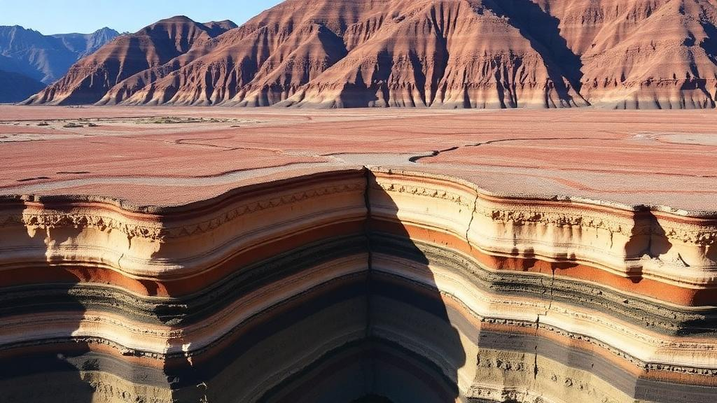
Beneath the vineyards, mining towns, and crowded streets of Salta in northwestern Argentina, the Earth’s crust is far more complicated than anyone had measured before. A team of seismologists from the University of Potsdam, the Instituto de Bio y Geociencias del NOA, and the University of Cologne has now produced the first detailed picture of the crust beneath the Lerma Valley, a 150-kilometer-long intermontane basin wedged between the Eastern Cordillera and the Santa Bárbara system. Their study, published in Solid Earth, combines several independent seismic techniques to map everything from soft valley sediments to the base of the crust more than 45 kilometers down, and it reveals a striking split between the northern and southern halves of the basin that has implications for both mountain building and earthquake hazard.
The Lerma Valley is an oddity within the Andean orogen. Unlike the high, actively shortening ranges on either side, the basin sits in what researchers call a passive orogenic setting, where deformation appears to be governed less by present-day tectonic forces than by inherited structures left over from hundreds of millions of years of geological history. Cretaceous extensional faults were later squeezed back together during Andean mountain building, and Quaternary faults continue to reactivate ancient weaknesses. Despite hosting a provincial capital, intensive agriculture, and mining operations, the valley had never been the subject of a systematic geophysical survey, leaving a conspicuous gap in scientists’ understanding of how the central Andes transfer stress from the active Pacific margin into the continental interior.
To fill that gap, the team deployed a temporary seismic network known as LEVARIS, the Lerma Valley Ring Installation of Seismometers, in August 2017. Thirteen stations, each pairing a Data-Cube3 digitizer with a Lennartz 3D/5s sensor buried roughly 60 centimeters underground and powered by solar panels, recorded continuously for thirteen months across an area spanning about 80 kilometers north to south and 30 kilometers east to west. Before this deployment, the entire valley relied on a single permanent short-period station operated by Argentina’s National Institute of Seismic Prevention. The new network captured both distant teleseismic earthquakes arriving from 30 to 90 degrees away and, crucially, waves from deep local earthquakes concentrated in the Jujuy seismic cluster roughly 200 kilometers beneath the region.
The methodological core of the study rests on two complementary seismic tools. The first is receiver function analysis, which isolates P-to-S wave conversions that occur when seismic waves from distant earthquakes strike sharp interfaces such as the crust-mantle boundary, or Moho. By deconvolving the vertical component of a seismogram from the horizontal components, the researchers stripped away the effects of the earthquake source and distant travel path, leaving a signal dominated by the structure directly beneath each station. The second tool is ambient noise tomography, which exploits the Earth’s ceaseless background vibration. By cross-correlating continuous noise recordings between pairs of stations, the team extracted empirical Green’s functions and measured Rayleigh wave phase velocities, effectively turning the hum of the planet into an imaging source that requires no earthquakes at all.
Combining these datasets required sophisticated inversion. The researchers jointly inverted stacked receiver functions and phase velocity dispersion curves using a Hamiltonian Monte Carlo approach, a Bayesian sampling technique well suited to exploring the high-dimensional, strongly correlated parameter spaces typical of seismic velocity models. They also applied an evolutionary algorithm, inspired by natural selection, to invert the dispersion curves alone, sharpening resolution in the upper five kilometers where conventional methods lose sensitivity. A key technical innovation was a layer-dependent correction for the vp/vs ratio, the ratio of compressional to shear wave speed. Because standard H-k stacking yields only a weighted average above each discontinuity, the team developed a bottom-up recursive scheme that reconstructs the true ratio in each layer, anchored at the Moho where measurements are most reliable.
The resulting image of the crust is strikingly layered. Four major discontinuities emerge at depths of roughly 53 to 43 kilometers, 35 to 30 kilometers, 10 to 8 kilometers, and 1.5 to 1.2 kilometers, corresponding respectively to the Moho, the boundary between the lower and middle crust, the top of a possible mid-crustal detachment zone, and the base of the sedimentary basin. The Moho sits at 48 plus or minus 5 kilometers, consistent with earlier regional estimates, and common conversion point stacking reveals that it dips southward, deepening beyond 50 kilometers beneath the southern part of the study area. An azimuthal shift in the transverse components of the receiver functions, centered near 200 degrees, independently supports this southward-dipping geometry, a pattern reminiscent of observations in New Zealand where Moho dips track subducting plate geometry.
Perhaps the most consequential finding is the pronounced north-south contrast in the shallow crust. Ambient noise tomography maps at periods of 3 to 5 seconds delineate a low-velocity southern sector, where shear wave velocities of only 1 to 2.5 kilometers per second indicate thick, poorly consolidated sediments, and a northern sector with velocities up to 3.5 kilometers per second, signaling more competent crustal material. The final five-layer velocity model quantifies this stratification: a soft upper sediment layer 0.8 kilometers thick with shear velocities of 1.25 kilometers per second, a medium-consolidated sediment layer 3.7 kilometers thick, a lower consolidated sediment layer 2 kilometers thick, a 32-kilometer-thick middle crustal layer, and a 10-kilometer-thick lower crustal layer. The corrected vp/vs ratios rise from about 1.65 at the Moho, suggesting a dry felsic lower crust, toward 2.0 in the upper layers.
One of the most intriguing discoveries appears only in the local receiver functions: a discontinuity at approximately 15 kilometers depth that is invisible to the longer-period teleseismic signals. The high-frequency content of waves from the deep Jujuy cluster gives local events the resolving power to detect fractured, damaged zones that smear out in lower-frequency data. The researchers interpret this interface as a mid-crustal detachment horizon, a zone of mechanical decoupling where strain is partitioned between the upper and lower crust. Detachment structures of this kind have long been invoked to explain the style of deformation in the Eastern Cordillera, where thick-skinned tectonics gives way to distributed strain at depth, but this is among the first direct seismic images of such a horizon beneath the Lerma Valley itself.
The hazard implications are immediate. The region has a documented history of destructive earthquakes, including the magnitude 6.1 Salta earthquake of 2010, the 2015 El Galpón event of magnitude 5.8, and historic shocks such as the 1692 Esteco and 1825 Anta earthquakes. The newly identified low-velocity layer in the south, attributed to the fine-grained Tajamar Formation, is particularly concerning: these unconsolidated silts are known to saturate with water during the austral monsoon and become susceptible to liquefaction during strong shaking. Detailed knowledge of sediment thickness and velocity is exactly what engineers need to model site amplification, the phenomenon by which soft basins magnify seismic waves and concentrate damage, as the 2010 and 2015 earthquakes demonstrated.
Beyond hazard, the study offers a template for understanding passive orogens and intraplate deformation worldwide. The southward-deepening Moho may reflect crustal underplating or lithospheric flexure driven by ongoing convergence, processes also documented across the central Andes and in collision zones such as the Tibetan Plateau. By integrating receiver functions, ambient noise tomography, H-k stacking, and two independent inversion schemes, the team showed how multiple imperfect constraints can converge on a robust structural model, even where each method alone is ambiguous. For a valley that had been seismically invisible for decades, the Lerma Valley now stands as one of the better-imaged corners of the Andean foreland, and as a natural laboratory for the inherited structures that quietly shape how continents deform.
Subject of Research: Crustal structure and seismic imaging of the Lerma Valley basin in northwestern Argentina
Article Title: Deciphering the crustal structure of the Lerma Valley (NW Argentina): a multi-method seismic investigation
Article References: Criado-Sutti, E. J. M., Olivar-Castaño, A., Krüger, F., Montero-López, C., Aranda-Viana, G., Zeckra, M., & Heimann, S. (2026). Deciphering the crustal structure of the Lerma Valley (NW Argentina): a multi-method seismic investigation. Solid Earth, 17(5), 711-733. https://doi.org/10.5194/se-17-711-2026
Image Credits: AI Generated
Keywords: Lerma Valley, crustal structure, receiver functions, ambient noise tomography, Moho, Andes, Argentina, seismic hazard, detachment zone, vp/vs ratio, Hamiltonian Monte Carlo, foreland basin
Cite Scienmag News
Violet Maxwell. (October 9, 2026). Hidden Layers Beneath Argentina’s Lerma Valley Reveal a Crust Split in Two. Scienmag. https://scienmag.com/hidden-layers-beneath-argentinas-lerma-valley-reveal-a-crust-split-in-two/
Violet Maxwell. "Hidden Layers Beneath Argentina’s Lerma Valley Reveal a Crust Split in Two." Scienmag, 9 October 2026, https://scienmag.com/hidden-layers-beneath-argentinas-lerma-valley-reveal-a-crust-split-in-two/. Accessed 9 October 2026.
Violet Maxwell. "Hidden Layers Beneath Argentina’s Lerma Valley Reveal a Crust Split in Two." Scienmag. October 9, 2026. https://scienmag.com/hidden-layers-beneath-argentinas-lerma-valley-reveal-a-crust-split-in-two/


