


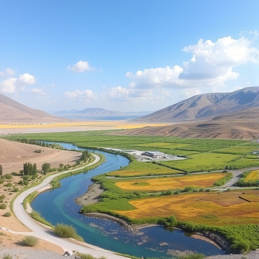
In a groundbreaking study published in Environmental Earth Sciences, researchers have unveiled a novel approach to mapping groundwater quality in Northwest Iran by integrating advanced machine learning, deep learning techniques, and Borda scoring algorithms. This innovative methodology addresses one of the most pressing environmental challenges of our time: accurately assessing and managing groundwater quality in complex, data-scarce regions. The significance of this research extends beyond regional boundaries, offering a template for environmental scientists and policymakers aiming to harness artificial intelligence for sustainable water resource management globally.
Groundwater, a critical source of fresh water for both agricultural activities and human consumption, faces increasing threats from pollution, over-extraction, and natural geological processes. Monitoring and mapping its quality is notoriously challenging due to spatial heterogeneity and the scarcity of comprehensive sampling data. Traditional methods, often reliant on physical sampling and chemical analysis, are time-consuming and costly, making them less feasible for large-scale applications. By leveraging machine and deep learning models, the research team has provided a scalable, data-driven solution that significantly enhances the resolution and accuracy of groundwater quality maps.
At the heart of the study lies the fusion of multiple computational intelligence techniques. The researchers employed a combination of machine learning algorithms, which are adept at pattern recognition and prediction based on structured data, alongside deep learning models capable of extracting complex, nonlinear relationships from large datasets. The integration of these approaches enabled the capture of intricate spatial variability and underlying factors influencing groundwater quality, which simpler models might overlook. This hybrid framework was further fortified by the application of the Borda scoring algorithm, a collective decision-making tool used here to amalgamate predictions from various models, effectively reducing uncertainty and enhancing reliability.
The case study focused on Northwest Iran, a region characterized by diverse hydrogeological formations and varied anthropogenic pressures. The area is marked by intricate soil compositions, agricultural runoff, industrial activities, and urbanization, all of which affect groundwater quality differently across locales. The researchers gathered extensive geospatial and environmental datasets, including chemical parameters such as nitrate, sulfate, chloride concentrations, and other quality indices, to train and validate their models. The comprehensive dataset, combined with the computational power of AI algorithms, allowed for precise and detailed spatial interpolation of groundwater quality parameters.
One of the notable advancements presented is the model’s capability to perform quality classification and spatial distribution mapping simultaneously. Through supervised learning, the model was trained to discern groundwater quality classes, enabling users to identify zones of potential contamination or high purity. This classification ability is crucial for targeted intervention and resource allocation, allowing authorities to prioritize areas requiring urgent remediation or protective measures. Furthermore, the continuous spatial mapping offers a nuanced gradient of quality changes across the landscape, revealing subtle patterns undetectable through conventional point-based assessments.
Deep learning, particularly convolutional neural networks (CNNs), played a pivotal role in deciphering the spatial dependencies inherent in environmental datasets. CNNs excel in processing grid-like data structures, such as geospatial rasters, making them ideal for mapping tasks. By transforming raw input layers representing diverse hydrochemical variables into multi-dimensional data matrices, CNNs extracted high-level features indicative of underground water quality variations. The deployment of these networks thus marks a significant stride in environmental modelling, proving AI’s capacity to bridge the gap between data complexity and actionable insights.
Complementing the machine and deep learning predictions, the Borda scoring mechanism served as an aggregative consensus tool. Traditionally used in voting systems to rank preferences, here it was ingeniously repurposed to consolidate outputs from multiple models, mitigating biases and overfitting issues inherent in individual algorithms. This ensemble strategy fortified the final groundwater quality predictions, ensuring robustness, accuracy, and generalizability across varying hydrogeological contexts. The synthesis of predictions via Borda counts enabled the research to circumvent pitfalls commonly faced in single-model analyses, such as sensitivity to outliers or noise.
The implications of this study extend well beyond academic curiosity into the realm of practical water management. Effective groundwater quality monitoring informs sustainable groundwater extraction policies, pollution control regulations, and public health safeguards. By providing high-resolution, trustworthy quality maps, stakeholders such as environmental agencies, municipal planners, and agricultural managers can make informed decisions to optimize water usage, prevent contamination, and safeguard ecosystems. The methodology’s adaptability also permits replication in other regions worldwide, particularly in developing areas with limited monitoring infrastructure but abundant environmental challenges.
Moreover, the study exemplifies the transformative role of interdisciplinary collaborations, combining environmental science expertise with data science ingenuity. The team harnessed advancements in computational statistics, AI programming, and hydrogeology, reflecting a paradigm shift where classical environmental assessments are augmented and expedited by cutting-edge technology. The convergence of domain-specific knowledge and artificial intelligence has opened new frontiers for environmental monitoring, promising enhanced predictive capabilities and more precise environmental stewardship.
A critical aspect highlighted by the authors is the model’s ability to operate effectively despite data scarcity—a common hurdle in environmental studies. By integrating multiple data sources and learning algorithms, the system compensates for incomplete or unevenly distributed sampling points, creating coherent and comprehensive groundwater quality profiles. This resilience ensures that stakeholders can rely on the models even in resource-constrained settings, where traditional extensive field surveys are unfeasible. The approach sets a benchmark for future research aiming to democratize access to environmental intelligence through AI-driven methods.
The research team also underscored the importance of temporal dynamics in groundwater quality assessments. Although the current study emphasizes spatial distribution, the modeling framework accommodates temporal datasets, opening possibilities for tracking groundwater quality trends and forecasting future scenarios. Incorporating time-series data will allow stakeholders to anticipate contamination events, assess the efficacy of remediation efforts, and adapt resource management strategies dynamically. Such forward-looking capabilities are vital in the context of climate change and evolving land-use patterns influencing water quality.
Future directions for this research include expanding the model to integrate additional environmental variables such as land-use changes, precipitation patterns, and soil characteristics, offering a holistic view of groundwater system interactions. The integration of remote sensing data with in-situ measurements could further enhance spatial coverage and temporal resolution, overcoming traditional data collection limitations. Additionally, advances in explainable AI can be harnessed to make model predictions more transparent, facilitating greater stakeholder trust and uptake of these technologies in policy frameworks.
In terms of global water security, this research presents a timely and impactful contribution. Groundwater constitutes a substantial portion of the world’s freshwater reserves, yet it remains under threat from pollution and over-extraction. The ability to rapidly and accurately assess its quality is paramount to preserving this resource for future generations. The innovative combination of AI methods explored in this study offers a replicable and scalable solution, bridging technical complexity with real-world applicability, underscoring the critical role artificial intelligence can play in sustainable environmental management.
The visual outputs of the study, including high-resolution groundwater quality maps, provide an intuitive and accessible format for communicating complex scientific data to diverse audiences. These graphics serve as powerful tools for education, awareness-raising, and stakeholder engagement, making the invisible dynamics of subsurface water quality visible and comprehensible. Such visualizations can galvanize community participation and inform localized interventions, reinforcing the societal value of integrating AI with environmental science.
In conclusion, the pioneering work by Nasiri Khiavi, Kheirkhah Zarkesh, Ghermezchesmeh, and colleagues serves as a testament to the transformative potential of AI-assisted environmental modelling. By effectively mapping groundwater quality in a geologically intricate region like Northwest Iran, the study not only advances scientific understanding but also lays the foundation for more informed and equitable water management policies. This fusion of cutting-edge technology and environmental stewardship exemplifies the new era of intelligent natural resource governance, essential for addressing the multifaceted challenges of the 21st century.
Cite Scienmag News
Blake Davidson. (November 26, 2025). Groundwater Quality Mapping in NW Iran Using AI. Scienmag. https://scienmag.com/groundwater-quality-mapping-in-nw-iran-using-ai/
Blake Davidson. "Groundwater Quality Mapping in NW Iran Using AI." Scienmag, 26 November 2025, https://scienmag.com/groundwater-quality-mapping-in-nw-iran-using-ai/. Accessed 5 September 2026.
Blake Davidson. "Groundwater Quality Mapping in NW Iran Using AI." Scienmag. November 26, 2025. https://scienmag.com/groundwater-quality-mapping-in-nw-iran-using-ai/


