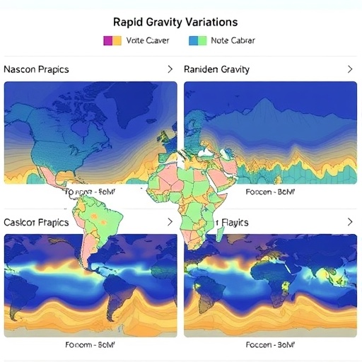
In recent years, the quest for understanding Earth’s dynamic geophysical processes has taken a significant leap forward with advancements in satellite gravimetry. A groundbreaking study by Ding, Li, Xu, and colleagues, published in 2026 in Communications Earth & Environment, introduces global daily mascon solutions derived from line-of-sight gravity differences measured from 330 kilometers above Earth’s surface. This pioneering approach enables rapid and precise analysis of gravity field variations, marking substantial progress in geodesy, climate science, and natural hazard monitoring.
The gravity field of the Earth is a complex and ever-changing tapestry shaped by shifts in mass distribution beneath and on the surface of the planet. Until now, traditional satellite gravimetry missions, such as GRACE and GRACE-FO, have provided invaluable insights into these gravity changes, though often limited by temporal resolution and spatial coverage. Ding and colleagues’ method harnesses mascon (mass concentration) solutions, a technique originally developed to enhance the resolution of gravity data by representing the Earth’s gravitational anomalies as discrete blobs of mass. By extending these mascon solutions to global daily scales at a finely detailed altitude of 330 kilometers, this study paves the way for near-real-time monitoring of Earth’s mass redistribution.
At the heart of the methodology lies the innovative use of line-of-sight gravity differences. Traditionally, satellite gravimetry involves measuring the distance between satellites or the acceleration changes caused by mass variations below. However, by focusing on line-of-sight differences, the researchers effectively captured gravity changes more sensitively and with improved spatial-temporal resolution. This approach allows the detection of subtle variations in Earth’s gravity field resulting from hydrological cycles, glacial melting, ocean dynamics, and tectonic activities on a daily basis, a feat previously unattainable at this scale.
The implications of such high-resolution daily gravity monitoring are far-reaching. Hydrologists, for example, can exploit these data to track water storage variations in river basins and aquifers with unprecedented temporal precision. This capability is critical in regions facing severe drought challenges or where groundwater depletion threatens sustainable development. With daily solutions, water management strategies could be adapted instantly in response to detected changes, potentially mitigating the socio-economic impacts associated with water scarcity.
Similarly, glaciologists stand to benefit tremendously. The daily mascon solutions enable the tracking of ice mass loss in polar and mountain glaciers with a temporal fidelity that can reveal episodic melting events linked to heatwaves or atmospheric anomalies. As climate change accelerates these processes, the enhanced gravity data provide vital feedback for refining models of sea level rise and predicting future impacts with better confidence.
Furthermore, the new gravimetric datasets hold promise for earthquake and volcanic eruption monitoring. Variations in subterranean mass before seismic events can subtly alter the gravity field. By capturing daily changes at high resolution, researchers may be able to identify precursory signals or ongoing magmatic movements, adding a powerful tool to the natural hazard early-warning arsenal. Though challenges remain in isolating these signals from background noise, the methodology lays important groundwork for future integration into hazard assessment protocols.
Oceanographers also gain a significant advantage through global daily gravity monitoring. Ocean mass distribution changes driven by currents and temperature variations influence the gravity field, and tracking these shifts complements satellite altimetry and other ocean observing systems. Such comprehensive monitoring supports better understanding of the ocean’s role in climate regulation and energy transport, particularly in the face of accelerating climate variability and extreme weather phenomena.
The study’s use of mascon modeling contributes to a more physically interpretable representation of gravity changes. Unlike spherical harmonic approaches that represent fields in mathematical bases less intuitive to relate to surface features, mascons directly tie gravity anomalies to localized mass concentrations. This clarity benefits multidisciplinary users who rely on geophysical interpretations tied closely to terrestrial processes, facilitating collaboration across hydrology, glaciology, oceanography, and geophysics.
Technically, the researchers overcame several challenges inherent in gravity field estimation from satellite data, including noise correction, signal de-aliasing, and orbital perturbation compensation. By carefully calibrating line-of-sight measurements and employing advanced inversion algorithms, they obtained reliable mascon solutions with minimized errors. These refinements enhance confidence in the daily gravity estimates, ensuring they are actionable for scientific and practical applications.
An essential part of this approach is the altitude from which measurements are made—330 kilometers. This height strikes a balance between closeness to Earth’s surface for spatial resolution and operational orbit stability for satellite longevity. By optimizing the observational geometry, the study’s authors improved sensitivity to mass anomalies while maintaining a continuous global coverage essential for daily updates.
The computational advancements underlying these mascon solutions are no less impressive. The processing pipeline leverages high-performance computing and sophisticated numerical techniques to transform raw satellite line-of-sight observations into global grids of mascon values. These grids can be assimilated into Earth system models or visualized in near-real time, expanding the utility of gravity data beyond traditional static maps and enabling dynamic Earth monitoring frameworks.
Looking forward, the integration of this daily mascon gravity data with complementary datasets—for example, atmospheric observations, GPS crustal deformation measurements, and remote sensing of land surface conditions—will unlock deeper insights into Earth’s coupled systems. Such integrated approaches hold the promise of transformative breakthroughs in our ability to observe and respond to planetary changes across meteorological, hydrological, cryospheric, and tectonic domains.
The release of this mascon-based gravity solution also coincides with ongoing international efforts to improve Earth observation capacities. Its open accessibility to researchers worldwide ensures that advances in understanding and mitigating climate-related and geophysical hazards are globally democratized. This open science ethos is critical to fostering innovation and informed policy-making in an era defined by environmental uncertainty.
In essence, the pioneering work of Ding, Li, Xu, and colleagues establishes a new paradigm in Earth gravity field monitoring. By delivering global daily mascon solutions at an operationally optimized altitude and utilizing a novel line-of-sight gravity difference approach, they provide the scientific community with powerful tools to dissect rapid mass variations. This capability is set to dramatically enhance our grasp of Earth’s complex geophysical rhythms and helps the world better anticipate and adapt to the challenges posed by a changing planet.
As monitoring technologies evolve and satellite constellations grow more sophisticated, future refinements of this method could push boundaries even further—improving spatial resolution, reducing latency, and enhancing predictive power. The study’s innovative foundation thus signals a new era in Earth observation and stewardship, where near-real-time gravity monitoring becomes a staple in understanding and protecting Earth’s delicate systems.
In summary, the study represents a monumental stride in satellite gravimetry and Earth system science. The combination of mascon modeling with line-of-sight gravity difference measurements, at a daily global scale and optimal orbit altitude, unlocks wide-ranging applications from water resource management to climate adaptation, and natural hazard assessment. As the research community continues to harness and expand these capabilities, our collective ability to respond to environmental change will improve dramatically, underscoring the critical importance of visionary geophysical innovation.
Article References:
Ding, J., Li, J., Xu, X. et al. Global daily mascon solutions at 330 kilometers from line-of-sight gravity differences for rapid variation analysis. Commun Earth Environ (2026). https://doi.org/10.1038/s43247-026-03424-z
Image Credits: AI Generated
