


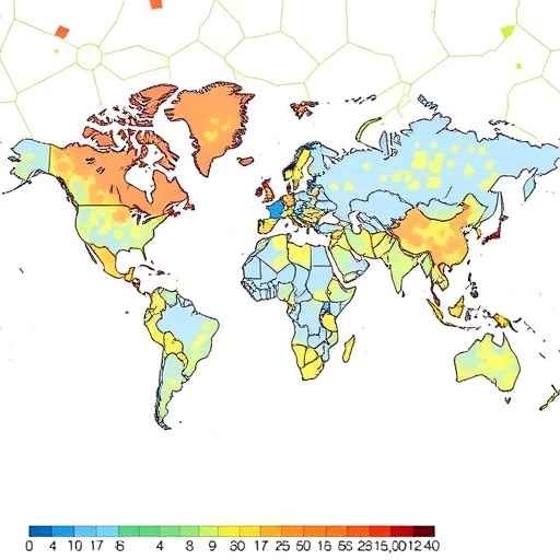
In a groundbreaking advancement that fuses geospatial analysis, environmental science, and machine learning, a team of researchers has unveiled a novel approach to predicting hypertension risk at an individual level. This development, introduced in the recent publication by Hu, Jamal, Deng, and colleagues in the Journal of Exposure Science and Environmental Epidemiology, illustrates a state-of-the-art multi-stage machine learning pipeline that capitalizes on geospatial environmental exposure indicators to enhance the accuracy of hypertension risk assessment. As hypertension remains one of the leading global health challenges with complex etiologies, this integrative methodology marks a pivotal moment in personalized healthcare and epidemiology, offering fresh insights into how our environments intricately influence chronic disease development.
Hypertension, commonly known as high blood pressure, is a multifactorial disease affected not only by genetics and lifestyle factors but increasingly recognized to be influenced by environmental determinants. Traditional risk prediction models often rely heavily on demographic and clinical parameters, thereby underestimating the subtle contributions of the environment. The innovative framework presented here leverages spatially explicit environmental data—such as air pollution levels, noise exposure, green space proximity, and urban heat islands—integrating them into advanced computational models designed to identify nuanced patterns and interactions that conventional analyses might overlook. This approach signals a shift from conventional risk paradigms to a more localized and granular risk prediction, accommodating place-based harm or protection metrics.
At the heart of this research lies a multi-stage machine learning pipeline tailored to manage and interpret complex, high-dimensional data arrays. The first stage involves the extraction and processing of diverse environmental exposure indicators from geospatial datasets, aligning these with individual residential histories and other personal health data. This integration creates a rich multidimensional dataset that encapsulates both temporal and spatial variability in exposures. In subsequent stages, feature selection algorithms sift through this high-dimensional space to identify the most predictive environmental factors, while robust training models iteratively refine risk estimates by learning from both environmental and clinical inputs. This pipeline design not only optimizes predictive performance but also enhances interpretability by clarifying which environmental features exert the strongest influence on hypertension risk.
The research team draws on a compelling dataset drawn from urban and peri-urban populations, where environmental variability is stark and health disparities pronounced. Urban environments, characterized by heterogeneity in air quality, available green spaces, and noise pollution, provide an ideal testbed for assessing how environmental heterogeneity modulates cardiovascular risk. By anchoring their analyses on precise geolocation data linked to individual participants, the study manages to peel back layers of ecological confounding that typically beset environmental epidemiology. This linkage transcends broad regional assessments and moves into a more nuanced risk landscape personalized to the environmental realities experienced by each individual.
One of the remarkable findings in this study is the potent impact of specific geospatial indicators that have often been overlooked or underweighted in previous hypertension models. For instance, chronic exposure to fine particulate matter (PM2.5) and nitrogen dioxide was robustly associated with increased hypertension risk, particularly in neighborhoods with lower socioeconomic status. Additionally, proximity to green spaces emerged as a protective factor, underscoring the role that urban planning and access to natural environments play in cardiovascular health. These insights highlight that environmental injustice and health disparities operate through tangible risk mechanisms that can now be measured and modeled more precisely.
Methodologically, this work pioneers the integration of cutting-edge geospatial environmental science with machine learning frameworks capable of encompassing temporal fluctuations and spatial autocorrelations. The researchers employed advanced geostatistical techniques to preprocess the environmental variables, ensuring spatial dependencies do not bias the predictive models. They also harnessed ensemble learning methods to improve robustness against overfitting, a common challenge in complex data environments. This methodological rigor ensures that the resultant risk prediction models provide reliable and generalizable insights that could be foundational for future research and clinical applications alike.
The implications for personalized medicine are profound. By incorporating detailed environmental exposures into risk prediction algorithms, healthcare providers can achieve a more complete profile of patient risk, leading to tailored interventions and preventive strategies. For example, patients living in areas with high pollution and limited green space might be prioritized for specific lifestyle counseling, pharmacological prophylaxis, or urban environment modifications. This elevates the standard of hypertension management from a one-size-fits-all approach to one that is dynamically responsive to the intersections of personal health and environment.
This research also opens new avenues for public health policy and urban planning. The ability to quantify environmental contributions to hypertension at the individual level empowers policymakers with data-driven tools to inform zoning laws, traffic regulations, and investments in green infrastructure. It offers a blueprint for how environmental health can be operationalized in a predictive framework that supports interventions not only at the point of care but at the community and societal levels. The findings underscore the necessity of cross-sector collaboration between environmental scientists, urban planners, healthcare professionals, and policymakers.
Furthermore, the multi-stage machine learning pipeline serves as a modular and extensible platform. While the current study focuses on hypertension, the framework is adaptable for predicting risks for other environmentally sensitive conditions such as asthma, diabetes, and mental health disorders. This flexibility ensures that the research presented is not only a significant scientific milestone but also a versatile tool for future environmental health challenges that abound in a rapidly urbanizing world.
The integration of geospatial environmental exposure indicators with individual health data required overcoming extensive computational and data harmonization challenges. Environmental datasets vary widely in scale, resolution, and temporal coverage, often requiring sophisticated interpolation and imputation methods. The research team meticulously addressed these issues, ensuring the environmental data layers aligned perfectly with the temporal windows relevant to hypertension development. This precise synchronization is critical to avoid misclassification of exposure and to enhance the fidelity of the predictive models.
The authors also conducted rigorous validation of their models across multiple independent cohorts to check robustness and reproducibility. Cross-validation techniques and independent testing demonstrated that the machine learning models consistently outperformed traditional clinical risk assessments. They achieved a higher degree of sensitivity and specificity in identifying at-risk individuals, providing compelling evidence that environmental exposures carry substantial predictive weight beyond conventional clinical markers alone.
Importantly, this study emphasizes the ethical and privacy concerns that accompany the integration of geospatial data with personal health records. The team implemented state-of-the-art data anonymization protocols and secure data handling processes to safeguard participant confidentiality. Their approach serves as a model for balancing the richness of geospatial environmental exposure data with individual privacy rights, a fundamentally important consideration as environmental health research increasingly intersects with digital epidemiology.
Looking forward, the researchers advocate expanding this integrative approach to global and multi-ethnic populations to capture diverse environmental exposures and genetic backgrounds. Climate change, urbanization trends, and socioeconomic disparities vary significantly worldwide, influencing hypertension risk in complex ways. The scalable machine learning pipeline developed here could be instrumental in global health efforts aimed at mitigating hypertension’s burden by tailoring interventions to localized environmental realities.
Moreover, the research underscores the need for ongoing updates to environmental exposure datasets to reflect changing urban landscapes and climate patterns. Real-time geospatial data integration with electronic health records could transform risk prediction from static snapshots into dynamic, continuously evolving models. Such real-time analytics hold the potential to anticipate hypertension risk before it manifests clinically, offering preemptive measures that could revolutionize chronic disease prevention.
In closing, the seminal work of Hu, Jamal, Deng, et al. heralds a new era in hypertension research where environmental exposures are not peripheral considerations but central elements woven into predictive health models. This multi-stage machine learning pipeline sets a new standard for integrating diverse data streams in health risk assessments and paves the way for more environmentally informed, precision cardiovascular medicine. As global urbanization accelerates, such innovations are paramount for addressing the complex interplay between our surroundings and health.
Cite Scienmag News
Ophelia Keating. (May 27, 2026). Geospatial Data Boosts Hypertension Risk Predictions. Scienmag. https://scienmag.com/geospatial-data-boosts-hypertension-risk-predictions/
Ophelia Keating. "Geospatial Data Boosts Hypertension Risk Predictions." Scienmag, 27 May 2026, https://scienmag.com/geospatial-data-boosts-hypertension-risk-predictions/. Accessed 3 September 2026.
Ophelia Keating. "Geospatial Data Boosts Hypertension Risk Predictions." Scienmag. May 27, 2026. https://scienmag.com/geospatial-data-boosts-hypertension-risk-predictions/


