


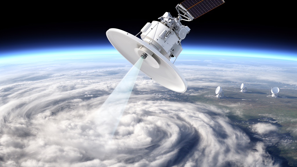
When the European Space Agency and the Japan Aerospace Exploration Agency launched the Earth Cloud, Aerosol, and Radiation Explorer, better known as EarthCARE, on 28 May 2024, they placed in orbit one of the most ambitious atmospheric observatories ever built. The satellite carries a Doppler cloud profiling radar operating at 94 GHz, an atmospheric lidar, a multispectral imager, and a broadband radiometer, all designed to work together to measure aerosols, clouds, precipitation, and the radiation they produce across the entire globe. But a satellite is only as good as the calibration of its instruments, and in the months since launch, a team of French and German researchers has been quietly doing the painstaking work of checking whether the numbers coming down from orbit can be trusted. Their verdict, published in the journal Atmospheric Measurement Techniques, is a resounding yes: the reflectivity measured by EarthCARE’s cloud radar differs from a carefully calibrated European ground network by a mere -0.2 plus or minus 0.4 decibels, a difference so small it borders on the negligible.
The study, led by Nathan Feuillard and Felipe Toledo Bittner of LATMOS at Université Paris-Saclay, together with colleagues at the University of Cologne and the Institut Pierre Simon Laplace, harnessed the power of the European Aerosol, Clouds and Trace Gases Research Infrastructure, or ACTRIS. This pan-European network operates cloud remote sensing sites across the continent, and its Centre for Cloud Remote Sensing has spent years ensuring that the ground-based radars at facilities in Palaiseau, Jülich, Leipzig, and Lindenberg all measure reflectivity on a common, traceable scale. That homogeneity is precisely what made the validation possible. Rather than trusting a single ground station, the team compared EarthCARE against seven calibrated radars, and because all of them trace their calibration back to the same portable reference instrument, the consistency of the results across sites became a powerful self-check on the entire methodology.
The technical challenge at the heart of the work is deceptively simple to state and fiendishly difficult to solve. EarthCARE’s Cloud Profiling Radar points straight down from an orbit roughly 400 kilometers above the Earth, sweeping out a narrow track that almost never passes directly over a ground radar. The ACTRIS sites were sited long before EarthCARE’s orbit was designed, chosen for scientific and logistical reasons rather than orbital convenience. Most of the ground radars are zenith-pointing only, staring fixedly at the sky above them, and their range is limited to roughly 20 kilometers because the 35 and 94 GHz frequencies they use are strongly attenuated by the atmosphere. Even at Lindenberg, where the satellite’s ground track comes within 400 meters to 3 kilometers of the site on each 25-day repeat cycle, the odds that the two instruments stare at the very same cloud at the very same moment are vanishingly small.
The team’s solution was to abandon the idea of direct co-localized comparison altogether and instead compare statistics. Over a period spanning July 2024 to November 2025, they collected every EarthCARE radar profile recorded within a 200-kilometer radius of each ground site, amounting to tens of thousands of satellite profiles, and paired them with every vertical profile the ground radars had measured during the same window, in one case nearly 200,000 profiles. The underlying assumption, supported by earlier studies of the CloudSat mission, is that given enough time, both instruments sample the same underlying cloud climatology for a region, so their reflectivity distributions should converge even though they almost never observe the same cloud simultaneously. The researchers tested this assumption directly: of 183 overpasses at Jülich, only 20 showed similar clouds between ground and satellite, yet the statistical distributions built from all the data proved robustly comparable.
Before any comparison could be made, the two datasets had to be made genuinely apples-to-apples. Ice clouds were chosen as the comparison target because they attenuate the radar signal negligibly, whereas liquid water clouds attenuate strongly and would attenuate the upward-looking ground radars far more than the downward-looking satellite. Profiles containing liquid water, drizzle, rain, or melting particles were therefore removed using the target classification products from both EarthCARE and the CloudNet processing chain. The ground data, with vertical resolutions between 25 and 50 meters, were resampled to match the satellite’s effective 100-meter resolution. A correction was applied to account for the different dielectric constants of water used in ground versus satellite reflectivity calculations. And in a crucial step, the sensitivity of the two instruments was matched: EarthCARE’s radar can detect reflectivities down to -35 dBZ throughout the troposphere, five decibels more sensitive than its CloudSat predecessor, while ground radar sensitivity degrades with distance from the antenna. By matching both the reflectivity and the pseudo-power dynamic ranges, the team ensured that only cloud pixels observable by both instruments entered the comparison.
The comparison itself relies on contoured frequency by altitude diagrams, or CFADs, which show how often each reflectivity value occurs at each height. For every height bin, the reflectivity distribution was fitted with a Gaussian function, and three statistical criteria determined whether a given height was trustworthy for the comparison: the correlation between the fitted centers of the satellite and ground distributions had to exceed 0.9, the ratio of their standard deviations had to be below 0.4, and the goodness of fit had to exceed an R-squared of 0.85. Only heights passing all three tests contributed to the final bias estimate, with the uncertainty derived from the spread of the height-by-height differences combined with the known calibration uncertainty of each ground radar, typically around one decibel. For the RPG94 radar at Jülich, for example, 36 consecutive height bins spanning 3.6 kilometers of the atmosphere passed the tests, yielding a satellite-versus-ground bias of 0.3 plus or minus 1.3 decibels.
The closure test is where the methodology earns its credibility. Because every ACTRIS radar involved had been calibrated against the same reference instrument, a portable W-band radar called BASTA-CCRES that is itself calibrated against a corner reflector characterized in an anechoic chamber, the individual satellite-versus-ground biases from all seven radars should agree with one another if the method is sound. They do. Most individual biases sit close to zero decibels, with the largest, at Lindenberg, reaching 1.5 plus or minus 1.7 decibels, a value the authors attribute to the algorithm selecting different height zones for that comparison rather than any calibration problem. The calibration chain of the ground network is entirely independent of the satellite’s own calibration, which relies on methods such as ocean surface backscattering, so the agreement between the two independent chains is a genuine cross-validation of both.
The study also delivered a practical rule of thumb that will shape future validation campaigns: how long must you observe before a bias estimate is reliable? To answer this, the team turned the clock back, applying their method to the CloudSat satellite and the MIRA radar at Lindenberg between August 2012 and January 2016. The resulting time series revealed a drift in the ground radar’s calibration, including a two-decibel jump after September 2013 linked to a misalignment in the phase correction of the radar’s magnetron signal processing, and a slow decline in transmitted power that foreshadowed the replacement of the magnetron and a faulty waveguide in 2016. For EarthCARE at Jülich, comparisons over windows of six, nine, and twelve months showed that three-month windows were too noisy, while nine-month windows mostly fell within the uncertainty of the full baseline. The authors recommend a minimum of nine months of data for reliable comparisons at mid-latitude sites, with one-year windows performing best.
The implications reach well beyond a single satellite check. Because the method works in both directions, EarthCARE, now established as an exquisitely calibrated reference, can in principle be used to calibrate ground radars in remote locations where reference instruments cannot easily travel, from Arctic observatories to the new AWACA sites being deployed in Antarctica. The finding that satellite and ground statistics converge even without temporal coincidence also suggests EarthCARE is sampling something close to the true regional ice cloud climatology, opening the door to climatological applications of its measurements. With a decade of operations planned, a validated radar, a network of ground truth stations, and a methodology proven by closure, atmospheric scientists now have a self-renewing calibration ecosystem for the cloud observations that feed weather and climate models, and the first verdict on EarthCARE’s most sensitive instrument could hardly have been better.
Subject of Research: Validation of the EarthCARE satellite cloud profiling radar reflectivity calibration using ground-based cloud radars of the ACTRIS network
Article Title: Validation of EarthCARE CPR reflectivity using the ACTRIS cloud radar network
Article References: Feuillard, N., Toledo Bittner, F., Pfitzenmaier, L., Ribaud, J.-F., Delanoë, J., Haeffelin, M., & Dupont, J.-C. (2026). Validation of EarthCARE CPR reflectivity using the ACTRIS cloud radar network. Atmospheric Measurement Techniques, 19(18), 6075-6097. https://doi.org/10.5194/amt-19-6075-2026
Image Credits: AI Generated
Keywords: EarthCARE, cloud profiling radar, ACTRIS, radar calibration, CloudSat, cloud radar, reflectivity, satellite validation, ice clouds, CFAD, remote sensing, atmospheric measurement
Cite Scienmag News
Russell Cooper. (October 9, 2026). European Ground Radars Confirm EarthCARE’s Cloud Radar Is Calibrated to Near Perfection. Scienmag. https://scienmag.com/european-ground-radars-confirm-earthcares-cloud-radar-is-calibrated-to-near-perfection/
Russell Cooper. "European Ground Radars Confirm EarthCARE’s Cloud Radar Is Calibrated to Near Perfection." Scienmag, 9 October 2026, https://scienmag.com/european-ground-radars-confirm-earthcares-cloud-radar-is-calibrated-to-near-perfection/. Accessed 9 October 2026.
Russell Cooper. "European Ground Radars Confirm EarthCARE’s Cloud Radar Is Calibrated to Near Perfection." Scienmag. October 9, 2026. https://scienmag.com/european-ground-radars-confirm-earthcares-cloud-radar-is-calibrated-to-near-perfection/


